National Register of Historic Places listings in Natchitoches Parish, Louisiana
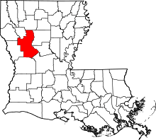
Location of Natchitoches Parish in Louisiana
This is a list of the National Register of Historic Places listings in Natchitoches Parish, Louisiana.
This is intended to be a complete list of the properties and districts on the National Register of Historic Places in Natchitoches Parish, Louisiana, United States. The locations of National Register properties and districts for which the latitude and longitude coordinates are included below, may be seen in a map.[1]
There are 33 properties and districts listed on the National Register in the parish, including 5 National Historic Landmarks. One property was once listed, but has been removed.
- This National Park Service list is complete through NPS recent listings posted December 16, 2016.[2]
Current listings
| [3] | Name on the Register[4] | Image | Date listed[5] | Location | City or town | Description |
|---|---|---|---|---|---|---|
| 1 | Badin-Roque House |  |
(#80001739) |
South of Natchez 31°36′06″N 92°58′22″W / 31.601667°N 92.972778°W |
Natchez | |
| 2 | Briarwood | Upload image | (#16000761) |
216 Caroline Dorman Rd. 32°07′57″N 92°58′43″W / 32.132530°N 92.978698°W |
Saline vicinity | |
| 3 | Cane River Creole National Historical Park | 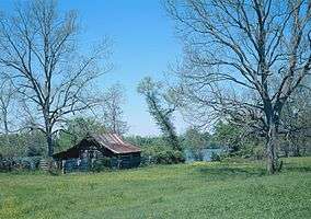 |
(#01000226) |
4386 Louisiana Highway 494 Coordinates missing |
Natchez | |
| 4 | Carnahan Store | 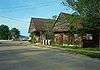 |
(#95001243) |
Main St. (Louisiana Highway 495) 31°32′39″N 92°54′58″W / 31.544167°N 92.916111°W |
Cloutierville | |
| 5 | Caspiana Plantation Store | 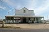 |
(#92000583) |
1300 Texas St. 31°46′13″N 93°05′47″W / 31.770278°N 93.096389°W |
Natchitoches | |
| 6 | Cedar Bend Plantation | Upload image | (#88001049) |
Louisiana Highway 119 31°40′55″N 93°00′40″W / 31.681944°N 93.011111°W |
Natchez | |
| 7 | Cherokee Plantation | 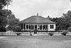 |
(#73000869) |
Southeast of Natchitoches on Cane River Rd. 31°41′20″N 93°02′17″W / 31.688889°N 93.038056°W |
Natchitoches | |
| 8 | Church of St. Anne | Upload image | (#94001271) |
Southwestern corner of the junction of Louisiana Highway 485 and Bloss Moore Rd. 31°47′08″N 93°17′09″W / 31.785556°N 93.285833°W |
Allen | |
| 9 | City Hotel | Upload image | (#93000317) |
Junction of Louisiana Highway 120 and Rains Ave. 31°44′21″N 93°23′43″W / 31.739167°N 93.395278°W |
Marthaville | |
| 10 | Alexis Cloutier House | Upload image | (#74000927) |
Main St. 31°32′27″N 92°55′04″W / 31.540833°N 92.917778°W |
Cloutierville | |
| 11 | Fish Hatchery 2 Site | Upload image | (#05000808) |
Address Restricted |
Natchitoches | |
| 12 | Flora Commissary | Upload image | (#10001194) |
Louisiana Highway 120, approximately ¼ mile west of Louisiana Highway 478 Coordinates missing |
Flora | |
| 13 | Fredericks Site | Upload image | (#00000307) |
Address Restricted |
Clarence | |
| 14 | Jones House | 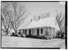 |
(#93000937) |
Louisiana Highway 484 along Cane River Lake 31°35′00″N 92°57′41″W / 31.583333°N 92.961389°W |
Melrose | |
| 15 | Jerry Jones House | Upload image | (#02000124) |
Louisiana Highway 484 31°36′22″N 92°59′08″W / 31.606111°N 92.985556°W |
Melrose | |
| 16 | John Carroll Jones House | Upload image | (#00000329) |
473 Louisiana Highway 484 31°38′30″N 93°00′38″W / 31.641667°N 93.010556°W |
Natchez | |
| 17 | Keegan House | Upload image | (#90000342) |
225 Williams Ave. 31°45′18″N 93°05′03″W / 31.755°N 93.084167°W |
Natchitoches | |
| 18 | Keegan House | 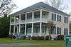 |
(#95000853) |
143 Chaplin Loop 31°41′35″N 93°18′13″W / 31.693056°N 93.303611°W |
Robeline | |
| 19 | Los Adaes | 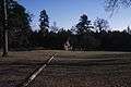 |
(#78001427) |
Northeast of Robeline off Louisiana Highway 6; also ½ mile north of Louisiana Highway 6 north of Robeline 31°42′30″N 93°17′34″W / 31.708333°N 93.292778°W |
Robeline | Second set of addresses represents a boundary increase of November 4, 1993 |
| 20 | Magnolia Plantation | .jpg) |
(#79001071) |
5487 Louisiana Highway 119 31°32′59″N 92°56′26″W / 31.549722°N 92.940556°W |
Derry | |
| 21 | Maison De Marie Therese | |
(#79001070) |
1 mile northwest of Bermuda 31°40′26″N 93°01′06″W / 31.673889°N 93.018333°W |
Bermuda | |
| 22 | Melrose Plantation | .jpg) |
(#72000556) |
Louisiana Highway 119 off Louisiana Highway 493 31°36′00″N 92°58′01″W / 31.6°N 92.966944°W |
Melrose | |
| 23 | Narcisse Prudhomme Plantation | .jpg) |
(#76000966) |
Southeast of Natchitoches on Cane River Rd. 31°40′11″N 93°00′36″W / 31.669722°N 93.01°W |
Natchitoches | Also known as Beau Fort |
| 24 | Natchitoches Historic District | .jpg) |
(#74000928) |
Roughly bounded by 2nd, 4th, Jefferson, and Parie Sts., and Williams and College Aves. 31°45′39″N 93°04′03″W / 31.760833°N 93.0675°W |
Natchitoches | |
| 25 | Normal Hill Historic District | Upload image | (#80001741) |
Northwestern State University campus 31°45′03″N 93°05′33″W / 31.750833°N 93.0925°W |
Natchitoches | |
| 26 | Northwestern State University Historic District | 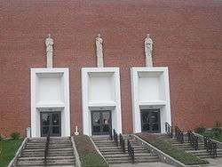 |
(#14000313) |
Roughly bounded by University Pkw., Harry Turpin Stadium, Fournet Quad., Cadwell & Sam Sibley Drs., Central Ave. 31°45′00″N 93°05′50″W / 31.75°N 93.0972°W |
Natchitoches | May be expansion of Normal Hill HD |
| 27 | Oaklawn Plantation | 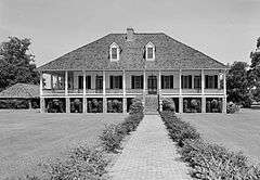 |
(#79001072) |
East of Natchez on Louisiana Highway 494 31°40′11″N 93°00′42″W / 31.669722°N 93.011667°W |
Natchez | |
| 28 | President's Home, Northwestern State University | 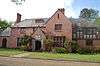 |
(#84001332) |
College Ave. 31°45′05″N 93°05′36″W / 31.751389°N 93.093333°W |
Natchitoches | |
| 29 | Jean Pierre Emmanuel Prud'homme Oakland Plantation | 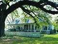 |
(#79001073) |
4386 Louisiana Highway 494 31°39′54″N 93°00′12″W / 31.665°N 93.003333°W |
Natchez | |
| 30 | Robeline Methodist Church | 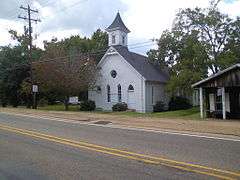 |
(#88000113) |
Texas St., Louisiana Highway 6 31°41′26″N 93°18′16″W / 31.690556°N 93.304444°W |
Robeline | |
| 31 | St. Augustine Catholic Church and Cemetery | Upload image | (#14000679) |
2262 Louisiana Highway 484 Coordinates missing |
Natchez vicinity | |
| 32 | St. Matthew High School | 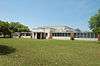 |
(#04001516) |
2552 Louisiana Highway 119 31°37′30″N 92°59′18″W / 31.625°N 92.988333°W |
Melrose | |
| 33 | Texas and Pacific Railroad Depot | 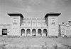 |
(#87000732) |
6th St. 31°45′40″N 93°05′38″W / 31.761111°N 93.093889°W |
Natchitoches | |
| 34 | Women's Gymnasium, Northwestern State University | 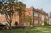 |
(#84001335) |
College Ave. 31°45′08″N 93°05′42″W / 31.752222°N 93.095°W |
Natchitoches |
Former listings
| [3] | Name on the Register | Image | Date listed | Date removed | Location | City or town | Summary |
|---|---|---|---|---|---|---|---|
| 1 | Kate Chopin House | 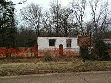 |
(#93001601) | Main St. (Louisiana Highway 1) 31°32′26″N 92°55′02″W / 31.540556°N 92.917222°W |
Cloutierville | Destroyed by fire in 2008. |
See also
| Wikimedia Commons has media related to National Register of Historic Places in Natchitoches Parish, Louisiana. |
- List of National Historic Landmarks in Louisiana
- National Register of Historic Places listings in Louisiana
References
- ↑ The latitude and longitude information provided in this table was derived originally from the National Register Information System, which has been found to be fairly accurate for about 99% of listings. For about 1% of NRIS original coordinates, experience has shown that one or both coordinates are typos or otherwise extremely far off; some corrections may have been made. A more subtle problem causes many locations to be off by up to 150 yards, depending on location in the country: most NRIS coordinates were derived from tracing out latitude and longitudes off of USGS topographical quadrant maps created under the North American Datum of 1927, which differs from the current, highly accurate WGS84 GPS system used by most on-line maps. Chicago is about right, but NRIS longitudes in Washington are higher by about 4.5 seconds, and are lower by about 2.0 seconds in Maine. Latitudes differ by about 1.0 second in Florida. Some locations in this table may have been corrected to current GPS standards.
- ↑ "National Register of Historic Places: Weekly List Actions". National Park Service, United States Department of the Interior. Retrieved on December 16, 2016.
- 1 2 Numbers represent an ordering by significant words. Various colorings, defined here, differentiate National Historic Landmarks and historic districts from other NRHP buildings, structures, sites or objects.
- ↑ National Park Service (2009-03-13). "National Register Information System". National Register of Historic Places. National Park Service.
- ↑ The eight-digit number below each date is the number assigned to each location in the National Register Information System database, which can be viewed by clicking the number.
| Topics | |
|---|---|
| Lists by states |
|
| Lists by insular areas | |
| Lists by associated states | |
| Other areas | |
| |
Municipalities and communities of Natchitoches Parish, Louisiana, United States | ||
|---|---|---|
| City | | |
| Town | ||
| Villages | ||
| CDPs | ||
| Other unincorporated communities |
| |
| Footnotes | ‡This populated place also has portions in an adjacent county or counties | |
This article is issued from Wikipedia - version of the 11/23/2016. The text is available under the Creative Commons Attribution/Share Alike but additional terms may apply for the media files.