| [3] |
Name on the Register[4] |
Image |
Date listed[5] |
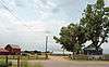
Location |
City or town |
Description |
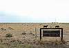
|---|
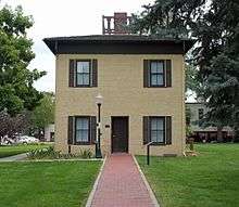
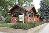
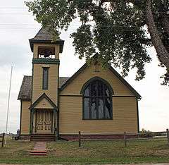
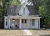
| 1 |
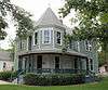
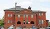
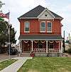
Amanda K. Alger Memorial Methodist Episcopal Church |
|
000000002006-10-25-0000October 25, 2006
(#06000949) |
303 Maple Ave.
40°31′45″N 104°42′49″W / 40.529167°N 104.713611°W / 40.529167; -104.713611 (Amanda K. Alger Memorial Methodist Episcopal Church) |
Eaton |
|
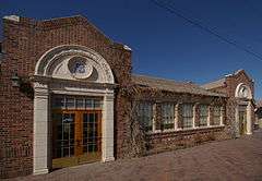
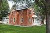
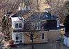
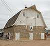
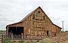
| 2 |
Anderson Barn |
|
000000002004-10-06-0000October 6, 2004
(#04001112) |
5255 State Highway 60
40°20′11″N 104°57′18″W / 40.336389°N 104.955°W / 40.336389; -104.955 (Anderson Barn) |
Johnstown |
|
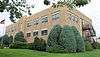
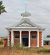
| 3 |
Clubhouse-Student Union |
|
000000002008-10-29-0000October 29, 2008
(#08001021) |
Between 18th and 19th Sts., and 8th and 10th Aves.
40°20′11″N 104°57′18″W / 40.336389°N 104.955°W / 40.336389; -104.955 (Clubhouse-Student Union) |
Greeley |
Now called Gray Hall. It houses police and parking departments of the University of Northern Colorado.
|
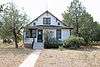
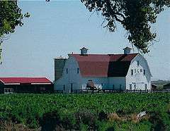
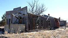
| 4 |
Elmer and Etta Ball Ranch |
|
000000001991-10-16-0000October 16, 1991
(#91001533) |
County Road 69 west of Briggsdale
40°37′26″N 104°24′45″W / 40.623889°N 104.4125°W / 40.623889; -104.4125 (Elmer and Etta Ball Ranch) |
Briggsdale |
|
| 5 |
Jared L. Brush Barn |
|
000000001991-10-16-0000October 16, 1991
(#91001532) |
24308 County Road 17
40°21′08″N 104°54′11″W / 40.352222°N 104.903056°W / 40.352222; -104.903056 (Jared L. Brush Barn) |
Johnstown |
|
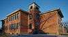
| 6 |
Daniels School |
|
000000002005-07-06-0000July 6, 2005
(#05000653) |
State Highway 60 and County Road 25
40°19′50″N 104°49′28″W / 40.330556°N 104.824444°W / 40.330556; -104.824444 (Daniels School) |
Milliken |
|
| 7 |
Dearfield |
|
000000001995-08-04-0000August 4, 1995
(#95001002) |
Along US 34, 11 miles west of Wiggins
40°17′18″N 104°15′25″W / 40.288333°N 104.256944°W / 40.288333; -104.256944 (Dearfield) |
Wiggins |
|
| 8 |
Aaron James Eaton House |
|
000000002006-04-19-0000April 19, 2006
(#06000281) |
207 Elm St.
40°31′40″N 104°42′44″W / 40.527778°N 104.712222°W / 40.527778; -104.712222 (Aaron James Eaton House) |
Eaton |
|
| 9 |
First Baptist Church |
|
000000001987-11-25-0000November 25, 1987
(#87001510) |
Northwestern corner of the intersection of 10th Ave. and 11th St.
40°25′18″N 104°41′39″W / 40.421667°N 104.694167°W / 40.421667; -104.694167 (First Baptist Church) |
Greeley |
|
| 10 |
First Methodist Episcopal Church |
|
000000002004-07-07-0000July 7, 2004
(#04000660) |
503 Walnut St.
40°28′42″N 104°54′14″W / 40.478333°N 104.903889°W / 40.478333; -104.903889 (First Methodist Episcopal Church) |
Windsor |
|
| 11 |
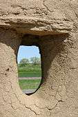
Fort Vasquez |
|
000000001970-09-30-0000September 30, 1970
(#70000169) |
13412 U.S. Highway 85
40°11′40″N 104°49′13″W / 40.194444°N 104.820278°W / 40.194444; -104.820278 (Fort Vasquez) |
Platteville |
|
| 12 |
Glazier House |
|
000000001991-02-05-0000February 5, 1991
(#91000002) |
1403 10th Ave.
40°25′00″N 104°41′39″W / 40.416667°N 104.694167°W / 40.416667; -104.694167 (Glazier House) |
Greeley |
|
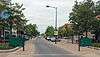
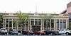
| 13 |
Greeley Downtown |
|
000000002008-07-24-0000July 24, 2008
(#08000707) |
Roughly bounded by 8th St., 8th Ave., 10th St., and 9th Ave.
40°25′26″N 104°41′30″W / 40.423902°N 104.691737°W / 40.423902; -104.691737 (Greeley Downtown) |
Greeley |
|
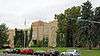
| 14 |
Greeley High School |
|
000000001999-04-15-0000April 15, 1999
(#99000444) |
1515 14th Ave.
40°24′53″N 104°42′07″W / 40.414722°N 104.701944°W / 40.414722; -104.701944 (Greeley High School) |
Greeley |
|
| 15 |
Greeley High School and Grade School |
|
000000001981-07-23-0000July 23, 1981
(#81000189) |
1015 8th St.
40°25′31″N 104°41′43″W / 40.425278°N 104.695278°W / 40.425278; -104.695278 (Greeley High School and Grade School) |
Greeley |
|
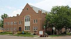
| 16 |
Greeley Junior High School |
|
000000002003-10-11-0000October 11, 2003
(#03001012) |
811 15th St.
40°24′58″N 104°41′27″W / 40.416111°N 104.690833°W / 40.416111; -104.690833 (Greeley Junior High School) |
Greeley |
|
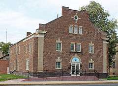
| 17 |
Greeley Masonic Temple |
|
000000002004-07-07-0000July 7, 2004
(#04000663) |
829 10th Ave.
40°25′27″N 104°41′39″W / 40.424167°N 104.694167°W / 40.424167; -104.694167 (Greeley Masonic Temple) |
Greeley |
|
| 18 |
Greeley Tribune Building |
|
000000002007-04-18-0000April 18, 2007
(#07000310) |
714 8th St.
40°25′29″N 104°41′22″W / 40.424722°N 104.689444°W / 40.424722; -104.689444 (Greeley Tribune Building) |
Greeley |
|
| 19 |
Greeley Union Pacific Railroad Depot |
|
000000001993-11-04-0000November 4, 1993
(#93001180) |
Junction of 7th Ave. and 9th St.
40°25′27″N 104°41′17″W / 40.424167°N 104.688056°W / 40.424167; -104.688056 (Greeley Union Pacific Railroad Depot) |
Greeley |
|
| 20 |
Jurgens Site |
Upload image |
000000001990-07-18-0000July 18, 1990
(#90001084) |
1 mile (1.6 km) north of Kersey on State Highway 37[6]
40°24′27″N 104°33′56″W / 40.407500°N 104.565556°W / 40.407500; -104.565556 (Jurgens Site) |
Kersey |
|
| 21 |
Keota Stone Circles Archeological District |
Upload image |
000000001981-07-28-0000July 28, 1981
(#81000190) |
Address Restricted
|
Keota |
|
| 22 |
Land Utilization Program Headquarters |
|
000000002009-10-29-0000October 29, 2009
(#09000854) |
44741 County Road 77
40°39′01″N 104°20′05″W / 40.650258°N 104.334608°W / 40.650258; -104.334608 (Land Utilization Program Headquarters) |
Briggsdale |
|
| 23 |
Lincoln School |
|
000000001981-07-22-0000July 22, 1981
(#81000188) |
645 Holbrook St.
40°03′03″N 105°02′58″W / 40.050833°N 105.049444°W / 40.050833; -105.049444 (Lincoln School) |
Erie |
|
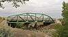
| 24 |
Little Thompson River Bridge |
|
000000002002-10-15-0000October 15, 2002
(#02001129) |
Interstate 25 service road at milepost 249.90
40°18′03″N 104°58′44″W / 40.300833°N 104.978889°W / 40.300833; -104.978889 (Little Thompson River Bridge) |
Berthoud |
|
| 25 |
Meeker Memorial Museum |
|
000000001970-02-26-0000February 26, 1970
(#70000168) |
1324 9th Ave.
40°25′02″N 104°41′29″W / 40.417222°N 104.691389°W / 40.417222; -104.691389 (Meeker Memorial Museum) |
Greeley |
|
| 26 |
Milne Farm |
|
000000001993-02-03-0000February 3, 1993
(#92001840) |
18457 State Highway 392
40°28′53″N 104°42′23″W / 40.481389°N 104.706389°W / 40.481389; -104.706389 (Milne Farm) |
Lucerne |
|
| 27 |
Nettleton-Mead House |
|
000000002002-04-02-0000April 2, 2002
(#02000290) |
1303 9th Ave.
40°25′06″N 104°41′32″W / 40.418333°N 104.692222°W / 40.418333; -104.692222 (Nettleton-Mead House) |
Greeley |
|
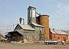
| 28 |
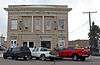
Ottesen Grain Company Feed Mill |
|
000000001998-11-05-0000November 5, 1998
(#98001320) |
815 7th St.
40°05′10″N 104°48′30″W / 40.086111°N 104.808333°W / 40.086111; -104.808333 (Ottesen Grain Company Feed Mill) |
Fort Lupton |
|
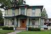
| 29 |
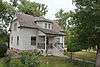
Harvey J. Parish House |
|
000000002000-04-14-0000April 14, 2000
(#00000368) |
701 Charlotte St.
40°20′10″N 104°54′49″W / 40.336111°N 104.913611°W / 40.336111; -104.913611 (Harvey J. Parish House) |
Johnstown |
|
| 30 |
Sandstone Ranch |
|
000000001984-01-23-0000January 23, 1984
(#84000904) |
East of Longmont off State Highway 119
40°09′05″N 105°02′12″W / 40.151389°N 105.036667°W / 40.151389; -105.036667 (Sandstone Ranch) |
Longmont |
|
| 31 |
SLW Ranch |
|
000000001991-03-15-0000March 15, 1991
(#91000288) |
27401 County Road 58½
40°24′53″N 104°29′34″W / 40.414722°N 104.492778°W / 40.414722; -104.492778 (SLW Ranch) |
Kersey vicinity |
|
| 32 |
United Church of Christ of Highlandlake |
|
000000001989-02-10-0000February 10, 1989
(#88002237) |
16896 County Road 5
40°14′55″N 105°00′50″W / 40.248611°N 105.013889°W / 40.248611; -105.013889 (United Church of Christ of Highlandlake) |
Mead |
|
| 33 |
Von Gohren-Thompson Homestead-Gerry Farm Rural Historic Landscape |
Upload image |
000000002011-05-04-0000May 4, 2011
(#11000240) |
Address Restricted
|
Greeley |
Historic Farms and Ranches of Weld County MPS
|
| 34 |
Von Trotha-Firestien Farm at Bracewell |
|
000000002009-05-12-0000May 12, 2009
(#09000291) |
Junction of O St. and 83rd Ave., in Bracewell[7]
40°27′32″N 104°49′00″W / 40.458889°N 104.816667°W / 40.458889; -104.816667 (Von Trotha-Firestien Farm at Bracewell) |
Bracewell vicinity |
|
| 35 |
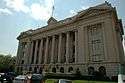
Weld County Courthouse |
|
000000001978-01-09-0000January 9, 1978
(#78000886) |
9th St. and 9th Ave.
40°25′25″N 104°41′33″W / 40.423611°N 104.6925°W / 40.423611; -104.6925 (Weld County Courthouse) |
Greeley |
|
| 36 |
West Stoneham Archeological District |
Upload image |
000000001994-09-23-0000September 23, 1994
(#94001115) |
Address Restricted
|
Stoneham |
|
| 37 |
White-Plumb Farm |
|
000000002005-07-27-0000July 27, 2005
(#05000729) |
955 39th Ave.
40°25′21″N 104°44′42″W / 40.4225°N 104.745°W / 40.4225; -104.745 (White-Plumb Farm) |
Greeley |
Now called the Plumb Farm Learning Center and owned by the City of Greeley.
|
| 38 |
Windsor Milling and Elevator Co. Building |
|
000000001998-09-03-0000September 3, 1998
(#98001129) |
301 Main St.
40°28′47″N 104°54′01″W / 40.479722°N 104.900278°W / 40.479722; -104.900278 (Windsor Milling and Elevator Co. Building) |
Windsor |
|
| 39 |
Windsor Town Hall |
|
000000001999-01-15-0000January 15, 1999
(#98001599) |
116 5th St.
40°28′50″N 104°54′13″W / 40.480556°N 104.903611°W / 40.480556; -104.903611 (Windsor Town Hall) |
Windsor |
|
| 40 |
Joseph A. Woodbury House |
|
000000001984-05-17-0000May 17, 1984
(#84000908) |
1124 7th St.
40°25′32″N 104°41′48″W / 40.425556°N 104.696667°W / 40.425556; -104.696667 (Joseph A. Woodbury House) |
Greeley |
|
.JPG)