Naylor, Missouri
| Naylor, Missouri | |
|---|---|
| City | |
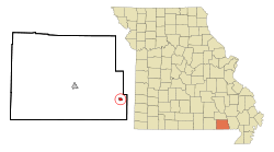 Location of Naylor, Missouri | |
| Coordinates: 36°34′27″N 90°36′16″W / 36.57417°N 90.60444°WCoordinates: 36°34′27″N 90°36′16″W / 36.57417°N 90.60444°W | |
| Country | United States |
| State | Missouri |
| County | Ripley |
| Area[1] | |
| • Total | 0.55 sq mi (1.42 km2) |
| • Land | 0.55 sq mi (1.42 km2) |
| • Water | 0 sq mi (0 km2) |
| Elevation | 305 ft (93 m) |
| Population (2010)[2] | |
| • Total | 632 |
| • Estimate (2012[3]) | 628 |
| • Density | 1,149.1/sq mi (443.7/km2) |
| Time zone | Central (CST) (UTC-6) |
| • Summer (DST) | CDT (UTC-5) |
| ZIP code | 63953 |
| Area code(s) | 573 |
| FIPS code | 29-51302[4] |
| GNIS feature ID | 0735742[5] |
Naylor is a city in Ripley County, Missouri, United States. The population was 632 at the 2010 census.
History
Naylor was a depot on the St. Louis, Iron Mountain and Southern Railway.[6]
Geography
Naylor is located at 36°34′27″N 90°36′16″W / 36.57417°N 90.60444°W (36.574160, -90.604355).[7]
According to the United States Census Bureau, the city has a total area of 0.55 square miles (1.42 km2), all land.[1]
Demographics
| Historical population | |||
|---|---|---|---|
| Census | Pop. | %± | |
| 1900 | 202 | — | |
| 1910 | 406 | 101.0% | |
| 1920 | 681 | 67.7% | |
| 1930 | 553 | −18.8% | |
| 1940 | 507 | −8.3% | |
| 1950 | 520 | 2.6% | |
| 1960 | 499 | −4.0% | |
| 1970 | 586 | 17.4% | |
| 1980 | 602 | 2.7% | |
| 1990 | 642 | 6.6% | |
| 2000 | 610 | −5.0% | |
| 2010 | 632 | 3.6% | |
| Est. 2015 | 615 | [8] | −2.7% |
2010 census
As of the census[2] of 2010, there were 632 people, 270 households, and 172 families residing in the city. The population density was 1,149.1 inhabitants per square mile (443.7/km2). There were 290 housing units at an average density of 527.3 per square mile (203.6/km2). The racial makeup of the city was 93.51% White, 0.32% Black or African American, 0.79% Native American, 0.16% from other races, and 5.22% from two or more races. Hispanic or Latino of any race were 0.95% of the population.
There were 270 households of which 29.6% had children under the age of 18 living with them, 45.9% were married couples living together, 11.9% had a female householder with no husband present, 5.9% had a male householder with no wife present, and 36.3% were non-families. 31.5% of all households were made up of individuals and 17.4% had someone living alone who was 65 years of age or older. The average household size was 2.34 and the average family size was 2.88.
The median age in the city was 42.3 years. 23.4% of residents were under the age of 18; 8.4% were between the ages of 18 and 24; 20.7% were from 25 to 44; 26.2% were from 45 to 64; and 21.4% were 65 years of age or older. The gender makeup of the city was 48.3% male and 51.7% female.
2000 census
As of the census[4] of 2000, there were 610 people, 255 households, and 177 families residing in the city. The population density was 1,124.6 people per square mile (436.2/km²). There were 317 housing units at an average density of 584.4 per square mile (226.7/km²). The racial makeup of the city was 94.43% White, 0.16% African American, 2.95% Native American, 0.33% Asian, and 2.13% from two or more races. Hispanic or Latino of any race were 2.46% of the population.
There were 255 households out of which 32.2% had children under the age of 18 living with them, 52.5% were married couples living together, 14.9% had a female householder with no husband present, and 30.2% were non-families. 28.6% of all households were made up of individuals and 17.3% had someone living alone who was 65 years of age or older. The average household size was 2.39 and the average family size was 2.91.
In the city the population was spread out with 26.1% under the age of 18, 8.9% from 18 to 24, 23.1% from 25 to 44, 22.3% from 45 to 64, and 19.7% who were 65 years of age or older. The median age was 39 years. For every 100 females there were 81.5 males. For every 100 females age 18 and over, there were 76.2 males.
The median income for a household in the city was $20,900, and the median income for a family was $26,250. Males had a median income of $21,438 versus $18,500 for females. The per capita income for the city was $18,402. About 19.2% of families and 24.1% of the population were below the poverty line, including 28.7% of those under age 18 and 18.9% of those age 65 or over.
Notable person
- Ernest Lenard Hall, the first Paul. E. Geier Professor of Robotics in the Department of Mechanical Engineering at the University of Cincinnati.
References
- 1 2 "US Gazetteer files 2010". United States Census Bureau. Retrieved 2012-07-08.
- 1 2 "American FactFinder". United States Census Bureau. Retrieved 2012-07-08.
- ↑ "Population Estimates". United States Census Bureau. Retrieved 2013-05-30.
- 1 2 "American FactFinder". United States Census Bureau. Retrieved 2008-01-31.
- ↑ "US Board on Geographic Names". United States Geological Survey. 2007-10-25. Retrieved 2008-01-31.
- ↑ History of Southeast Missouri: A Narrative Account of Its Historical Progress, Its People and Its Principal Interests, Volume 1. Lewis Publishing Company. 1912. p. 384.
- ↑ "US Gazetteer files: 2010, 2000, and 1990". United States Census Bureau. 2011-02-12. Retrieved 2011-04-23.
- ↑ "Annual Estimates of the Resident Population for Incorporated Places: April 1, 2010 to July 1, 2015". Retrieved July 2, 2016.
- ↑ "Census of Population and Housing". Census.gov. Retrieved June 4, 2015.
Municipalities and communities of Ripley County, Missouri, United States | ||
|---|---|---|
| Cities | 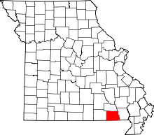 | |
| Townships |
| |
| CDPs | ||
| Other unincorporated communities | ||
| Ghost towns |
| |
| Footnotes | ‡This populated place also has portions in an adjacent county or counties | |