Neosho Falls, Kansas
| Neosho Falls, Kansas | |
|---|---|
| City | |
 Location within Woodson County and Kansas | |
 KDOT map of Woodson County (legend) | |
| Coordinates: 38°0′21″N 95°33′24″W / 38.00583°N 95.55667°WCoordinates: 38°0′21″N 95°33′24″W / 38.00583°N 95.55667°W | |
| Country | United States |
| State | Kansas |
| County | Woodson |
| Area[1] | |
| • Total | 0.57 sq mi (1.48 km2) |
| • Land | 0.54 sq mi (1.40 km2) |
| • Water | 0.03 sq mi (0.08 km2) |
| Elevation | 974 ft (297 m) |
| Population (2010)[2] | |
| • Total | 141 |
| • Estimate (2015)[3] | 134 |
| • Density | 250/sq mi (95/km2) |
| Time zone | Central (CST) (UTC-6) |
| • Summer (DST) | CDT (UTC-5) |
| ZIP code | 66758 |
| Area code | 620 |
| FIPS code | 20-49825 [4] |
| GNIS feature ID | 0478098 [5] |
Neosho Falls is a city in Woodson County, Kansas, United States. As of the 2010 census, the city population was 141.[6]
History
Neosho Falls was founded in 1857, making it the oldest town and first county seat in Woodson County.[7] It was named from the Neosho River, on which it is situated.[8] The first post office in Neosho Falls was established in May 1857.[9]
Neosho Falls was originally platted and extensively improved by a company led by Benjamin F. Goss and his brother N. S. Goss, who would later organize a company of cavalry in the area to fight for the Union in the American Civil War.
In popular culture
The town served as an inspiration for the 1988 album In the Spirit of Things by the rock band Kansas.[10][11]
Geography
Neosho Falls is located at 38°0′21″N 95°33′24″W / 38.00583°N 95.55667°W (38.005865, -95.556708).[12] According to the United States Census Bureau, the city has a total area of 0.57 square miles (1.48 km2), of which, 0.54 square miles (1.40 km2) is land and 0.03 square miles (0.08 km2) is water.[1]
Demographics
| Historical population | |||
|---|---|---|---|
| Census | Pop. | %± | |
| 1870 | 532 | — | |
| 1880 | 552 | 3.8% | |
| 1890 | 606 | 9.8% | |
| 1900 | 763 | 25.9% | |
| 1910 | 571 | −25.2% | |
| 1920 | 628 | 10.0% | |
| 1930 | 462 | −26.4% | |
| 1940 | 452 | −2.2% | |
| 1950 | 355 | −21.5% | |
| 1960 | 222 | −37.5% | |
| 1970 | 184 | −17.1% | |
| 1980 | 157 | −14.7% | |
| 1990 | 157 | 0.0% | |
| 2000 | 179 | 14.0% | |
| 2010 | 141 | −21.2% | |
| Est. 2015 | 134 | [3] | −5.0% |
| U.S. Decennial Census | |||
2010 census
the 2010 census,[2] there were 141 people, 59 households, and 38 families residing in the city. The population density was 261.1 inhabitants per square mile (100.8/km2). There were 84 housing units at an average density of 155.6 per square mile (60.1/km2). The racial makeup of the city was 132 White individuals (93.6%), 8 Hispanic or Latino individuals (5.7%), and one Native American individual (0.7%).
There were 59 households of which 22 (37.3%) had children under the age of 18 living with them, 24 (40.7%) were married couples living together, 6 (10.2%) had a female householder with no husband present, 8 (13.6%) had a male householder with no wife present, and 21 (35.6%) were non-families. 19 households (32.2%) were made up of individuals and 8 (13.6%) had someone living alone who was 65 years of age or older. The average household size was 2.39 and the average family size was 2.89.
The median age in the city was 40.2 years. 40 residents (28.4%) were under the age of 18; 10 (7.2%) were between the ages of 18 and 24; 29 (20.6%) were from 25 to 44; 36 (25.6%) were from 45 to 64; and 26 (18.4%) were 65 years of age or older. The gender makeup of the city was 51.1% male and 48.9% female.
2000 census
As of the census[4] of 2000, there were 179 people, 76 households, and 45 families residing in the city. The population density was 328.1 people per square mile (125.7/km²). There were 90 housing units at an average density of 164.9 per square mile (63.2/km²). The racial makeup of the city was 96.65% White, 2.79% Native American, and 0.56% from two or more races. Hispanic or Latino of any race were 2.23% of the population.
There were 76 households out of which 28.9% had children under the age of 18 living with them, 47.4% were married couples living together, 10.5% had a female householder with no husband present, and 39.5% were non-families. 38.2% of all households were made up of individuals and 18.4% had someone living alone who was 65 years of age or older. The average household size was 2.36 and the average family size was 3.13.
In the city the population was spread out with 30.7% under the age of 18, 3.9% from 18 to 24, 21.8% from 25 to 44, 28.5% from 45 to 64, and 15.1% who were 65 years of age or older. The median age was 39 years. For every 100 females there were 103.4 males. For every 100 females age 18 and over, there were 100.0 males.
The median income for a household in the city was $27,188, and the median income for a family was $33,000. Males had a median income of $29,250 versus $14,583 for females. The per capita income for the city was $9,543. About 18.8% of families and 24.8% of the population were below the poverty line, including 34.4% of those under the age of eighteen and 21.7% of those sixty five or over.
Notable people
- Benjamin Goss, Wisconsin legislator[13]
- James Swan, Wisconsin legislator[14]
See also
References
- 1 2 "US Gazetteer files 2010". United States Census Bureau. Retrieved 2012-07-06.
- 1 2 "American FactFinder". United States Census Bureau. Retrieved 2012-07-06.
- 1 2 "Annual Estimates of the Resident Population for Incorporated Places: April 1, 2010 to July 1, 2015". Retrieved July 2, 2016.
- 1 2 "American FactFinder". United States Census Bureau. Retrieved 2008-01-31.
- ↑ "US Board on Geographic Names". United States Geological Survey. 2007-10-25. Retrieved 2008-01-31.
- ↑ "2010 City Population and Housing Occupancy Status". U.S. Census Bureau. Retrieved July 31, 2011.
- ↑ Blackmar, Frank Wilson (1912). Kansas: A Cyclopedia of State History, Volume 2. Standard Publishing Company. p. 350.
- ↑ Kansas State Historical Society (1916). Biennial Report of the Board of Directors of the Kansas State Historical Society. Kansas State Printing Plant. p. 316.
- ↑ "Kansas Post Offices, 1828-1961". Kansas Historical Society. Archived from the original on October 9, 2013. Retrieved 27 June 2014.
- ↑ Atlanta Journal Constitution
- ↑ Popson, Tom (January 27, 1989). "Band Hears Music In Deserted Kansas Town". Chicago Tribune. Retrieved May 1, 2016.
- ↑ "US Gazetteer files: 2010, 2000, and 1990". United States Census Bureau. 2011-02-12. Retrieved 2011-04-23.
- ↑ 'Wisconsin Blue Book 1893,' Biographical Sketch of Benjamin Goss, pg. 564
- ↑ 'Wisconsin Blue Book 1973,' Biographical Sketch of James D. Swan, pg. 50
External links
| Wikimedia Commons has media related to Neosho Falls, Kansas. |
- City
- Schools
- USD 366, local school district
- Historical
- Neosho Falls - Falling on Hard Times, LegendsOfKansas.com
- Maps
- Neosho Falls City Map, KDOT
Municipalities and communities of Woodson County, Kansas, United States | ||
|---|---|---|
| Cities | 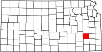 | |
| CDP | ||
| Unincorporated communities | ||