Nichlaul
| Nichlaul निचलौल | |
|---|---|
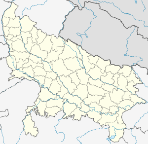 Location in Uttar Pradesh, India | |
| Coordinates: 27°19′N 83°44′E / 27.32°N 83.73°ECoordinates: 27°19′N 83°44′E / 27.32°N 83.73°E | |
| Country |
|
| State | Uttar Pradesh |
| District | Maharajganj |
| Government | |
| • Type | State Government |
| • Body | U.P. |
| Elevation | 91 m (299 ft) |
| Population (2011) | |
| • Total | 45,901 |
| Languages | |
| • Official | Hindi |
| Time zone | IST (UTC+5:30) |
Nichlaul (Hindi: निचलौल)is a town and a nagar panchayat Tahsil in Maharajganj district in the Indian state of Uttar Pradesh. It is situated 80 km from Gorakhpur and 25 km from Maharajganj in North direction. It is very close to Nepal as just 13 km
Nichlaul is known for its ancient history. It was a part of Chandragupt Mourya's vast empire. Later it was ruled by Raja Ratna Sen.
Government facilities
There is a Sadar Hospital and Animal Hospital facilitated by the government. Block and Tehsil headquarters are there. The Police Station is also in the centre of the town. The state government facilitate Buses for transport to link it with Nepal, Gorakhpur and other neighbourhoods. However Nichloul is not connected by a rail line. The nearest Railway Station is Gurli Ramgadwa, a village 15 km to the southeast.
Famous and religious places
Etahia Shiv Mandir is just 8 km from the place, considered as most popular pleace for holy place of lord Shiva. In the month of Shravan as per Hindu caleader there is a huge arrival of pilgrims at the place. Tikulahia Devi temple is also there within the town. here,the gorgeous palace of Lord Raja Ratan sen was situated but it is turned into 'khandahar" in nowadays,
Demographics
As of 2011 India census,[1] Nichlaul had a population of 45901. Males constitute 53% of the population and females 47%. Nichlaul has an average literacy rate of 65.9%, lower than the national average of 59.5%: male literacy is 67%, and female literacy is 44%. In Nichlaul, 18% of the population is under 6 years of age.
Languages
Bhojpuri was mostly spoken by the people in the past. But now, Hindi is the official language.
References
- ↑ "Census of India 2001: Data from the 2001 Census, including cities, villages and towns (Provisional)". Census Commission of India. Archived from the original on 2004-06-16. Retrieved 2008-11-01.