North Marysville, Washington
| North Marysville, Washington | |
|---|---|
| CDP | |
 Location of North Marysville, Washington | |
| Coordinates: 48°5′48″N 122°9′18″W / 48.09667°N 122.15500°WCoordinates: 48°5′48″N 122°9′18″W / 48.09667°N 122.15500°W | |
| Country | United States |
| State | Washington |
| County | Snohomish |
| Area | |
| • Total | 1.3 sq mi (3.4 km2) |
| • Land | 1.3 sq mi (3.4 km2) |
| • Water | 0.0 sq mi (0.0 km2) |
| Elevation | 82 ft (25 m) |
| Population (2010) | |
| • Total | 108 |
| • Density | 83.3/sq mi (32.2/km2) |
| Time zone | Pacific (PST) (UTC-8) |
| • Summer (DST) | PDT (UTC-7) |
| FIPS code | 53-49992[1] |
| GNIS feature ID | 1867623[2] |
North Marysville is a census-designated place (CDP) in Snohomish County, Washington, United States. The majority of the community was annexed into the city of Marysville. The population was 108 at the 2010 census.[3]
Geography
North Marysville is located at 48°5′48″N 122°9′18″W / 48.09667°N 122.15500°W (48.096777, -122.155135).[4]
According to the United States Census Bureau, the CDP has a total area of 1.3 square miles (3.4 km²), all of it land.
Demographics
| Historical population | |||
|---|---|---|---|
| Census | Pop. | %± | |
| 1980 | 15,159 | — | |
| 1990 | 18,711 | 23.4% | |
| 2000 | 21,161 | 13.1% | |
| 2010 | 108 | −99.5% | |
| U.S. Decennial Census | |||
As of the census[1] of 2000, there were 21,161 people, 7,031 households, and 5,744 families residing in the CDP. The population density was 1,539.6 people per square mile (594.6/km²). There were 7,186 housing units at an average density of 522.8/sq mi (201.9/km²). The racial makeup of the CDP was 89.84% White, 0.71% African American, 1.27% Native American, 3.35% Asian, 0.17% Pacific Islander, 1.75% from other races, and 2.92% from two or more races. Hispanic or Latino of any race were 4.60% of the population.
There were 7,031 households out of which 44.6% had children under the age of 18 living with them, 67.2% were married couples living together, 9.7% had a female householder with no husband present, and 18.3% were non-families. 13.3% of all households were made up of individuals and 4.0% had someone living alone who was 65 years of age or older. The average household size was 3.01 and the average family size was 3.27.
In the CDP the age distribution of the population shows 30.9% under the age of 18, 7.4% from 18 to 24, 32.8% from 25 to 44, 21.2% from 45 to 64, and 7.7% who were 65 years of age or older. The median age was 34 years. For every 100 females there were 100.1 males. For every 100 females age 18 and over, there were 97.7 males.
The median income for a household in the CDP was $56,699, and the median income for a family was $59,694. Males had a median income of $45,420 versus $29,935 for females. The per capita income for the CDP was $20,842. About 3.6% of families and 4.9% of the population were below the poverty line, including 5.6% of those under age 18 and 3.0% of those age 65 or over.
References
- 1 2 "American FactFinder". United States Census Bureau. Retrieved 2008-01-31.
- ↑ "US Board on Geographic Names". United States Geological Survey. 2007-10-25. Retrieved 2008-01-31.
- ↑ "Incorporated Places and Minor Civil Divisions: Washington". Population Census. 2010 United States Census. 2011-07-18. Retrieved 2011-07-27.
- ↑ "US Gazetteer files: 2010, 2000, and 1990". United States Census Bureau. 2011-02-12. Retrieved 2011-04-23.
Municipalities and communities of Snohomish County, Washington, United States | ||
|---|---|---|
| Cities | 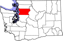 | |
| Towns | ||
| CDPs |
| |
| Other unincorporated communities | ||
| Ghost town | ||
| Indian reservation | ||
| Footnotes | ‡This populated place also has portions in an adjacent county or counties | |