Novomoskovsk, Russia
| Novomoskovsk (English) Новомосковск (Russian) | |
|---|---|
| - City[1] - | |
 Central square in Novomoskovsk | |
.svg.png) Location of Tula Oblast in Russia | |
 Novomoskovsk | |
|
| |
.png) |
|
|
| |
| City Day | May 25 |
| Administrative status (as of June 2014) | |
| Country | Russia |
| Federal subject | Tula Oblast[1] |
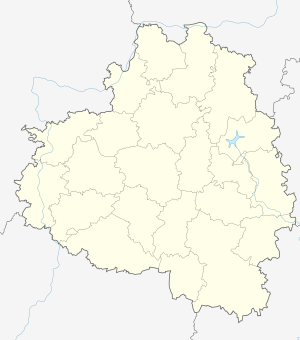
| Administrative district | Novomoskovsky District[1] |
| City under district jurisdiction | Novomoskovsk[2] |
| Administrative center of | Novomoskovsky District,[1] Novomoskovsk Town Under District Jurisdiction[3] |
| Municipal status (as of October 2009) | |
| Urban okrug | Novomoskovsk Urban Okrug[4] |
| Administrative center of | Novomoskovsk Urban Okrug[5] |
| Head | Anatoly Prorokov |
| Representative body | Assembly of Deputies[6] |
| Statistics | |
| Area | 74.7 km2 (28.8 sq mi)[7] |
| Population (2010 Census) | 131,386 inhabitants[8] |
| - Rank in 2010 | 124th |
| Density | 1,759/km2 (4,560/sq mi)[9] |
| Time zone | MSK (UTC+03:00)[10] |
| Founded | 1930 |
| City status since | 1930 |
| Previous names |
Bobriki (until 1933), Stalinogorsk (until 1961) |
| Postal code(s)[11] | 301650–301654, 301657, 301659–301666, 301668, 301670, 301679 |
| Dialing code(s) | +7 48762 |
|
| |
| Novomoskovsk on Wikimedia Commons | |
Novomoskovsk (Russian: Новомоско́вск) is a city and the administrative center of Novomoskovsky District in Tula Oblast, Russia, located at the source of the Don and Shat Rivers. Population: 131,386 (2010 Census);[8] 134,081 (2002 Census);[12] 146,302 (1989 Census);[13] 143,000 (1974); 107,000 (1959); 76,000 (1939).
History

The city originated in the 18th century as the family manor of Counts Bobrinsky, who industrialized it towards the end of the 19th century. The city, under the name of Bobriki (Бобрики) was officially established in 1930 and continued to develop as a coal (lignite) mining center throughout the Soviet period. In 1933, it was renamed Stalinogorsk (Сталиногорск). During World War II, the city was occupied by the German Army from November 22, 1941 to December 11, 1941. In 1961, it was given its present name. The city was awarded the Order of the Red Banner of Labor on January 14, 1971.
Administrative and municipal status
Within the framework of administrative divisions, Novomoskovsk serves as the administrative center of Novomoskovsky District.[1] As an administrative division, it is, together with three rural localities, incorporated within Novomoskovsky District as Novomoskovsk City Under District Jurisdiction.[2] As a municipal division, the territories of Novomoskovsk Town Under District Jurisdiction and of thirteen rural okrugs of Novomoskovsky District are incorporated as Novomoskovsk Urban Okrug.[4][14]
Notable people
- Ksenia Semyonova, gymnast
Twin towns and sister cities
Novomoskovsk is twinned with:
References
Sources
- 1 2 3 4 5 Law #954-ZTO
- 1 2 Law #954-ZTO defines a city under district jurisdiction as a city which is a part of one of the districts of the oblast. OKATO lists the city of Novomoskovsk as a part of Novomoskovsky District and separately from other administrative divisions of the district.
- ↑ Государственный комитет Российской Федерации по статистике. Комитет Российской Федерации по стандартизации, метрологии и сертификации. №ОК 019-95 1 января 1997 г. «Общероссийский классификатор объектов административно-территориального деления. Код 70 234 501», в ред. изменения №259/2014 от 12 декабря 2014 г.. (State Statistics Committee of the Russian Federation. Committee of the Russian Federation on Standardization, Metrology, and Certification. #OK 019-95 January 1, 1997 Russian Classification of Objects of Administrative Division . Code 70 234 501, as amended by the Amendment #259/2014 of December 12, 2014. ).
- 1 2 Law #1058-ZTO
- ↑ Федеральная служба государственной статистики. Федеральное агентство по технологическому регулированию и метрологии. №ОК 033-2013 1 января 2014 г. «Общероссийский классификатор территорий муниципальных образований. Код 70 724». (Federal State Statistics Service. Federal Agency on Technological Regulation and Metrology. #OK 033-2013 January 1, 2014 Russian Classification of Territories of Municipal Formations. Code 70 724. ).
- ↑ Official website of Novomoskovsk Urban Okrug. Assembly of Deputies (Russian)
- ↑ Федеральная служба государственной статистики. Регионы России. Основные социально-экономические показатели городов - 2011г.
- 1 2 Russian Federal State Statistics Service (2011). "Всероссийская перепись населения 2010 года. Том 1" [2010 All-Russian Population Census, vol. 1]. Всероссийская перепись населения 2010 года (2010 All-Russia Population Census) (in Russian). Federal State Statistics Service. Retrieved June 29, 2012.
- ↑ The value of density was calculated automatically by dividing the 2010 Census population by the area specified in the infobox. Please note that this value may not be accurate as the area specified in the infobox does not necessarily correspond to the area of the entity proper or is reported for the same year as the population.
- ↑ Правительство Российской Федерации. Федеральный закон №107-ФЗ от 3 июня 2011 г. «Об исчислении времени», в ред. Федерального закона №271-ФЗ от 03 июля 2016 г. «О внесении изменений в Федеральный закон "Об исчислении времени"». Вступил в силу по истечении шестидесяти дней после дня официального опубликования (6 августа 2011 г.). Опубликован: "Российская газета", №120, 6 июня 2011 г. (Government of the Russian Federation. Federal Law #107-FZ of June 31, 2011 On Calculating Time, as amended by the Federal Law #271-FZ of July 03, 2016 On Amending Federal Law "On Calculating Time". Effective as of after sixty days following the day of the official publication.).
- ↑ Почта России. Информационно-вычислительный центр ОАСУ РПО. (Russian Post). Поиск объектов почтовой связи (Postal Objects Search) (Russian)
- ↑ Russian Federal State Statistics Service (May 21, 2004). "Численность населения России, субъектов Российской Федерации в составе федеральных округов, районов, городских поселений, сельских населённых пунктов – районных центров и сельских населённых пунктов с населением 3 тысячи и более человек" [Population of Russia, Its Federal Districts, Federal Subjects, Districts, Urban Localities, Rural Localities—Administrative Centers, and Rural Localities with Population of Over 3,000] (XLS). Всероссийская перепись населения 2002 года [All-Russia Population Census of 2002] (in Russian). Retrieved August 9, 2014.
- ↑ Demoscope Weekly (1989). "Всесоюзная перепись населения 1989 г. Численность наличного населения союзных и автономных республик, автономных областей и округов, краёв, областей, районов, городских поселений и сёл-райцентров" [All Union Population Census of 1989: Present Population of Union and Autonomous Republics, Autonomous Oblasts and Okrugs, Krais, Oblasts, Districts, Urban Settlements, and Villages Serving as District Administrative Centers]. Всесоюзная перепись населения 1989 года [All-Union Population Census of 1989] (in Russian). Институт демографии Национального исследовательского университета: Высшая школа экономики [Institute of Demography at the National Research University: Higher School of Economics]. Retrieved August 9, 2014.
- ↑ Registry of the Inhabited Localities in Tula Oblast
Notes
- Тульская областная Дума. Закон №954-ЗТО от 27 декабря 2007 г. «Об административно-территориальном устройстве Тульской области», в ред. Закона №2131-ЗТО от 11 июня 2014 г. «О внесении изменений в Закон Тульской области "Об административно-территориальном устройстве Тульской области" и Закон Тульской области "Об установлении границ административно-территориальных единиц – районов в городе Туле"». Вступил в силу по истечении десяти дней после дня официального опубликования. Опубликован: "Вестник Тульской областной Думы", №11–12(142–143), часть 4, ноябрь–декабрь 2007 г.. (Tula Oblast Duma. Law #954-ZTO of December 27, 2007 On the Administrative-Territorial Structure of Tula Oblast, as amended by the Law #2131-ZTO of June 11, 2014 On Amending the Law of Tula Oblast "On the Administrative-Territorial Structure of Tula Oblast" and the Law of Tula Oblast "On Establishing the Borders of the Administrative-Territorial Units–the Districts in the City of Tula". Effective as of the day which is ten days after the official publication date.).
- Тульская областная Дума. Закон №1058-ЗТО от 8 июля 2008 г. «О преобразовании муниципального образования город Новомосковск Новомосковского района, установлении границы муниципального образования город Новомосковск Новомосковского района», в ред. Закона №1332-ЗТО от 7 октября 2009 г «Об установлении границы муниципального образования город Новомосковск». Вступил в силу по истечении десяти дней после дня официального опубликования. Опубликован: "Тульские известия", №134, 10 июля 2008 г. (Tula Oblast Duma. Law #1058-ZTO of July 8, 2008 On the Transformation of the Municipal Formation of the Town of Novomoskovsk of Novomoskovsky District, on Establishing the Border of the Municipal Formation of the Town of Novomoskovsk of Novomoskovsky District, as amended by the Law #1332-ZTO of October 7, 2009 On Establishing the Border of the Municipal Formation of the Town of Novomoskovsk. Effective as of upon passage of ten days from the day of the official publication.).
- Registry of the Inhabited Localities in Tula Oblast
| Cities and towns | |||
|---|---|---|---|
| Administrative districts | |||