Nyköping
| Nyköping | ||
|---|---|---|
|
images of Nyköping | ||
| ||
 Nyköping 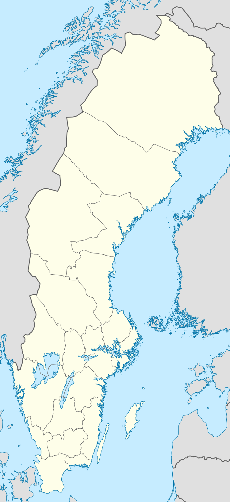 Nyköping | ||
| Coordinates: 58°45′11″N 17°00′31″E / 58.75306°N 17.00861°ECoordinates: 58°45′11″N 17°00′31″E / 58.75306°N 17.00861°E | ||
| Country | Sweden | |
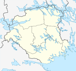
| Province | Södermanland | |
| County | Södermanland County | |
| Municipality | Nyköping Municipality | |
| Founded | 1187 | |
| Area[1] | ||
| • City | 13.43 km2 (5.19 sq mi) | |
| Elevation | 20 m (70 ft) | |
| Population (31 December 2010)[1] | ||
| • City | 29,891 | |
| • Density | 2,225/km2 (5,760/sq mi) | |
| • Metro | 50,760 | |
| Time zone | CET (UTC+1) | |
| • Summer (DST) | CEST (UTC+2) | |
| Postal code | 611 xx | |
| Area code(s) | (+46) 155 | |
| Website | www.nykoping.se (English) | |


Nyköping (Swedish pronunciation: [nyːˈɕœpɪŋ])[2] is a locality and the seat of Nyköping Municipality, Södermanland County, Sweden with 29,891 inhabitants in 2010.[1] The city is also the capital of Södermanland County. Including Arnö, the locality on the southern shore of the bay just a couple of kilometres from the city centre, Nyköping would have 33,762 inhabitants according to the same SCB source. Commonly, Arnö is referred to as a part of the city proper. It forms a wider conurbation with neighbouring minor town Oxelösund 10 kilometres (6.2 mi) south of its outskirts.
Nyköping literally translates as Newmarket into English. The prefix Ny is translated as New and köping is an old Swedish word for a market place and a commonly used suffix for cities in the south central region of the country. The city is located near the open Baltic Sea coast, and is regarded as a coastal location. Nyköping is also the home of Stockholm Skavsta Airport which is located less than 10 kilometres (6.2 mi) from the city centre. Nyköping is part of the wider area of the Mälaren Valley, being around 100 kilometres (62 mi) from inner Stockholm. It retains an oceanic/continental climate hybrid, causing warm summers and snowy winters.
History
The area bears traces of settlers since around 2000 BC. In the early medieval age, around 1000 AD, Nyköping was a capital of one of the many Swedish petty kingdoms. In the 13th century, construction on the Nyköping Fortress was begun; the following century it became the strongest fortress of the country. The coat of arms probably depicts the fortress, or one of its towers.
In 1317 the Nyköping Banquet took place, a renowned episode in Sweden's history, when King Birger of Sweden captured his two brothers as a revenge for earlier sufferings and had them imprisoned without food until they starved to death. (See Nyköpings gästabud.)
The earliest known charter dates from 1444, making it one of the now defunct Cities in Sweden. In the 16th century Nyköping became the seat of Duke Charles who later became Charles IX of Sweden. With the status of a Royal residential seat, Nyköping was at its peak of development.
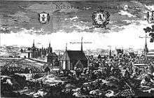
In 1665 large parts of the city including the fortress were damaged in a fire. The same thing happened again in 1719 when Russian troops invaded the city. It was then rebuilt with its current street plan.
Nyköping was industrialized relatively early compared to the rest of Sweden. In the early 19th century, textile industry was established, and the population soon rose as Nyköping's industry grew. In 1879, C.A. Wedholms mejerikärlsfabrik was founded, starting to produce milk churns.
20th century

Nyköping was the town where Nordiska Kompaniet had its furniture factory. The business created a spin-off named ANA, which licence-built American and English cars. The company was later purchased by Saab Automobile and led to SAAB becoming the largest employer in the town during the 1980s, as well as the relocation of the headquarters to Spelhagen. But when GM bought SAAB from Investor AB, the headquarters was moved back to Trollhättan and about two thousand lost their jobs.[3]
Military history
Nyköping has been a stronghold for the reconnaissance squadrons of the Swedish Air Force. Between 1941 and 1980, the nearby Stockholm Skavsta Airport was hosting the F11 wing which had three squadrons with reconnaissance aircraft. It was the only dedicated reconnaissance wing in the Swedish Air Force. The city has also hosted the flying school of the Swedish Army which was located at Brandholmen between 1963 and 1985.
Geography
Position
Nyköping lies about 100 kilometres (62 mi) south-west of capital Stockholm along the Baltic Sea. It is roughly 60 kilometres (37 mi) north-east of Norrköping, both cities being accessible by highway-divided motorway. It is also about 80 kilometres (50 mi) south of Eskilstuna; the largest settlement of the county. The northern areas of the city is on exactly the same parallel of 58° 46' N as Canadian 'polar bear capital of the world' Churchill, demonstrating how warm the climate is in comparison in spite of its northerly parallel. The southern edge of the municipality also straddles the same parallel as the northernmost point of mainland Scotland at Thurso – that has a much more narrower of temperature. The southern edge of the municipality is the southernmost point of Svealand, the middle of Sweden's traditional three crown lands that once formed the country. The city is located at a few miles more southerly latitude than the country's northernmost west coast town of Strömstad.
Living environment
Nyköping is the exodus of a small river named Nyköpingsån (Nyköping River), which runs through the city centre, dividing the city into a natural eastern and western part. Due to the narrowness of the river, there are a full seven crossings available for automobile traffic, one of them being for the E4. For pedestrians and bikers, an additional seven bridges are available, and in addition to that there's also one bridge for train traffic. All automobile bridges except E4 also carry pedestrian sidewalks, which means transport is seldom made longer than the actual distance. There is also a small pedestrian bridge in an unpopulated nature reserve called Hållet that is very close to the E4 route. The small river Kilaån separates Nyköping and Arnö, with that river being even narrower. Also separating Nyköping and Arnö is the so-called Stadsfjärden (the City bay), which is a bay stretching around the Arnö peninsula down to the neighboring municipality of Oxelösund. Stadsfjärden is primarily used for tourist shipping and canoeing, with an internationally renowned canoeing stadium being situated along the northern shore. The port is much smaller than Oxelösund's and is primarily used for civil traffic, as opposed to cargo shipments and ferry traffic which is dominated by nearby ports of Oxelösund and Nynäshamn. This is due to the port being some 15 kilometres from open sea as opposed to Oxelösund's position on the edge of the peninsula. Even though Nyköping is a relatively flat city there are some hills in the northern parts of the town, barely reaching 50 metres altitude. The city centre is essentially just above sea level and doesn't rise above 20 metres altitude, although it contains hills surrounding it.
Populated areas of Nyköping
- Brandholmen
- Brandkärr
- Bryngelstorp
- Ekensberg
- Fågelbo
- Isaksdal
- Harg
- Herrhagen (at Arnö)
- Högbrunn
- Kuggnäs (at Arnö)
- Långsätter (at Arnö)
- Malmbryggshagen
- Myntan (at Arnö)
- Oppeby
- Oxbacken
- Påljungshage
- Rosenkälla
- Stenkulla
- Väster (the West)
- Öster (the East)
- Östra bergen (the Eastern Mountains)
The area of Gumsbacken only carries a large shopping mall centre but is part of the city proper.
Connected areas
The rural localities of Sjösa, Bergshammar, Svalsta and Enstaberga located within 10 kilometres (6.2 mi) are connected to the city centre by cycle tracks with permanent floodlightning. In addition there is a nature and coastal area called Tjuvholmen east of the city centre that is part of the locality with many holiday homes. Tjuvholmen lacks an asphalted access road and is in general seen as a rural area in spite of its proximity to the city centre. East of Arnö on the southern shore there are similar areas such as Örstig which is connected by asphalt road and cycle tracks to Arnö and Nyköping. Other nearby rural areas on the southern shore include holiday home areas such as Linudden and Örstigsnäs and also the coastal camping place of Strandstugeviken. There is also lighted cycling tracks all the way south roughly 15 kilometres (9.3 mi) to neighbouring city Oxelösund, making pedestrian and biking transport to nearby areas effective and avoids potentially dangerous contacts with motor vehicles.
Transportation

Buses
Nyköping's intercity and city bus-links are operated by Nobina Sverige. The city bus network consists of seven lines:[4]
| Number | Origin | Final destination | Frequency | Distance |
|---|---|---|---|---|
| 1 | Bryngelstorp | Harg | Every 15 minutes | 11.4 km (7.1 mi) |
| 2 | Arnö | Brandkärr | Every 15 minutes | 7.8 km (4.8 mi) |
| 3 | Bus station | Brandholmen | Twice an hour | 3.4 km (2.1 mi) |
| 160 | Myntan (North Arnö) | Myntan (North Arnö) | Every 40 minutes | NA |
| 161 | Bus station | Bus station (via Brandkärr) | 10 times/day | NA |
| 162 | Bus station | Bus station (via Isaksdal) | 10 times/day | NA |
| 164 | Bryngelstorp | Bus station | Morning bus, 1 time/day | NA |
Coaches to Stockholm and Gothenburg are operated by Swebus.
Rail

The city is located on a branch line to the Södra stambanan. Scheduled railway connections on the line is provided by SJ AB. These are mostly operated by Electric Multiple Units of which the SJ X40 is the most common. Commuter trains towards Norrköping may be operated by X12s. SJ does currently not operate any X 2000 services to Nyköping.
| Line | Vehicles | Operator |
|---|---|---|
| Gävle-Stockholm-Linköping | SJ Rc • SJ X40 | SJ AB |
| Norrköping | SJ X12 | SJ AB |
| Stockholm-Malmö | Bombardier TRAXX • Eurosprinter | Veolia operated by Hector Rail. |
Air
Stockholm-Skavsta Airport offers intra-European routes on Ryanair and Wizz Air. The airport is located about 10 kilometers outside of the city.
Climate
Nyköping has, along with the rest of Mälardalen, a relatively mild humid continental climate.[5] In recent decades the climate has more resembled a four-season oceanic climate. Winter averages around the freezing point during daytime with only the cold nights causing winter conditions in many winters. Summer average highs are between 20 °C (68 °F) and 23 °C (73 °F) depending on month and weather patterns. However, both summers and winters have been significantly warmer and colder, respectively, than the averages. Temperatures over 30 °C (86 °F) are occasional but not overly common, with temperatures above 32 °C (90 °F) unknown in recent decades.[6] Winters are normally tempered by the Gulf Stream influence from the west and to a lesser degree the Baltic Sea to the east, but when cold air breaks through cold temperatures can occur, sometimes for a prolonged time. As typical of southern Sweden there is a slight seasonal lag, rendering that the warmest period is often occurring during the second half of summer.
The inland areas of the municipality are very much similar to the coastal areas, but the weather station at Skavsta shows lower summer mean temperatures than Oxelösund's, indicating that the inner city wider urban area nearer the water has milder nights year round. Both stations are within a meteorological relevant range from the city centre.
| Climate data for Nyköping | |||||||||||||
|---|---|---|---|---|---|---|---|---|---|---|---|---|---|
| Month | Jan | Feb | Mar | Apr | May | Jun | Jul | Aug | Sep | Oct | Nov | Dec | Year |
| Average high °C (°F) | 0 (32) |
1 (34) |
7 (45) |
11 (52) |
16 (61) |
20 (68) |
23 (73) |
22 (72) |
17 (63) |
10 (50) |
5 (41) |
2 (36) |
11.2 (52.3) |
| Average low °C (°F) | −5 (23) |
−5 (23) |
−3 (27) |
1 (34) |
6 (43) |
10 (50) |
13 (55) |
12 (54) |
8 (46) |
4 (39) |
1 (34) |
−4 (25) |
3.2 (37.8) |
| Average precipitation mm (inches) | 40.8 (1.606) |
27.2 (1.071) |
28.2 (1.11) |
32.2 (1.268) |
33.1 (1.303) |
46.0 (1.811) |
66.4 (2.614) |
58.4 (2.299) |
56.7 (2.232) |
50.8 (2) |
56.2 (2.213) |
49.0 (1.929) |
544.9 (21.453) |
| Source: SMHI.se[7] | |||||||||||||
Sports
Nyköping has two major sport clubs:
- Nyköpings Boll-och Idrottsällskap is the local Division 1 football club;[8] they play their home matches at the Rosvalla Nyköping Eventcenter.
- Nyköpings Hockey is the local ice hockey club; its home rink is PEAB Arena.
The city is yet to have a team in the major football or hockey leagues of Sweden, with stints in the second tiers being the greatest achievements for both sides.
Sights
Nyköping includes the cinema Biostaden which houses Sweden's largest cinema screen.[9] The cinema was newly built from the ground in 2012. It is located in Högbrunn.
Nyköpings Stadsbibliotek (Nyköping City Library) is located in the city center, which offers various book clubs and activities for children. There is free Internet access and wifi for visitors. It has books of all genres, for all ages, and in many languages.[10]

 City hall
 Library and cultural center
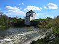
 Vattengränd, The oldest street in Nyköping
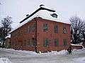 Westerlingska gården
 Rosvalla Highrise
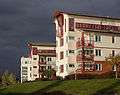 Brandholmen Seaside houses
 Sankta Anna Catholic Church
 Sankta Katarina Lutheran Church, Arnö
 Hjortensberg Pentecostal Church
 Villa Sturegården, by architect Gunnar Asplund
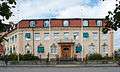 Former headquarters of Sunlights AB
 Spelhagen, former location of AB Nyköpings Automobilfabrik
 Maingate
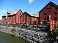 Rökeriet Nyköping
Twin cities
References
- 1 2 3 "Tätorternas landareal, folkmängd och invånare per km2 2005 och 2010" (in Swedish). Statistics Sweden. 14 December 2011. Archived from the original on 10 January 2012. Retrieved 10 January 2012.
- ↑ Duden Aussprachewörterbuch gives Swedish pronunciation: [ˌnyːçøːpiŋ]
- ↑ http://www.sn.se/polopoly_fs/1.561819.1259760309!/sn-saab-20090131.pdf
- ↑ "Tidtabeller i PDF-format". www.sormlandstrafiken.se. Retrieved 2016-06-02.
- ↑ "Nykoping, Sweden Climate Summary". Weatherbase. Retrieved 17 December 2014.
- ↑ "Nykoping, Sweden Temperature averages". Weatherbase. Retrieved 17 December 2014.
- ↑ "Weather Information for Nyköping 1961–1990". Swedish Meteorological Institute. Retrieved 31 October 2012.
- ↑ "Nyköpings BIS – Fotboll Klubb". Retrieved 2010-09-16.
- ↑ "Biostaden". Retrieved 2015-06-03.
- ↑ "Welcome – Nykoping". bibliotek.nykoping.se. Retrieved 2015-06-03.
External links
| Wikimedia Commons has media related to Nyköping. |
| Wikivoyage has a travel guide for Nyköping. |
- Official website (English)
- Visit Nyköping – The official visitors' guide
- Nyköping Facebook – The official Facebook-page
Municipalities and seats of Södermanland County | ||
|---|---|---|
| Municipalities | ||
| Municipal seats | ||
Administrative seats of Swedish counties (län) | ||
|---|---|---|
| ||