Oberndorf in Tirol
| Oberndorf in Tirol | ||
|---|---|---|
| ||
 Oberndorf in Tirol Location within Austria | ||
| Coordinates: 47°29′55″N 12°23′05″E / 47.49861°N 12.38472°ECoordinates: 47°29′55″N 12°23′05″E / 47.49861°N 12.38472°E | ||
| Country | Austria | |
| State | Tyrol | |
| District | Kitzbühel | |
| Government | ||
| • Mayor | Johann Schweigkofler | |
| Area | ||
| • Total | 17.7 km2 (6.8 sq mi) | |
| Elevation | 687 m (2,254 ft) | |
| Population (1 January 2016)[1] | ||
| • Total | 2,116 | |
| • Density | 120/km2 (310/sq mi) | |
| Time zone | CET (UTC+1) | |
| • Summer (DST) | CEST (UTC+2) | |
| Postal code | 6372 | |
| Area code | 05352 | |
| Vehicle registration | KB | |
| Website | www.oberndorf-tirol.at | |

Oberndorf is a municipality in Kitzbühel district in the Austrian state of Tyrol. It is located in the Leukental valley, on the Kitzbühler Ache stream, halfway between St. Johann in Tirol and Kitzbühel.
The municipality consists of a main village and several hamlets, reaching up to the Kitzbühler Horn mountain. Its neighbouring municipalities are Going am Wilden Kaiser, Kitzbühel, Reith bei Kitzbühel, and St. Johann in Tirol.
Population
| Historical population | ||
|---|---|---|
| Year | Pop. | ±% |
| 1869 | 759 | — |
| 1880 | 765 | +0.8% |
| 1890 | 641 | −16.2% |
| 1900 | 639 | −0.3% |
| 1910 | 726 | +13.6% |
| 1923 | 769 | +5.9% |
| 1934 | 811 | +5.5% |
| 1939 | 744 | −8.3% |
| 1951 | 846 | +13.7% |
| 1961 | 933 | +10.3% |
| 1971 | 1,137 | +21.9% |
| 1981 | 1,420 | +24.9% |
| 1991 | 1,650 | +16.2% |
| 2001 | 1,944 | +17.8% |
| 2011 | 2,015 | +3.7% |
Economy
Until the 18th century copper was mined at the Rerobichl.
Today, economy is focused on tourism, and a quarry. Oberndorf has a railway halt on the Salzburg-Tyrol Railway.
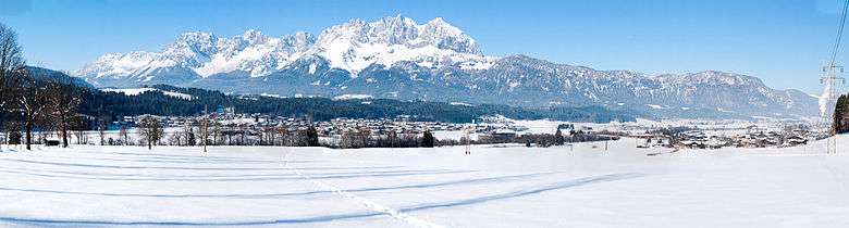
Panorama
References
- ↑ Statistik Austria - Bevölkerung zu Jahresbeginn 2002-2016 nach Gemeinden (Gebietsstand 1.1.2016) for Oberndorf in Tirol.
External links
| Wikimedia Commons has media related to Oberndorf in Tirol. |
This article is issued from Wikipedia - version of the 1/7/2014. The text is available under the Creative Commons Attribution/Share Alike but additional terms may apply for the media files.