Okaton, South Dakota
| Okaton, South Dakota | |
|---|---|
| CDP | |
 Location in Jones County and the state of South Dakota | |
| Country | United States |
| State | South Dakota |
| Counties | Jones |
| Area | |
| • Total | 29.8 sq mi (77.2 km2) |
| • Land | 29.8 sq mi (77.1 km2) |
| • Water | 0 sq mi (0.1 km2) |
| Population (2010)[1] | |
| • Total | 36 |
| • Density | 1.2/sq mi (0.47/km2) |
Okaton is a census-designated place (CDP) in Jones County, South Dakota, United States. As of the 2010 census, the population was 36.
Okaton had its start in 1906 by the building of the Milwaukee Railroad through that territory.[2]
Geography
Okaton is located at 43°53′13″N 100°53′33″W / 43.88694°N 100.89250°W (43.88706, -100.89239).
According to the United States Census Bureau, Okaton has a total area of 29.8 square miles (77 km2), of which, 29.8 square miles (77 km2) of it is land and 0.04 square miles (0.10 km2) of it (0.10%) is water.
Okaton has been assigned the ZIP code 57562.
Demographics
| Historical population | |||
|---|---|---|---|
| Census | Pop. | %± | |
| 2000 | 29 | — | |
| 2010 | 36 | 24.1% | |
| U.S. Decennial Census | |||
As of the census[3] of 2000, there were 29 people, 14 households, and 7 families residing in the CDP. The population density was 1.0 people per square mile (0.4/km²). There were 18 housing units at an average density of 0.6/sq mi (0.2/km²). The racial makeup of the CDP was 75.86% White, 20.69% from two or more races, and 3.45% Pacific Islander.
There were 14 households out of which 21.4% had children under the age of 18 living with them, 57.1% were married couples living together, and 42.9% were non-families. 42.9% of all households were made up of individuals and 21.4% had someone living alone who was 65 years of age or older. The average household size was 2.07 and the average family size was 2.88.
In the CDP the population was spread out with 17.2% under the age of 18, 13.8% from 18 to 24, 13.8% from 25 to 44, 27.6% from 45 to 64, and 27.6% who were 65 years of age or older. The median age was 48 years. For every 100 females there were 123.1 males. For every 100 females age 18 and over, there were 140.0 males.
The median income for a household in the CDP was $23,750, and the median income for a family was $30,625. Males had a median income of $11,250 versus $28,750 for females. The per capita income for the CDP was $13,859. None of the population or families were below the poverty line.
References
- ↑ "2010 Census Redistricting Data (Public Law 94-171) Summary File". American FactFinder. United States Census Bureau. Archived from the original on July 21, 2011. Retrieved 27 April 2012.
- ↑ Federal Writers' Project (1940). South Dakota place-names, v.1-3. University of South Dakota. p. 52.
- ↑ "American FactFinder". United States Census Bureau. Archived from the original on September 11, 2013. Retrieved 2008-01-31.
Municipalities and communities of Jones County, South Dakota, United States | ||
|---|---|---|
| City | 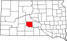 | |
| Town | ||
| CDP | ||
| Unincorporated communities | ||
| Township | ||