Okollo
| Okollo | |
|---|---|
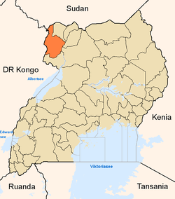
 Okollo Map of Uganda showing the location of Okollo. | |
| Coordinates: 02°39′15″N 31°08′44″E / 2.65417°N 31.14556°E | |
| District | Arua District |
| Elevation | 800 m (2,600 ft) |
| Time zone | EAT (UTC+3) |
Okollo is a town in Arua District, northwestern Uganda.
Location
Okollo is located approximately 58 kilometres (36 mi), by road, southeast of Arua, the largest city in the sub-region, on the Arua-Nebbi Highway.[1] The coordinates of the town are: 02 39 15N, 31 08 44E (Latitude:2.65417; Longitude:31.14556).
Overview
Okollo is the headquarters of Okollo sub-county in Madi-Okollo County in Arua District. The town lies on the Arua-Nebbi Highway which continues on to Gulu, the largest city in Northern Uganda. Okollo also lies in the path of the 33kV electric power line from Nyagak Power Station in Paidha, Nebbi District, connecting to Arua, through Nebbi, Okollo and Bondo.
Population
The exact population of the town of Okollo is not known at this time.
See also
References
Capital: Arua | ||
| Counties and sub-counties |
|  |
| Towns and villages | ||
| Economy |
| |
| Notable landmarks |
| |
| Education | ||
| Transport |
| |
| Health | ||
| Notable people |
| |
Coordinates: 02°39′15″N 31°08′44″E / 2.65417°N 31.14556°E