Bondo, Uganda
| Bondo | |
|---|---|
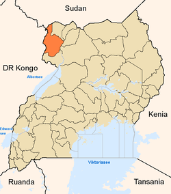
 Bondo Map of Uganda showing the location of Bondo | |
| Coordinates: 02°47′00″N 30°58′00″E / 2.78333°N 30.96667°E | |
| Region | Northern Uganda |
| Sub-region | West Nile sub-region |
| District | Arua District |
| Time zone | EAT (UTC+3) |
Bondo is a town in Uganda.
Location
Bondo is located in Arua District, West Nile sub-region, in Northern Uganda. It lies approximately 29 kilometres (18 mi), by road, southeast of Arua, the largest town in the sub-region, on the Arua - Nebbi Highway.[1] The coordinates of the town are: 02 47 00N, 30 58 00E.
Overview
The town lies on the Arua-Nebbi Highway which continues on to Gulu, the largest city in Northern Uganda. Bondo also lies along the path of the 33kV electric power line from Nyagak Power Station in Paidha, Nebbi District, connecting to Arua, through Nebbi, Okollo and Bondo.
Points of interest
Some of the points of interest in the town include the following:
- The offices of Bondo Town Council
- Bondo Central Market
- The Arua-Gulu Road - The all-tarmac road passes through the middle of town
- The 33kV electric power line from Paidha, Zombo District to Arua, Arua District - The power transmission line also passes through Nebbi in Nebbi District and through Okollo in Arua District.
See also
References
External links
Capital: Arua | ||
| Counties and sub-counties |
|  |
| Towns and villages | ||
| Economy |
| |
| Notable landmarks |
| |
| Education | ||
| Transport |
| |
| Health | ||
| Notable people |
| |
Coordinates: 02°47′00″N 30°58′00″E / 2.78333°N 30.96667°E