Old Clee
| Old Clee | |
 Church Lane, Old Clee |
|
 Old Clee |
|
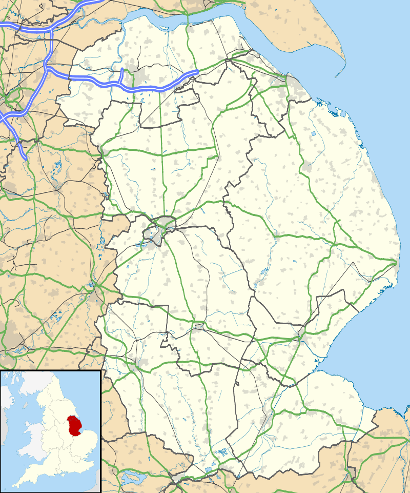
| OS grid reference | TA293084 |
|---|---|
| – London | 140 mi (230 km) S |
| District | North East Lincolnshire |
| Shire county | Lincolnshire |
| Region | Yorkshire and the Humber |
| Country | England |
| Sovereign state | United Kingdom |
| Post town | Grimsby |
| Postcode district | DN32 |
| Police | Humberside |
| Fire | Humberside |
| Ambulance | East Midlands |
| EU Parliament | Yorkshire and the Humber |
| UK Parliament | Cleethorpes |
|
|
Coordinates: 53°33′24″N 0°02′54″W / 53.556578°N 0.048308°W
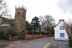
Old Clee is located in the Clee Road (A46) and Carr Lane area of eastern Grimsby, North East Lincolnshire, England, and adjoins the neighbouring town of Cleethorpes, to which it has historic links. The population is included in the Heneage ward of the North East Lincolnshire Unitary Council. Previously a separate village, its parish church of Holy Trinity and Saint Mary, claimed to be the oldest building in Grimsby, has a Saxon tower dating from 1050 AD. Located in the area are the Old Clee infants/junior schools (Colin Avenue) and the Havelock Academy (Holyoake Road). Nearby is the King George V Stadium.
History
The settlement of Clee was in existence by the time of the Norman Conquest and is mentioned in the Domesday Book, as a village of over twenty households, held by brothers Erik and Tosti in 1066, and by Odo, half-brother of William the Conqueror, following the conquest.[1] Its Domesday Book name was Cleia, from the Old English for clay, in reference to the area's soil.[2]
Clee was one of six villages, or thorpes, within a wider ancient parish, also called Clee.[3] Of the six villages, only Old Clee, as it is now known,[2] and, to the west, Weelsby,[4] remain.[3] The north-western village of Holme, or South Holm, is now part of Grimsby,[5] while the eastern villages of Hole or Oole, Itterby and Thrunscoe joined to form the town of Cleethorpes.[5]
The southern boundary with Humberston was at Buck Beck. It had long been settled by Saxon fishermen and their families. Unfortunately for the Saxon settlements, Viking raiders frequently pillaged the area after landing on the Promenade which led off from the North side of Ooles' slipway. After the original inhabitants of Oole were resettled to nearby Thrunscoe, the Vikings immediately set about making Oole and its sandy beaches and slipway into a forward base from which they could attack up and down the Eastern coast of England from the River Humber and also upriver as far as Scunny, which they soon conquered and had its name changed to Scunthorpe. Within twenty years it became a central hub of the Danelaw. The latter three settlements later joined to form the town of Cleethorpes.
A long-standing dispute with Grimsby over the position of the boundary stone near what is now Bath Street was legally settled in favour of Clee in 1830. Until the mid-19th century, Clee parish operated the open field system of agriculture. Under the Enclosure award of 1846 land in Clee village and Cleethorpes was divided between various landowners, mainly G.F Heneage, Richard Thorold and Sidney Sussex College.
As trade in the Grimsby commercial and fishing docks expanded, its population grew, which led to a shortage of land for housing within Grimsby. From the 1860s there was a movement of people across the town's eastern boundary into the almost uninhabited northern part of Clee (called New Clee) near Grimsby docks. This area lay between Humber Street and Park Street, which formed the boundary with the Cleethorpes section of the parish.
By the 1880s the population of New Clee had reached over 9,000, nearly all dependent on the fishing trades. From this built-up area, about a mile to the south-east lay the sparsely populated rural area of Old Clee, with its medieval church, farms, cottages and grammar school.
The western boundary of Clee parish with Grimsby ran along the eastern side of what is now Scartho Road cemetery, crossed Weelsby Road wound through the Peoples Park, then veered north-east into Welholme Road. From there it continued north along the length of and included Willingham Street, also taking in part of Pasture Street and Bradley Street to Hainton Square.
From Hainton Square the boundary then crossed Wellington Street to the junction with Albion Street. Albion Street was on the Grimsby side of the boundary whereas neighbouring Charles Street (later renamed Hope Street) was in Clee. Moving north the line continued to Bath Street, Cleethorpe Road, ending at Humber Street near Grimsby docks.
In 1889 New Clee, Old Clee and the northern part of Weelsby were absorbed by Grimsby.[6] In 1894 this area was re-constituted as the civil parish of Clee within the borough of Grimsby[7] a status it retained until 1928. During the following years the open space between New Clee and Old Clee village disappeared as housing developments spread into the Grant Thorold and Carr Lane areas. Also in 1894 the area south of Weelsby Road and Clee Road became the separate parish of Weelsby [8] which remained outside the enlarged borough. Cleethorpes became an urban district.
Church history
An early church existed in Old Clee prior to the Norman Conquest which was under the supervision of the Austin canons of Wellow Abbey.[3]
The present church is Grade I English Heritage listed.[9] Its Saxon tower dates to 1050,[10] while a Latin inscription records the dedication of the church,[9] to 'Saint Trinity and St. Mary the Virgin', by Hugh, Bishop of Lincoln, in 1192.[11] The church was intended to provide not only a place of worship, but also a vantage point from which to watch for Viking invaders and a sanctuary to protect the villagers. During the building of the tower, an image of a face was added to one side.
Clee Hall

Clee Hall, formerly known as Mordaunt Hall, for the family of that name which lived there,[3] is two storey farmhouse, which dates to the Elizabethan era, with some late 19th to early 20th century additions.[12] The house and garden are surrounded by the remains of a Medieval moat.[12]
Further reading
- Gillet, Edward; A History of Grimsby, University of Hull Press (1986). ISBN 0859584534
- Drury, Edward; The Great Grimsby Story, E. Drury (1987)
- Watson, C. Ernest; A History of Clee and the Thorpes of Clee, Lulu.com (2008). ISBN 140923844X
References
- ↑ "Old Clee". Open Domesday. Retrieved 30 November 2013.
- 1 2 A Dictionary of British Place-Names. Oxford University Press. p. 117. ISBN 978-0-19-960908-6.
- 1 2 3 4 5 Gomme (Editor), George Laurence (1883). The Gentleman's magazine library being a classified collection of the chief contents of the Gentleman's magazine from 1731 to 1868. London: E. Stock. Retrieved 30 November 2013.
- ↑ "Clee With Weelsby AP/CP: Unit history & boundary changes"; Visionofbritain.org.uk. Retrieved 14 May 2012
- 1 2 Foster (Editor), C.W. (1920). Final Concords of the County of Lincoln: 1244-1272. British History Online. Retrieved 30 November 2013.
- ↑ "BYGONES: Church's Saxon tower built around 1050 AD". The Grimsby Telegraph. 27 January 2012. Retrieved 30 November 2013.
- ↑ "Clee CP: Boundary Map; Visionofbritain.org.uk. Retrieved 14 May 2012
- ↑ "Weelsby CP: Unit history & boundary changes"; Visionofbritain.org.uk. Retrieved 14 May 2012
- 1 2 Historic England. "Church of the Holy Trinity and Holy Mary the Virgin, Old Clee (1379405)". National Heritage List for England. Retrieved 30 November 2013.
- ↑ "Old Clee Holy Trinity and St Mary the Virgin Parish Church". Lincolnshire County Council. Retrieved 30 November 2013.
- ↑ "The dedication stone of the church of Clee". Catholic Herald. 15 November 1940. Retrieved 30 November 2013.
- 1 2 Historic England. "Clee Hall Farmhouse (81421)". PastScape. Retrieved 30 November 2013.
External links
 Media related to Old Clee at Wikimedia Commons
- Old Clee School
- Old Clee in the Domesday Book
England Portal | |
| Unitary authorities | |
| Boroughs or districts | |
| Major settlements |
|
| Topics | |