Our Town, Alabama
| Our Town, Alabama | |
|---|---|
| Census-designated place | |
 Our Town, Alabama | |
| Coordinates: 32°49′41″N 85°57′43″W / 32.82806°N 85.96194°WCoordinates: 32°49′41″N 85°57′43″W / 32.82806°N 85.96194°W | |
| Country | United States |
| State | Alabama |
| County | Tallapoosa |
| Area[1] | |
| • Total | 11.915 sq mi (30.86 km2) |
| • Land | 11.879 sq mi (30.77 km2) |
| • Water | 0.036 sq mi (0.09 km2) |
| Elevation | 659 ft (201 m) |
| Population (2010)[2] | |
| • Total | 641 |
| • Density | 54/sq mi (21/km2) |
| Time zone | Central (CST) (UTC-6) |
| • Summer (DST) | CDT (UTC-5) |
| Area code(s) | 256 & 938 |
| GNIS feature ID | 158894[3] |
Our Town is a census-designated place and unincorporated community in Tallapoosa County, Alabama, United States. Its population was 641 as of the 2010 census.[2]
Our Town had its start around 1913 when the railroad was extended to that point. The community was named by the original owner of the site for "everyone".[4]
References
- ↑ "US Gazetteer files: 2010, 2000, and 1990". United States Census Bureau. 2011-02-12. Retrieved 2011-04-23.
- 1 2 "American FactFinder". United States Census Bureau. Retrieved 2011-05-14.
- ↑ "Our Town". Geographic Names Information System. United States Geological Survey.
- ↑ Growald, Richard (Jun 1, 1978). "The senior citizen of Our Town". The Bryan Times. p. 20. Retrieved 20 December 2015.
Municipalities and communities of Tallapoosa County, Alabama, United States | ||
|---|---|---|
| Cities | 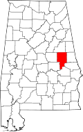 | |
| Towns | ||
| CDPs | ||
| Unincorporated community | ||
| Footnotes | ‡This populated place also has portions in an adjacent county or counties | |
This article is issued from Wikipedia - version of the 12/20/2015. The text is available under the Creative Commons Attribution/Share Alike but additional terms may apply for the media files.