Palmetto, Georgia
| Palmetto, Georgia | |
|---|---|
| City | |
|
Downtown Palmetto | |
 Location in Fulton County and the state of Georgia | |
| Coordinates: 33°31′16″N 84°40′4″W / 33.52111°N 84.66778°WCoordinates: 33°31′16″N 84°40′4″W / 33.52111°N 84.66778°W | |
| Country | United States |
| State | Georgia |
| Counties | Fulton, Coweta |
| Area | |
| • Total | 11.6 sq mi (30.0 km2) |
| • Land | 11.4 sq mi (29.5 km2) |
| • Water | 0.2 sq mi (0.5 km2) |
| Elevation | 1,020 ft (311 m) |
| Population (2010) | |
| • Total | 4,488 |
| • Density | 390/sq mi (150/km2) |
| Time zone | Eastern (EST) (UTC-5) |
| • Summer (DST) | EDT (UTC-4) |
| ZIP code | 30268 |
| Area code(s) | 770 |
| FIPS code | 13-58884[1] |
| GNIS feature ID | 0332596[2] |
| Website | Palmetto, GA |

Palmetto (established 1853) is a city located mostly in Fulton County (originally Campbell County) and now partly in Coweta County in the U.S. state of Georgia. The population was 4,488 at the 2010 census.[3]
Geography
Palmetto, elevation 1050 feet 0r 320 meters AMSL, is located at 33°31′16″N 84°40′4″W / 33.52111°N 84.66778°W (33.521117, -84.667662)[4]
According to the United States Census Bureau, the city has a total area of 11.6 square miles (30 km2), of which 11.4 square miles (30 km2) is land and 0.2 square miles (0.52 km2), or 1.60%, is water.
Demographics
| Historical population | |||
|---|---|---|---|
| Census | Pop. | %± | |
| 1860 | 1,526 | — | |
| 1870 | 294 | −80.7% | |
| 1880 | 473 | 60.9% | |
| 1890 | 552 | 16.7% | |
| 1900 | 620 | 12.3% | |
| 1910 | 922 | 48.7% | |
| 1920 | 965 | 4.7% | |
| 1930 | 964 | −0.1% | |
| 1940 | 1,029 | 6.7% | |
| 1950 | 1,257 | 22.2% | |
| 1960 | 1,466 | 16.6% | |
| 1970 | 2,045 | 39.5% | |
| 1980 | 2,086 | 2.0% | |
| 1990 | 2,612 | 25.2% | |
| 2000 | 3,400 | 30.2% | |
| 2010 | 4,488 | 32.0% | |
| Est. 2015 | 4,733 | [5] | 5.5% |
As of the 2010 United States Census, there were 4,488 people residing in the city. The racial makeup of the city was 56.9% Black, 26.9% White, 0.1% Native American, 0.7% Asian, 0.0% Pacific Islander, 0.1% from some other race and 2.5% from two or more races. 12.7% were Hispanic or Latino of any race.
As of the census[1] of 2000, there were 3,400 people, 1,223 households, and 881 families residing in the city. The population density was 656.2 people per square mile (253.4/km²). There were 1,283 housing units at an average density of 247.6 per square mile (95.6/km²). The racial makeup of the city was 47.41% White, 44.18% African American, 0.62% Native American, 0.03% Asian, 0.03% Pacific Islander, 5.38% from other races, and 2.35% from two or more races. Hispanic or Latino of any race were 11.62% of the population.
There were 1,223 households out of which 38.7% had children under the age of 18 living with them, 42.4% were married couples living together, 23.5% had a female householder with no husband present, and 27.9% were non-families. 24.3% of all households were made up of individuals and 10.1% had someone living alone who was 65 years of age or older. The average household size was 2.78 and the average family size was 3.27.
In the city the population was spread out with 30.1% under the age of 18, 9.9% from 18 to 24, 31.5% from 25 to 44, 18.8% from 45 to 64, and 9.6% who were 65 years of age or older. The median age was 31 years. For every 100 females there were 91.9 males. For every 100 females age 18 and over, there were 88.9 males.
The median income for a household in the city was $32,286, and the median income for a family was $36,989. Males had a median income of $31,944 versus $20,417 for females. The per capita income for the city was $15,097. About 7.8% of families and 11.3% of the population were below the poverty line, including 16.8% of those under age 18 and 6.8% of those age 65 or over.
References
- 1 2 "American FactFinder". United States Census Bureau. Retrieved 2008-01-31.
- ↑ "US Board on Geographic Names". United States Geological Survey. 2007-10-25. Retrieved 2008-01-31.
- ↑ "Race, Hispanic or Latino, Age, and Housing Occupancy: 2010 Census Redistricting Data (Public Law 94-171) Summary File (QT-PL), Palmetto city, Georgia". U.S. Census Bureau, American FactFinder 2. Retrieved October 28, 2011.
- ↑ "US Gazetteer files: 2010, 2000, and 1990". United States Census Bureau. 2011-02-12. Retrieved 2011-04-23.
- ↑ "Annual Estimates of the Resident Population for Incorporated Places: April 1, 2010 to July 1, 2015". Retrieved July 2, 2016.
- ↑ "Census of Population and Housing". Census.gov. Retrieved June 4, 2015.
External links
- Palmetto at Georgia.gov
- Palmetto historical marker
Municipalities and communities of Coweta County, Georgia, United States | ||
|---|---|---|
| Cities | 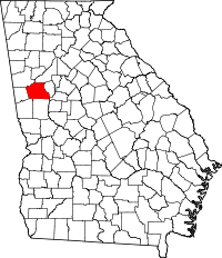 | |
| Towns | ||
| CDP | ||
| Unincorporated communities | ||
| Footnotes | ‡This populated place also has portions in an adjacent county or counties | |
Municipalities and communities of Fulton County, Georgia, United States | ||
|---|---|---|
| Cities | 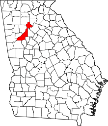 | |
| Unincorporated communities | ||
| Footnotes | ‡This populated place also has portions in an adjacent county or counties | |