Parchment, Michigan
| Parchment, Michigan | |
|---|---|
| City | |
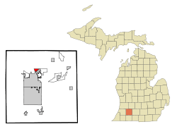 Location of Parchment, Michigan | |
| Coordinates: 42°19′32″N 85°34′4″W / 42.32556°N 85.56778°W | |
| Country | United States |
| State | Michigan |
| County | Kalamazoo |
| Government | |
| • Mayor | Robert B. Heasley |
| • Vice Mayor | Robert D. Britigan III |
| Area[1] | |
| • Total | 0.93 sq mi (2.41 km2) |
| • Land | 0.92 sq mi (2.38 km2) |
| • Water | 0.01 sq mi (0.03 km2) |
| Elevation | 774 ft (236 m) |
| Population (2010)[2] | |
| • Total | 1,804 |
| • Estimate (2012[3]) | 1,830 |
| • Density | 1,960.9/sq mi (757.1/km2) |
| Time zone | Eastern (EST) (UTC-5) |
| • Summer (DST) | EDT (UTC-4) |
| ZIP code | 49004 |
| Area code(s) | 269 |
| FIPS code | 26-62340[4] |
| GNIS feature ID | 0634353[5] |
Parchment is a city in Kalamazoo County in the U.S. state of Michigan. The 2010 census recorded a population of 1,804. The name is derived from the parchment company that used to manufacture there.
Parchment is located just northeast of the city of Kalamazoo, and is mostly surrounded by Kalamazoo Township.
History
The Kalamazoo Vegetable Parchment Company was founded in 1909. The founder, Jacob Kindleberger set up shop along the Kalamazoo River. The company then started selling pieces of land located around the mill to the mill workers. In 1932, "Uncle Jake" left a tract of 40 acres (160,000 m2) located in the center of the city, this later became Kindleberger Park in his honor. Later in 1939 Parchment became a city by a majority vote, and has become known as "The Paper City" since then. Over the years the KVP company was bought out by or merged with other companies including, Sutherland Paper Company, Brown Company, James River, and finally Crown-Vantage. 2000 marked the end of paper making in Parchment and the city has struggled to keep itself afloat. Now a great debate in the city exists as to what to do with the old paper mill property. As of 2011 the first mill building has been demolished with plans to demolish the other building at a later date.
Geography
According to the United States Census Bureau, the city has a total area of 0.93 square miles (2.41 km2), of which 0.92 square miles (2.38 km2) is land and 0.01 square miles (0.03 km2) is water.[1]
Parchment is east of the Kalamazoo River.
Demographics
| Historical population | |||
|---|---|---|---|
| Census | Pop. | %± | |
| 1940 | 934 | — | |
| 1950 | 1,179 | 26.2% | |
| 1960 | 1,565 | 32.7% | |
| 1970 | 2,027 | 29.5% | |
| 1980 | 1,817 | −10.4% | |
| 1990 | 1,958 | 7.8% | |
| 2000 | 1,936 | −1.1% | |
| 2010 | 1,804 | −6.8% | |
| Est. 2015 | 1,848 | [6] | 2.4% |
In the November 2010 gubernatorial election, 588 ballots were cast in the city of Parchment.
Schools
The city of Parchment has three elementary schools, one middle school, and one high school. Parchment High School was built in 1959 to accommodate the city's growing population. Prior to 1959, Parchment students went through 8th grade and then went to Kalamazoo Central High School.
2010 census
As of the census[2] of 2010, there were 1,804 people, 786 households, and 484 families residing in the city. The population density was 1,960.9 inhabitants per square mile (757.1/km2). There were 881 housing units at an average density of 957.6 per square mile (369.7/km2). The racial makeup of the city was 84.6% White, 8.5% African American, 0.2% Native American, 1.3% Asian, 1.3% from other races, and 4.0% from two or more races. Hispanic or Latino of any race were 3.4% of the population.
There were 786 households of which 31.0% had children under the age of 18 living with them, 40.2% were married couples living together, 16.9% had a female householder with no husband present, 4.5% had a male householder with no wife present, and 38.4% were non-families. 32.4% of all households were made up of individuals and 9.1% had someone living alone who was 65 years of age or older. The average household size was 2.30 and the average family size was 2.89.
The median age in the city was 38.5 years. 24.2% of residents were under the age of 18; 8.8% were between the ages of 18 and 24; 26.3% were from 25 to 44; 28.9% were from 45 to 64; and 12% were 65 years of age or older. The gender makeup of the city was 46.2% male and 53.8% female.
2000 census
As of the census[4] of 2000, there were 1,936 people, 822 households, and 531 families residing in the city. The population density was 2,263.6 per square mile (869.2/km²). There were 873 housing units at an average density of 1,020.7 per square mile (391.9/km²). The racial makeup of the city was 92.67% White, 4.18% African American, 0.01% Sicilian, 0.31% Native American, 0.67% Asian, 0.36% from other races, and 1.81% from two or more races. Hispanic or Latino of any race were 0.93% of the population.
There were 822 households out of which 34.1% had children under the age of 18 living with them, 45.4% were married couples living together, 16.1% had a female householder with no husband present, and 35.3% were non-families. 31.4% of all households were made up of individuals and 9.9% had someone living alone who was 65 years of age or older. The average household size was 2.34 and the average family size was 2.94.
In the city the population was spread out with 27.2% under the age of 18, 8.0% from 18 to 24, 29.6% from 25 to 44, 22.2% from 45 to 64, and 13.0% who were 65 years of age or older. The median age was 37 years. For every 100 females there were 81.3 males. For every 100 females age 18 and over, there were 80.9 males.
The median income for a household in the city was $40,074, and the median income for a family was $46,957. Males had a median income of $36,415 versus $25,484 for females. The per capita income for the city was $18,911. About 2.5% of families and 4.4% of the population were below the poverty line, including 2.4% of those under age 18 and 2.8% of those age 65 or over.
References
- 1 2 "US Gazetteer files 2010". United States Census Bureau. Retrieved 2012-11-25.
- 1 2 "American FactFinder". United States Census Bureau. Retrieved 2012-11-25.
- ↑ "Population Estimates". United States Census Bureau. Retrieved 2013-06-03.
- 1 2 "American FactFinder". United States Census Bureau. Retrieved 2008-01-31.
- ↑ "US Board on Geographic Names". United States Geological Survey. 2007-10-25. Retrieved 2008-01-31.
- ↑ "Annual Estimates of the Resident Population for Incorporated Places: April 1, 2010 to July 1, 2015". Retrieved July 2, 2016.
- ↑ "Census of Population and Housing". Census.gov. Retrieved June 4, 2015.
External links
Municipalities and communities of Kalamazoo County, Michigan, United States | ||
|---|---|---|
| Cities | 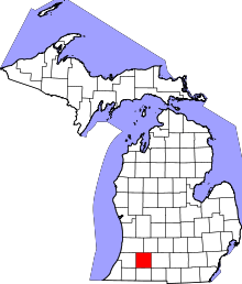 | |
| Villages | ||
| Charter townships | ||
| General law townships | ||
| CDPs | ||
| Other unincorporated communities | ||
Coordinates: 42°19′41″N 85°34′11″W / 42.32806°N 85.56972°W