Parkman, Maine
| Parkman, Maine | |
|---|---|
| Town | |
 Location in Piscataquis County and the state of Maine. | |
| Coordinates: 45°7′33″N 69°26′10″W / 45.12583°N 69.43611°W | |
| Country | United States |
| State | Maine |
| County | Piscataquis |
| Incorporated | January 29, 1822 |
| Area[1] | |
| • Total | 46.05 sq mi (119.27 km2) |
| • Land | 45.23 sq mi (117.15 km2) |
| • Water | 0.82 sq mi (2.12 km2) |
| Elevation | 735 ft (224 m) |
| Population (2010)[2] | |
| • Total | 843 |
| • Estimate (2012[3]) | 836 |
| • Density | 18.6/sq mi (7.2/km2) |
| Time zone | Eastern (EST) (UTC-5) |
| • Summer (DST) | EDT (UTC-4) |
| ZIP code | 04443 |
| Area code(s) | 207 |
| FIPS code | 23-56765 |
| GNIS feature ID | 0579055 |
Parkman is a town in Piscataquis County, Maine, United States. The population was 843 at the 2010 census.
History
First known as Plantation Number Five, Sixth Range, it was purchased by Samuel Parkman, a Boston Brahmin.[4] In 1822, it was incorporated as a town and named for its proprietor. It was inherited by the proprietor's son, George Parkman, who visited it annually. Much of the town has excellent soil for farming. In 1837, the wheat crop was 6,018 bushels.[5] In 1859, it was noted for making butter and cheese.[6] By 1886, Parkman had several sawmills and a gristmill.[7]
Geography
According to the United States Census Bureau, the town has a total area of 46.05 square miles (119.27 km2), of which, 45.23 square miles (117.15 km2) of it is land and 0.82 square miles (2.12 km2) is water.[1] Parkman is drained by a branch of the Piscataquis River. The principal bodies of water are Bennett and Harlow ponds.
Demographics
| Historical population | |||
|---|---|---|---|
| Census | Pop. | %± | |
| 1820 | 255 | — | |
| 1830 | 802 | 214.5% | |
| 1840 | 1,205 | 50.2% | |
| 1850 | 1,243 | 3.2% | |
| 1860 | 1,166 | −6.2% | |
| 1870 | 1,105 | −5.2% | |
| 1880 | 1,005 | −9.0% | |
| 1890 | 813 | −19.1% | |
| 1900 | 718 | −11.7% | |
| 1910 | 646 | −10.0% | |
| 1920 | 565 | −12.5% | |
| 1930 | 538 | −4.8% | |
| 1940 | 581 | 8.0% | |
| 1950 | 590 | 1.5% | |
| 1960 | 530 | −10.2% | |
| 1970 | 457 | −13.8% | |
| 1980 | 621 | 35.9% | |
| 1990 | 790 | 27.2% | |
| 2000 | 811 | 2.7% | |
| 2010 | 843 | 3.9% | |
| Est. 2014 | 828 | [8] | −1.8% |
2010 census
As of the census[2] of 2010, there were 843 people, 353 households, and 241 families residing in the town. The population density was 18.6 inhabitants per square mile (7.2/km2). There were 538 housing units at an average density of 11.9 per square mile (4.6/km2). The racial makeup of the town was 97.7% White, 0.1% African American, 0.5% Native American, 0.1% Asian, 0.5% from other races, and 1.1% from two or more races. Hispanic or Latino of any race were 2.6% of the population.
There were 353 households of which 28.0% had children under the age of 18 living with them, 58.1% were married couples living together, 5.9% had a female householder with no husband present, 4.2% had a male householder with no wife present, and 31.7% were non-families. 24.4% of all households were made up of individuals and 7.9% had someone living alone who was 65 years of age or older. The average household size was 2.39 and the average family size was 2.83.
The median age in the town was 45.2 years. 21.5% of residents were under the age of 18; 6.7% were between the ages of 18 and 24; 21.6% were from 25 to 44; 35.2% were from 45 to 64; and 14.9% were 65 years of age or older. The gender makeup of the town was 52.2% male and 47.8% female.
2000 census
As of the census[10] of 2000, there were 811 people, 311 households, and 222 families residing in the town. The population density was 17.8 people per square mile (6.9/km²). There were 498 housing units at an average density of 10.9 per square mile (4.2/km²). The racial makeup of the town was 98.03% White, 0.86% African American, 0.12% Native American, 0.12% Asian, and 0.86% from two or more races. Hispanic or Latino of any race were 0.49% of the population.
There were 311 households out of which 35.7% had children under the age of 18 living with them, 61.4% were married couples living together, 6.4% had a female householder with no husband present, and 28.3% were non-families. 21.5% of all households were made up of individuals and 9.0% had someone living alone who was 65 years of age or older. The average household size was 2.61 and the average family size was 3.03.
In the town the population was spread out with 27.6% under the age of 18, 4.9% from 18 to 24, 30.5% from 25 to 44, 25.9% from 45 to 64, and 11.1% who were 65 years of age or older. The median age was 38 years. For every 100 females there were 109.0 males. For every 100 females age 18 and over, there were 106.7 males.
The median income for a household in the town was $28,355, and the median income for a family was $32,000. Males had a median income of $26,207 versus $20,313 for females. The per capita income for the town was $11,965. About 8.5% of families and 15.4% of the population were below the poverty line, including 11.8% of those under age 18 and 21.8% of those age 65 or over.
Notable people
- Chet Chadbourne, baseball player
- Charles Alton Ellis, professor, mathematician, and structural engineer of the Golden Gate Bridge
- Victor A. McKusick, geneticist, original author of Mendelian Inheritance in Man database
- Vincent L. McKusick, chief justice of the Maine Supreme Judicial Court
- Burt Shavitz, beekeeper and photographer, co-founder of Burt's Bees
References
- 1 2 "US Gazetteer files 2010". United States Census Bureau. Retrieved 2012-12-16.
- 1 2 "American FactFinder". United States Census Bureau. Retrieved 2012-12-16.
- ↑ "Population Estimates". United States Census Bureau. Archived from the original on June 17, 2013. Retrieved 2013-07-06.
- ↑ "Profile for Parkman, Maine". ePodunk. Retrieved 2010-05-07.
- ↑ Hayward's New England Gazetteer of 1839
- ↑ Coolidge, Austin J.; John B. Mansfield (1859). A History and Description of New England. Boston, Massachusetts. p. 248.
- ↑ George J. Varney, History of Parkman, Maine; Boston, 1886
- ↑ "Annual Estimates of the Resident Population for Incorporated Places: April 1, 2010 to July 1, 2014". Retrieved June 4, 2015.
- ↑ "Census of Population and Housing". Census.gov. Archived from the original on May 11, 2015. Retrieved June 4, 2015.
- ↑ "American FactFinder". United States Census Bureau. Archived from the original on September 11, 2013. Retrieved 2008-01-31.
External links
Municipalities and communities of Piscataquis County, Maine, United States | ||
|---|---|---|
| Towns | 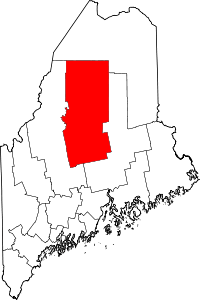 | |
| Plantations | ||
| Unorganized territories | ||
| CDPs | ||
Coordinates: 45°08′01″N 69°25′59″W / 45.13361°N 69.43306°W