Pataskala, Ohio
| Pataskala, Ohio | ||
|---|---|---|
| City | ||
|
Aerial photograph of downtown Pataskala | ||
| ||
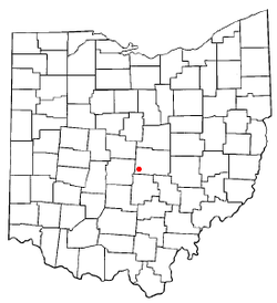 Location of Pataskala, Ohio | ||
 Location of Pataskala in Licking County | ||
| Coordinates: 39°59′52″N 82°41′51″W / 39.99778°N 82.69750°WCoordinates: 39°59′52″N 82°41′51″W / 39.99778°N 82.69750°W | ||
| Country |
| |
| State |
| |
| County | Licking | |
| Area[1] | ||
| • Total | 28.72 sq mi (74.38 km2) | |
| • Land | 28.62 sq mi (74.13 km2) | |
| • Water | 0.10 sq mi (0.26 km2) | |
| Elevation[2] | 1,001 ft (305 m) | |
| Population (2010)[3] | ||
| • Total | 14,962 | |
| • Estimate (2012[4]) | 15,091 | |
| • Density | 522.8/sq mi (201.9/km2) | |
| Time zone | Eastern (EST) (UTC-5) | |
| • Summer (DST) | EDT (UTC-4) | |
| ZIP code | 43062 | |
| Area code(s) | 740 | |
| FIPS code | 39-61112[5] | |
| GNIS feature ID | 1049066[2] | |
| Website | http://www.ci.pataskala.oh.us | |


Pataskala is a city in Licking County, Ohio, United States. The population was 14,962 at the 2010 census. Pataskala was a small community until 1996, when what was then the village of Pataskala merged with Lima Township, vastly increasing its population and geographic area.
History
Pataskala was laid out in 1851 when the railroad was extended to that point.[6] Pataskala is a name derived from the Delaware language.[7] A post office has been in operation at Pataskala since 1852.[8]
Geography
Pataskala is located at 39°59′52″N 82°41′51″W / 39.99778°N 82.69750°W (39.997890, -82.697411),[9] along the South Fork of the Licking River in Southwestern Licking County. Pataskala is also the home of two school districts, Southwest Licking Local Schools and Licking Heights Local Schools. The Licking Heights district also serves parts of Reynoldsburg, and Jefferson Township as well as the city of Blacklick.
According to the United States Census Bureau, the city has a total area of 28.72 square miles (74.38 km2), of which 28.62 square miles (74.13 km2) is land and 0.10 square miles (0.26 km2) is water.[1]
Demographics
| Historical population | |||
|---|---|---|---|
| Census | Pop. | %± | |
| 1870 | 462 | — | |
| 1880 | 634 | 37.2% | |
| 1890 | 568 | −10.4% | |
| 1900 | 675 | 18.8% | |
| 1910 | 800 | 18.5% | |
| 1920 | 771 | −3.6% | |
| 1930 | 787 | 2.1% | |
| 1940 | 824 | 4.7% | |
| 1950 | 928 | 12.6% | |
| 1960 | 1,046 | 12.7% | |
| 1970 | 1,831 | 75.0% | |
| 1980 | 2,284 | 24.7% | |
| 1990 | 3,046 | 33.4% | |
| 2000 | 10,249 | 236.5% | |
| 2010 | 14,962 | 46.0% | |
| Est. 2015 | 15,245 | [10] | 1.9% |
| Sources:[11][12][13][14][5][15] | |||
2010 census
As of the census[3] of 2010, there were 14,962 people, 5,588 households, and 4,132 families residing in the city. The population density was 522.8 inhabitants per square mile (201.9/km2). There were 5,960 housing units at an average density of 208.2 per square mile (80.4/km2). The racial makeup of the city was 90.0% White, 6.0% African American, 0.3% Native American, 0.7% Asian, 0.6% from other races, and 2.5% from two or more races. Hispanic or Latino of any race were 2.0% of the population.
There were 5,588 households of which 39.9% had children under the age of 18 living with them, 56.3% were married couples living together, 12.7% had a female householder with no husband present, 4.9% had a male householder with no wife present, and 26.1% were non-families. 20.6% of all households were made up of individuals and 6.5% had someone living alone who was 65 years of age or older. The average household size was 2.66 and the average family size was 3.07.
The median age in the city was 35.8 years. 27.6% of residents were under the age of 18; 6.8% were between the ages of 18 and 24; 29.9% were from 25 to 44; 25.2% were from 45 to 64; and 10.6% were 65 years of age or older. The gender makeup of the city was 49.1% male and 50.9% female.
2000 census
As of the census[5] of 2000, there were 10,249 people, 3,922 households, and 2,914 families residing in the city. The population density was 359.5 people per square mile (138.8/km²). There were 4,132 housing units at an average density of 144.9 per square mile (56.0/km²). The racial makeup of the city was 94.58% White, 2.96% African American, 0.34% Native American, 0.54% Asian, 0.01% Pacific Islander, 0.56% from other races, and 1.02% from two or more races. Hispanic or Latino of any race were 1.01% of the population.
There were 3,922 households out of which 38.1% had children under the age of 18 living with them, 59.9% were married couples living together, 10.7% had a female householder with no husband present, and 25.7% were non-families. 20.9% of all households were made up of individuals and 7.8% had someone living alone who was 65 years of age or older. The average household size was 2.59 and the average family size was 3.00.
In the city the population was spread out with 27.8% under the age of 18, 7.1% from 18 to 24, 32.8% from 25 to 44, 22.7% from 45 to 64, and 9.5% who were 65 years of age or older. The median age was 34 years. For every 100 females there were 95.7 males. For every 100 females age 18 and over, there were 92.7 males.
The median income for a household in the city was $51,684, and the median income for a family was $58,021. Males had a median income of $39,322 versus $30,628 for females. The per capita income for the city was $23,099. About 5.0% of families and 5.4% of the population were below the poverty line, including 4.5% of those under age 18 and 9.2% of those age 65 or over.
Notable people
- Jeaniene Frost, New York Times Bestselling author of paranormal romance and urban fantasy for HarperCollins publishers.
- John Holmes, better known as Johnny Wadd, one of the most prolific pornstars of all time, having starred in nearly 2500 full-length films and loops. He lived in Pataskala as a teenager before enlisting in the army at the age of 16.
- Greg Koch, co-founder, executive chairman and former CEO of Stone Brewing Co..
- John Reuben, a Christian rap artist signed to Gotee Records. He has a song sharing the town's name on his album Hindsight because he was born and raised there.
- Robert Smith, Professional ten-pin bowler who owns 7 career titles on the PBA Tour; won the 2000 U.S. Open.
- Chalmers Wylie, an American politician who served thirteen terms as a member of the United States House of Representatives
References
| Wikimedia Commons has media related to Pataskala, Ohio. |
- 1 2 "US Gazetteer files 2010". United States Census Bureau. Retrieved 2013-01-06.
- 1 2 "US Board on Geographic Names". United States Geological Survey. 2007-10-25. Retrieved 2008-01-31.
- 1 2 "American FactFinder". United States Census Bureau. Retrieved 2013-01-06.
- ↑ "Population Estimates". United States Census Bureau. Retrieved 2013-06-17.
- 1 2 3 "American FactFinder". United States Census Bureau. Retrieved 2008-01-31.
- ↑ Brister, Edwin M. P. (1909). Centennial History of the City of Newark and Licking County, Ohio. S.J. Clarke Publishing Company. p. 379.
- ↑ Overman, William Daniel (1958). Ohio Town Names. Akron, OH: Atlantic Press. p. 108.
- ↑ "Licking County". Jim Forte Postal History. Retrieved 6 December 2015.
- ↑ "US Gazetteer files: 2010, 2000, and 1990". United States Census Bureau. 2011-02-12. Retrieved 2011-04-23.
- ↑ "Annual Estimates of the Resident Population for Incorporated Places: April 1, 2010 to July 1, 2015". Retrieved July 2, 2016.
- ↑ "Population: Ohio" (PDF). 1910 U.S. Census. U.S. Census Bureau. Retrieved 28 November 2013.
- ↑ "Population: Ohio" (PDF). 1930 US Census. U.S. Census Bureau. Retrieved 28 November 2013.
- ↑ "Number of Inhabitants: Ohio" (PDF). 18th Census of the United States. U.S. Census Bureau. Retrieved 22 November 2013.
- ↑ "Ohio: Population and Housing Unit Counts" (PDF). U.S. Census Bureau. Retrieved 22 November 2013.
- ↑ "Incorporated Places and Minor Civil Divisions Datasets: Subcounty Population Estimates: April 1, 2010 to July 1, 2012". U.S. Census Bureau. Retrieved 25 November 2013.
Municipalities and communities of Licking County, Ohio, United States | ||
|---|---|---|
| Cities |  | |
| Villages | ||
| Townships | ||
| CDPs | ||
| Unincorporated communities | ||
| Ghost towns | ||
| Footnotes | ‡This populated place also has portions in an adjacent county or counties | |