Pecan Gap, Texas
| Pecan Gap, Texas | |
|---|---|
| City | |
|
3rd Street in Pecan Gap | |
| Nickname(s): The Gap | |
 Location of Pecan Gap, Texas | |
 | |
| Coordinates: 33°26′17″N 95°50′56″W / 33.43806°N 95.84889°WCoordinates: 33°26′17″N 95°50′56″W / 33.43806°N 95.84889°W | |
| Country |
|
| State |
|
| Counties | Delta, Fannin |
| Settled | 1884 |
| Named for | Nearby pecan grove |
| Government | |
| • Representative | Larry Phillips (R)[1] |
| • TX Senate | Bob Deuell (R)[1] |
| • U.S. Congress | John Ratcliffe (R)[1] |
| Area | |
| • Total | 0.6 sq mi (1.6 km2) |
| • Land | 0.6 sq mi (1.6 km2) |
| • Water | 0.0 sq mi (0.0 km2) |
| Elevation | 571 ft (174 m) |
| Population (2010)[2] | |
| • Total | 203 |
| • Density | 338.3/sq mi (126.9/km2) |
| Time zone | Central (CST) (UTC-6) |
| • Summer (DST) | CDT (UTC-5) |
| ZIP code | 75469[3] |
| Area code(s) | 903 |
| FIPS code | 48-56468[4] |
| GNIS feature ID | 1364973[5] |
.jpg)
Pecan Gap is a city in Delta and Fannin counties within the U.S. state of Texas. It is sometimes informally referred to as "The Gap" by area residents. The population was 203 at the time of the 2010 census.[6] It is named for the gap between two pecan trees, but unfortunately one of the two pecan trees was destroyed by a tornado in 1963.
History
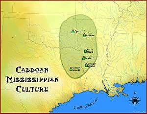
The first inhabitants of the area that is now Pecan Gap were the Caddo people, who settled large portions of eastern Texas as early as 800 A.D. The Caddo were highly advanced, living in large wooden structures, and were skilled farmers.[7] The first European to visit the area was French explorer François Hervey, around 1750. A few decades afterwards, European disease and attacks from neighboring tribes as well as attacks from European settlers forced the Caddo out of the area around Pecan Gap. Around 1820, Delaware, Quapaw, and Seminole tribes began settling in the area. In 1836, the Republic of Texas officially recognized the region around Pecan Gap as part of Red River County. In 1840, Lamar County was formed, which absorbed much of the area just south of Pecan Gap. However, just six years later, the region was designated as part of the newly formed Hopkins County. In 1870 Delta County was created. As Pecan Gap grew it expanded west into Fannin County.[8]
Geography


Pecan Gap is one of just two incorporated communities in Delta County. The city is the second largest in the county, population-wise, behind Cooper.[9][10] According to statistics from the Census Bureau, the city covers a total area of 0.63 square miles (1.64 km2), of which 0.01 square miles (0.02 km2), or 1.13%, is water.[6]
Pecan Gap, as well as most of Delta County, is located in the Texas blackland prairies region, a flat, tallgrass prairie ecosystem which covers a large portion of north central Texas. The region's elevation rarely strays from around 400 to 500 feet (120 to 150 m). The area's geology consists mainly of deep clay, or clay mixed with a dark-colored loam. However, the county is also known to have high-quality topsoil, ideal for crop growing.[8] A specific layer of the soil in the region is known as Pecan Gap Chalk, named for the city when it was discovered nearby in 1918. The layer is a blue-gray, sandy chalk substance, which is fossil-rich and is located in much of the Pecan Gap vicinity.[11]
Under the Köppen climate classification, Pecan Gap is located in zone Cfa, which experiences warm, wet summers and a humid subtropical climate.[12] Temperature in Pecan Gap are generally high, with the average in January being 42 °F (6 °C) and in July being 82 °F (28 °C). The highest recorded temperature for Pecan Gap was 115 °F (46 °C) in July 1936, while the lowest recorded temperature was −5 °F (−21 °C) in January 1930. On average, the hottest month of the year is August, when temperatures stay around an average of 82 °F (28 °C). January is generally the coolest month, when the average temperature is around 42 °F (6 °C). The community receives little precipitation, with the average monthly high being around 5.5 inches (140 mm) in May and June. August is the dryest month for the city, when it receives an average of just 2 inches (51 mm) of rain.[13]
| Climate data for Pecan Gap, Texas | |||||||||||||
|---|---|---|---|---|---|---|---|---|---|---|---|---|---|
| Month | Jan | Feb | Mar | Apr | May | Jun | Jul | Aug | Sep | Oct | Nov | Dec | Year |
| Record high °F (°C) | 82 (28) |
92 (33) |
98 (37) |
99 (37) |
104 (40) |
108 (42) |
112 (44) |
115 (46) |
109 (43) |
103 (39) |
88 (31) |
86 (30) |
115 (46) |
| Average high °F (°C) | 53 (12) |
57 (14) |
65 (18) |
73 (23) |
80 (27) |
88 (31) |
92 (33) |
93 (34) |
86 (30) |
76 (24) |
64 (18) |
54 (12) |
73.4 (23) |
| Average low °F (°C) | 31 (−1) |
35 (2) |
42 (6) |
50 (10) |
60 (16) |
68 (20) |
72 (22) |
71 (22) |
63 (17) |
52 (11) |
42 (6) |
32 (0) |
51.5 (10.9) |
| Record low °F (°C) | −5 (−21) |
−5 (−21) |
9 (−13) |
22 (−6) |
32 (0) |
48 (9) |
52 (11) |
52 (11) |
34 (1) |
19 (−7) |
8 (−13) |
−4 (−20) |
−5 (−21) |
| Average precipitation inches (mm) | 2.7 (69) |
3.3 (84) |
4.4 (112) |
3.9 (99) |
5.6 (142) |
5.3 (135) |
3.2 (81) |
2.2 (56) |
3.4 (86) |
5.1 (130) |
3.4 (86) |
3.6 (91) |
46.1 (1,171) |
| Source: [13] | |||||||||||||
Demographics
| Historical population | |||
|---|---|---|---|
| Census | Pop. | %± | |
| 1940 | 409 | — | |
| 1950 | 319 | −22.0% | |
| 1960 | 278 | −12.9% | |
| 1970 | 291 | 4.7% | |
| 1980 | 250 | −14.1% | |
| 1990 | 245 | −2.0% | |
| 2000 | 214 | −12.7% | |
| 2010 | 203 | −5.1% | |
| Est. 2015 | 197 | [14] | −3.0% |
| U.S Decennial Census 1940-2010[15][16] | |||
As of the census[4] of 2000, there were 214 people, 103 households, and 57 families residing in the city. The population density was 343.6 people per square mile (133.3/km²). There were 123 housing units at an average density of 197.5 per square mile (76.6/km²). The racial makeup of the city was 88.32% White, 7.94% African American, 0.47% Asian, 2.80% from other races, and 0.47% from two or more races. Hispanic or Latino of any race were 6.54% of the population.
There were 103 households out of which 20.4% had children under the age of 18 living with them, 40.8% were married couples living together, 12.6% had a female householder with no husband present, and 43.7% were non-families. 40.8% of all households were made up of individuals and 17.5% had someone living alone who was 65 years of age or older. The average household size was 2.08 and the average family size was 2.78.
In the city the population was spread out with 19.6% under the age of 18, 6.5% from 18 to 24, 31.8% from 25 to 44, 22.9% from 45 to 64, and 19.2% who were 65 years of age or older. The median age was 41 years. For every 100 females there were 98.1 males. For every 100 females age 18 and over, there were 97.7 males.
The median income for a household in the city was $31,389, and the median income for a family was $43,125. Males had a median income of $38,000 versus $22,000 for females. The per capita income for the city was $16,704. About 16.7% of families and 19.0% of the population were below the poverty line, including 18.4% of those under the age of eighteen and 25.0% of those sixty five or over.
Pecan Festival
Held annually on the second Saturday of October, a localized event known as the Pecan Festival (or simply "Pecan Fest") takes place. It is organized by the Pecan Gap Ladies Club and features various attractions such as a parade, pet show, lawnmower races, food & drinks, and a gift shop open only during the event.
Education
Pecan Gap is served by the Fannindel Independent School District.
References
- 1 2 3 Staff (2013). "Districts By City". Who Represents Me?. Texas House of Representatives. Retrieved September 10, 2014.
- ↑ Staff (2010). "Profile of General Population and Housing Characteristics: 2010". United States Census Bureau. Archived from the original on December 14, 2014. Retrieved September 10, 2014.
- ↑ Staff. "75469 Zip Code Detailed Profile". City-Data.com. Retrieved March 4, 2013.
- 1 2 Staff (2010). "American FactFinder". United States Census Bureau. Retrieved September 10, 2014.
- ↑ Staff (March 11, 2008). "City of Pecan Gap". Geographic Names Information System (GNIS). United States Geological Survey. Retrieved September 10, 2014.
- 1 2 "Geographic Identifiers: 2010 Demographic Profile Data (G001): Pecan Gap city, Texas". U.S. Census Bureau, American Factfinder. Retrieved August 23, 2016.
- ↑ Perttula, Timothy K. "Caddo Indians". Handbook of Texas Online. Texas State Historical Association. Retrieved September 10, 2014.
- 1 2 McCroskey, Vista K. "Delta County". Handbook of Texas Online. Texas State Historical Association. Retrieved September 10, 2014.
- ↑ Staff (2005). "Places in Delta County". Delta County, TX. National Association of Counties. Archived from the original on September 27, 2008. Retrieved May 11, 2009.
- ↑ Staff (2000). "Population, Housing Units, Area, and Density: 2000". United States Census Bureau. Archived from the original on December 14, 2014. Retrieved September 9, 2014.
- ↑ Pessagno, Jr. (1969), p. 87
- ↑ Peel, M. C. and Finlayson, B. L. and McMahon, T. A. (2007). "Updated world map of the Köppen−Geiger climate classification". Hydrol. Earth Syst. Sci. 11: 1633–1644. doi:10.5194/hess-11-1633-2007. ISSN 1027-5606. Retrieved September 9, 2014. (direct: Final Revised Paper)
- 1 2 Staff (2014). "Monthly Averages for Pecan Gap, TX (75469)". The Weather Channel. Retrieved September 9, 2014.
- ↑ "Annual Estimates of the Resident Population for Incorporated Places: April 1, 2010 to July 1, 2015". Retrieved July 2, 2016.
- ↑ United States Census Bureau (1960). Population of All Incorporated and of Unincorperated Places of 1,000 or More (Report) (1960 ed.). United States Department of Commerce. p. 39. Retrieved September 10, 2014.
- ↑ United States Census Bureau (1990). 1990 Census of Population and Housing–Population and Housing Unit Counts–Texas (PDF) (Report) (1990 ed.). United States Department of Commerce. p. 87. Retrieved September 10, 2014.
Municipalities and communities of Delta County, Texas, United States | ||
|---|---|---|
| Cities |  | |
| Unincorporated communities | ||
| Ghost town | ||
| Footnotes | ‡This populated place also has portions in an adjacent county or counties | |
Municipalities and communities of Fannin County, Texas, United States | ||
|---|---|---|
| Cities | 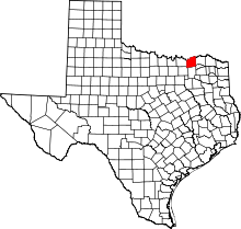 | |
| Towns | ||
| Unincorporated communities | ||
| Footnotes | ‡This populated place also has portions in an adjacent county or counties | |