Pierce County, Georgia
| Pierce County, Georgia | |
|---|---|
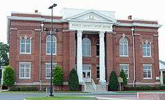 Pierce County Courthouse in Blackshear | |
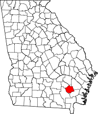 Location in the U.S. state of Georgia | |
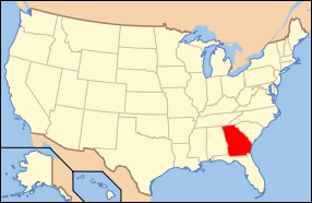 Georgia's location in the U.S. | |
| Founded | December 18, 1857 |
| Named for | Franklin Pierce |
| Seat | Blackshear |
| Largest city | Blackshear |
| Area | |
| • Total | 343 sq mi (888 km2) |
| • Land | 316 sq mi (818 km2) |
| • Water | 27 sq mi (70 km2), 7.8% |
| Population | |
| • (2010) | 18,758 |
| • Density | 59/sq mi (23/km²) |
| Congressional district | 1st |
| Time zone | Eastern: UTC-5/-4 |
| Website |
pc |
Pierce County is a county located in the U.S. state of Georgia. As of the 2010 census, the population was 18,758.[1] The county seat is Blackshear.[2]
Pierce County is part of the Waycross, GA Micropolitan Statistical Area.
History
Pierce County is named for Franklin Pierce, fourteenth President of the United States. It was created December 18, 1857, from Appling and Ware counties.
Geography
According to the U.S. Census Bureau, the county has a total area of 343 square miles (890 km2), of which 316 square miles (820 km2) is land and 27 square miles (70 km2) (7.8%) is water.[3]
The northeastern third of Pierce County, bordered by a line from just west of Mershon to just south of Bristol, then south to just north of Blackshear, and then heading due east, is located in the Little Satilla River sub-basin of the St. Marys River-Satilla River basin. The southern two-thirds of the county is located in the Satilla River sub-basin of the St. Marys-Satilla River basin.[4]
Major highways
Adjacent counties
- Appling County - north
- Wayne County - northeast
- Brantley County - southeast
- Ware County - west
- Bacon County - northwest
Demographics
| Historical population | |||
|---|---|---|---|
| Census | Pop. | %± | |
| 1860 | 1,973 | — | |
| 1870 | 2,778 | 40.8% | |
| 1880 | 4,538 | 63.4% | |
| 1890 | 6,379 | 40.6% | |
| 1900 | 8,100 | 27.0% | |
| 1910 | 10,749 | 32.7% | |
| 1920 | 11,934 | 11.0% | |
| 1930 | 12,522 | 4.9% | |
| 1940 | 11,800 | −5.8% | |
| 1950 | 11,112 | −5.8% | |
| 1960 | 9,678 | −12.9% | |
| 1970 | 9,281 | −4.1% | |
| 1980 | 11,897 | 28.2% | |
| 1990 | 13,328 | 12.0% | |
| 2000 | 15,636 | 17.3% | |
| 2010 | 18,758 | 20.0% | |
| Est. 2015 | 19,103 | [5] | 1.8% |
| U.S. Decennial Census[6] 1790-1960[7] 1900-1990[8] 1990-2000[9] 2010-2013[1] | |||
2000 census
As of the census[10] of 2000, there were 15,636 people, 5,958 households, and 4,438 families residing in the county. The population density was 46 people per square mile (18/km²). There were 6,719 housing units at an average density of 20 per square mile (8/km²). The racial makeup of the county was 86.90% White, 10.91% Black or African American, 0.26% Native American, 0.18% Asian, 0.05% Pacific Islander, 0.97% from other races, and 0.73% from two or more races. 2.28% of the population were Hispanic or Latino of any race.
As of the census[10] of 2000, the largest ancestry groups were: 71.14% of people in Pierce County were of English descent, 11.37% were of Scots-Irish descent and 10.91% were of African descent.
There were 5,958 households out of which 34.70% had children under the age of 18 living with them, 59.00% were married couples living together, 11.60% had a female householder with no husband present, and 25.50% were non-families. 23.10% of all households were made up of individuals and 9.80% had someone living alone who was 65 years of age or older. The average household size was 2.61 and the average family size was 3.06.
In the county the population was spread out with 26.70% under the age of 18, 8.50% from 18 to 24, 28.10% from 25 to 44, 24.50% from 45 to 64, and 12.20% who were 65 years of age or older. The median age was 36 years. For every 100 females there were 96.90 males. For every 100 females age 18 and over, there were 92.40 males.
The median income for a household in the county was $29,895, and the median income for a family was $35,903. Males had a median income of $28,331 versus $19,771 for females. The per capita income for the county was $14,230. About 14.40% of families and 18.40% of the population were below the poverty line, including 25.50% of those under age 18 and 22.40% of those age 65 or over.
2010 census
As of the 2010 United States Census, there were 18,758 people, 7,083 households, and 5,268 families residing in the county.[11] The population density was 59.3 inhabitants per square mile (22.9/km2). There were 7,986 housing units at an average density of 25.2 per square mile (9.7/km2).[12] The racial makeup of the county was 86.9% white, 8.9% black or African American, 0.4% American Indian, 0.3% Asian, 0.1% Pacific islander, 2.1% from other races, and 1.4% from two or more races. Those of Hispanic or Latino origin made up 4.7% of the population.[11] In terms of ancestry, 18.6% were American, 14.9% were Irish, 12.8% were English, and 7.2% were German.[13]
Of the 7,083 households, 37.7% had children under the age of 18 living with them, 55.7% were married couples living together, 13.6% had a female householder with no husband present, 25.6% were non-families, and 21.8% of all households were made up of individuals. The average household size was 2.63 and the average family size was 3.05. The median age was 38.4 years.[11]
The median income for a household in the county was $37,062 and the median income for a family was $47,157. Males had a median income of $38,770 versus $26,510 for females. The per capita income for the county was $18,283. About 13.6% of families and 15.4% of the population were below the poverty line, including 20.3% of those under age 18 and 14.9% of those age 65 or over.[14]
Media
- The Blackshear Times (weekly newspaper)
- The Pierce County Press (weekly newspaper)
- Waycross Journal-Herald (daily newspaper)
- WKUB 105.1FM (Country radio)
- WWUF 97.7FM (Oldies radio)
- WSFN AM 1350 (Sports radio)
- WAYX AM 1230 (News Talk radio)
Communities
Cities
- Blackshear
- Offerman
- Patterson
- Waycross (a small part) Effective July 1, 2015, Waycross is no longer located nor allowed to be located in Pierce County, Georgia. Rep. Chad Nimmer[15] introduced HB 523 during the 2015 Legislative Session without providing the required statutory notice to the City of Waycross. HB 523 de-annexed the portion of Waycross located in Pierce County and prevents the City of Waycross from coming back into Pierce County.[16] Rep. Nimmer had also received numerous campaign contributions from Jimmy Stewart, CEO of The Stewart Companies.[17] The Stewart Companies own and operate a commercial business in the area of Pierce County which was previously in the City of Waycross and would benefit greatly from deannexation.
Unincorporated communities
- Blue Lake
- Bristol
- Hacklebarney
- Jot Em Down Store
- Mershon
- Otter Creek
- Sandy Bottom
- Walkerville
- Zirkle's Landing
See also
References
- 1 2 "State & County QuickFacts". United States Census Bureau. Retrieved June 25, 2014.
- ↑ "Find a County". National Association of Counties. Retrieved 2011-06-07.
- ↑ "US Gazetteer files: 2010, 2000, and 1990". United States Census Bureau. 2011-02-12. Retrieved 2011-04-23.
- ↑ "Georgia Soil and Water Conservation Commission Interactive Mapping Experience". Georgia Soil and Water Conservation Commission. Retrieved 2015-11-27.
- ↑ "County Totals Dataset: Population, Population Change and Estimated Components of Population Change: April 1, 2010 to July 1, 2015". Retrieved July 2, 2016.
- ↑ "U.S. Decennial Census". United States Census Bureau. Retrieved June 25, 2014.
- ↑ "Historical Census Browser". University of Virginia Library. Retrieved June 25, 2014.
- ↑ "Population of Counties by Decennial Census: 1900 to 1990". United States Census Bureau. Retrieved June 25, 2014.
- ↑ "Census 2000 PHC-T-4. Ranking Tables for Counties: 1990 and 2000" (PDF). United States Census Bureau. Retrieved June 25, 2014.
- 1 2 "American FactFinder". United States Census Bureau. Retrieved 2008-01-31.
- 1 2 3 "DP-1 Profile of General Population and Housing Characteristics: 2010 Demographic Profile Data". United States Census Bureau. Retrieved 2015-12-30.
- ↑ "Population, Housing Units, Area, and Density: 2010 - County". United States Census Bureau. Retrieved 2015-12-30.
- ↑ "DP02 SELECTED SOCIAL CHARACTERISTICS IN THE UNITED STATES – 2006-2010 American Community Survey 5-Year Estimates". United States Census Bureau. Retrieved 2015-12-30.
- ↑ "DP03 SELECTED ECONOMIC CHARACTERISTICS – 2006-2010 American Community Survey 5-Year Estimates". United States Census Bureau. Retrieved 2015-12-30.
- ↑ http://www.house.ga.gov/Representatives/en-US/member.aspx?Member=790&Session=24
- ↑ http://www.legis.ga.gov/Legislation/20152016/151607.pdf
- ↑ http://media.ethics.ga.gov/search/Campaign/Campaign_ByContributionsearchresults.aspx?Contributor=Stewart&Zip=&City=Waycross&ContTypeID=0&PAC=&Employer=&Occupation=&From=&To=&Cash=&InK=&Filer=&Candidate=Nimmer&Committee=
 |
Bacon County | Appling County | Wayne County | |
| Ware County | |
|||
| ||||
| | ||||
| Brantley County |
Template:Georgia
Coordinates: 31°22′N 82°13′W / 31.36°N 82.22°W