Ware County, Georgia
| Ware County, Georgia | |
|---|---|
 Ware County Courthouse, (Built 1957), Waycross | |
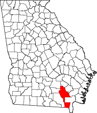 Location in the U.S. state of Georgia | |
 Georgia's location in the U.S. | |
| Founded | December 15, 1824 |
| Named for | Nicholas Ware |
| Seat | Waycross |
| Largest city | Waycross |
| Area | |
| • Total | 908 sq mi (2,352 km2) |
| • Land | 892 sq mi (2,310 km2) |
| • Water | 16 sq mi (41 km2), 1.7% |
| Population | |
| • (2010) | 36,312 |
| • Density | 41/sq mi (16/km²) |
| Congressional district | 1st |
| Time zone | Eastern: UTC-5/-4 |
| Website |
www |

Ware County is a county located in the southeast of the U.S. state of Georgia. As of the 2010 census, the population was 36,312.[1] The county seat is Waycross.[2]
Ware County is part of the Waycross, Georgia Micropolitan Statistical Area.
By geographic area, Ware County is the largest Georgia county. There is a local saying that the county seat of Waycross is "the largest city in the largest county in the largest state, east of the Mississippi".
History
Ware County, Georgia's 60th county, was created on December 15, 1824, by an act of the Georgia General Assembly from land that was originally part of Appling County.
The county is named for Nicholas Ware, the mayor of Augusta, Georgia from (1819–1821) and United States Senator who represented Georgia from 1821 until his death in 1824.
Several counties were later created from parts of the original Ware County borders:
- Bacon County (from portions of Appling, Pierce, and Ware counties in 1917)
- Charlton County (from portions of Camden and Ware county)
- Clinch County (from portions of Lowndes and Ware counties in 1850)
- Coffee County (from portions of Clinch, Irwin, Telfair, and Ware counties in 1854)
- Pierce County (from portions of Appling and Ware counties in 1857)
Geography
According to the U.S. Census Bureau, the county has a total area of 908 square miles (2,350 km2), of which 892 square miles (2,310 km2) is land and 16 square miles (41 km2) (1.7%) is water.[3] It is the largest county in Georgia by area. A large portion of the county lies within the Okefenokee Swamp and its federally protected areas.
More than half of Ware County, made up by the western half of the southern portion of the county, the land bridge to the northern portion of the county, and the southern and western portion of the northern section of the county, is located in the Upper Suwannee River sub-basin of the Suwannee River basin. The eastern half of the southern portion of Ware County is located in the St. Marys River sub-basin of the St. Marys-Satilla River basin. The rest of the county, from just southeast to north and west of Waycross, is located in the Satilla River sub-basin of the same St. Marys-Satilla River basin.[4]
Major highways
Adjacent counties
- Bacon County - north
- Pierce County - east
- Brantley County - east
- Charlton County - southeast
- Baker County, Florida - south
- Clinch County - west
- Atkinson County - west
- Coffee County - northwest
National protected area
Demographics
| Historical population | |||
|---|---|---|---|
| Census | Pop. | %± | |
| 1830 | 1,205 | — | |
| 1840 | 2,323 | 92.8% | |
| 1850 | 3,888 | 67.4% | |
| 1860 | 2,200 | −43.4% | |
| 1870 | 2,286 | 3.9% | |
| 1880 | 4,159 | 81.9% | |
| 1890 | 8,811 | 111.9% | |
| 1900 | 13,761 | 56.2% | |
| 1910 | 22,957 | 66.8% | |
| 1920 | 28,361 | 23.5% | |
| 1930 | 26,558 | −6.4% | |
| 1940 | 27,929 | 5.2% | |
| 1950 | 30,289 | 8.4% | |
| 1960 | 34,219 | 13.0% | |
| 1970 | 33,525 | −2.0% | |
| 1980 | 37,180 | 10.9% | |
| 1990 | 35,471 | −4.6% | |
| 2000 | 35,483 | 0.0% | |
| 2010 | 36,312 | 2.3% | |
| Est. 2015 | 35,370 | [5] | −2.6% |
| U.S. Decennial Census[6] 1790-1960[7] 1900-1990[8] 1990-2000[9] 2010-2013[1] | |||
2000 census
As of the census[10] of 2000, there were 35,483 people, 13,475 households, and 9,297 families residing in the county. The population density was 39 people per square mile (15/km²). There were 15,831 housing units at an average density of 18 per square mile (7/km²). The racial makeup of the county was 69.65% White, 28.01% Black or African American, 0.18% Native American, 0.48% Asian, 0.03% Pacific Islander, 0.99% from other races, and 0.66% from two or more races. 1.94% of the population were Hispanic or Latino of any race.
According to the census[10] of 2000, the largest ancestry groups in Ware County were English 46.13%, African 28.01%, Scots-Irish 12.29%, Scottish 4.3%, Irish 2.21% and Welsh 1.9%.
There were 13,475 households out of which 30.70% had children under the age of 18 living with them, 50.30% were married couples living together, 14.80% had a female householder with no husband present, and 31.00% were non-families. 27.90% of all households were made up of individuals and 12.30% had someone living alone who was 65 years of age or older. The average household size was 2.47 and the average family size was 3.01.
In the county the population was spread out with 24.80% under the age of 18, 9.10% from 18 to 24, 28.10% from 25 to 44, 22.60% from 45 to 64, and 15.40% who were 65 years of age or older. The median age was 37 years. For every 100 females there were 97.60 males. For every 100 females age 18 and over, there were 94.50 males.
The median income for a household in the county was $28,360, and the median income for a family was $34,372. Males had a median income of $26,910 versus $20,424 for females. The per capita income for the county was $14,384. About 15.90% of families and 20.50% of the population were below the poverty line, including 30.10% of those under age 18 and 16.70% of those age 65 or over.
2010 census
As of the 2010 United States Census, there were 36,312 people, 13,654 households, and 9,209 families residing in the county.[11] The population density was 40.7 inhabitants per square mile (15.7/km2). There were 16,326 housing units at an average density of 18.3 per square mile (7.1/km2).[12] The racial makeup of the county was 66.4% white, 29.5% black or African American, 0.8% Asian, 0.3% American Indian, 1.5% from other races, and 1.5% from two or more races. Those of Hispanic or Latino origin made up 3.3% of the population.[11] In terms of ancestry, 13.6% were American, 13.1% were English, 10.9% were Irish, and 5.6% were German.[13]
Of the 13,654 households, 33.3% had children under the age of 18 living with them, 44.6% were married couples living together, 17.7% had a female householder with no husband present, 32.6% were non-families, and 28.4% of all households were made up of individuals. The average household size was 2.48 and the average family size was 3.03. The median age was 38.4 years.[11]
The median income for a household in the county was $35,517 and the median income for a family was $47,609. Males had a median income of $36,149 versus $27,034 for females. The per capita income for the county was $18,295. About 16.7% of families and 20.5% of the population were below the poverty line, including 32.5% of those under age 18 and 10.3% of those age 65 or over.[14]
Education
High schools
- Ware County High School, Waycross
Middle schools
- Ware County Middle School, Waycross
- Waycross Middle School, Waycross
Elementary schools
- Wacona Elementary School, Waycross
- Center Elementary School, Waycross
- Williams Heights Elementary School, Waycross
- Memorial Drive Elementary School, Waycross
- Ruskin Elementary School, Waycross
- Waresboro Elementary School, Waycross
Preschools
- DAFFODIL Preschool, Waycross
Private schools
Higher education
- South Georgia State College, Waycross
- Coastal Pines Technical College, Waycross
Communities
Cities
Census-designated places
Unincorporated communities
See also
| Wikimedia Commons has media related to Ware County Courthouse. |
References
- 1 2 "State & County QuickFacts". United States Census Bureau. Retrieved June 27, 2014.
- ↑ "Find a County". National Association of Counties. Retrieved 2011-06-07.
- ↑ "US Gazetteer files: 2010, 2000, and 1990". United States Census Bureau. 2011-02-12. Retrieved 2011-04-23.
- ↑ "Georgia Soil and Water Conservation Commission Interactive Mapping Experience". Georgia Soil and Water Conservation Commission. Retrieved 2015-11-27.
- ↑ "County Totals Dataset: Population, Population Change and Estimated Components of Population Change: April 1, 2010 to July 1, 2015". Retrieved July 2, 2016.
- ↑ "U.S. Decennial Census". United States Census Bureau. Retrieved June 27, 2014.
- ↑ "Historical Census Browser". University of Virginia Library. Retrieved June 27, 2014.
- ↑ "Population of Counties by Decennial Census: 1900 to 1990". United States Census Bureau. Retrieved June 27, 2014.
- ↑ "Census 2000 PHC-T-4. Ranking Tables for Counties: 1990 and 2000" (PDF). United States Census Bureau. Retrieved June 27, 2014.
- 1 2 "American FactFinder". United States Census Bureau. Retrieved 2008-01-31.
- 1 2 3 "DP-1 Profile of General Population and Housing Characteristics: 2010 Demographic Profile Data". United States Census Bureau. Retrieved 2015-12-30.
- ↑ "Population, Housing Units, Area, and Density: 2010 - County". United States Census Bureau. Retrieved 2015-12-30.
- ↑ "DP02 SELECTED SOCIAL CHARACTERISTICS IN THE UNITED STATES – 2006-2010 American Community Survey 5-Year Estimates". United States Census Bureau. Retrieved 2015-12-30.
- ↑ "DP03 SELECTED ECONOMIC CHARACTERISTICS – 2006-2010 American Community Survey 5-Year Estimates". United States Census Bureau. Retrieved 2015-12-30.
- ↑ Ware County, Georgia
External links
- Official Ware County website
- Ware County Community Website & Community Calendar
- Georgia GenWeb Ware County site
- Okefenokee Swamp Park homepage
- Okefenokee National Wildlife Refuge U.S. Fish and Wildlife Service
 |
Coffee County | Bacon County | | |
| Atkinson County and Clinch County | |
Pierce County and Brantley County | ||
| ||||
| | ||||
| Baker County, Florida | Charlton County |
Municipalities and communities of Ware County, Georgia, United States | ||
|---|---|---|
| City | | |
| CDPs | ||
| Unincorporated communities | ||
| Footnotes | ‡This populated place also has portions in an adjacent county or counties | |
Template:Georgia
Coordinates: 31°03′N 82°25′W / 31.05°N 82.42°W