Podjelovo Brdo
| Podjelovo Brdo | |
|---|---|
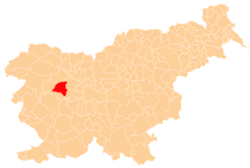
 Podjelovo Brdo Location in Slovenia | |
| Coordinates: 46°6′7.41″N 14°2′22.11″E / 46.1020583°N 14.0394750°ECoordinates: 46°6′7.41″N 14°2′22.11″E / 46.1020583°N 14.0394750°E | |
| Country |
|
| Traditional region | Upper Carniola |
| Statistical region | Upper Carniola |
| Municipality | Gorenja Vas–Poljane |
| Area | |
| • Total | 4.35 km2 (1.68 sq mi) |
| Elevation | 813.1 m (2,667.7 ft) |
| Population (2002) | |
| • Total | 130 |
| [1] | |
Podjelovo Brdo (pronounced [pɔˈdjeːlɔʋɔ ˈbəɾdɔ]; German: Podjelowoberdo[2]) is a dispersed settlement in the Škofja Loka Hills, east of Gorenja Vas, in the Municipality of Gorenja Vas–Poljane in the Upper Carniola region of Slovenia.[3]
References
- ↑ Statistical Office of the Republic of Slovenia
- ↑ Leksikon občin kraljestev in dežel zastopanih v državnem zboru, vol. 6: Kranjsko. 1906. Vienna: C. Kr. Dvorna in Državna Tiskarna, p. 60.
- ↑ Gorenja Vas–Poljane municipal site
External links
| Settlements | Administrative centre: Gorenja Vas
|  |
|---|---|---|
| Landmarks |
| |
| Notable people | ||
This article is issued from Wikipedia - version of the 12/29/2015. The text is available under the Creative Commons Attribution/Share Alike but additional terms may apply for the media files.