Volaka
| Volaka | |
|---|---|
 Volaka Location in Slovenia | |
| Coordinates: 46°7′45.1″N 14°6′46.43″E / 46.129194°N 14.1128972°ECoordinates: 46°7′45.1″N 14°6′46.43″E / 46.129194°N 14.1128972°E | |
| Country |
|
| Traditional region | Upper Carniola |
| Statistical region | Upper Carniola |
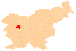
| Municipality | Gorenja Vas–Poljane |
| Area | |
| • Total | 1.5 km2 (0.6 sq mi) |
| Elevation | 459.6 m (1,507.9 ft) |
| Population (2002) | |
| • Total | 76 |
| [1] | |
Volaka (pronounced [ʋɔˈlaːka]) is a dispersed settlement in the hills north of Hotavlje in the Municipality of Gorenja Vas–Poljane in the Upper Carniola region of Slovenia.[2]
Name
The name Volaka is believed to refer to early foreign-born residents of the settlement, related to the word Vlach.[3]
History
Volaščica Creek, which runs through the settlement, was set as the original border of the Dominion of Freising in AD 973. Oral tradition states that in the 11th century a castle owned by Hemma of Gurk stood on Gradišče Hill above the settlement. In the 17th century, iron ore was dug in the area and carried across the hills to Potok and Železniki for processing. For a number of years a foundry operated in Volaka.[3]
References
- ↑ Statistical Office of the Republic of Slovenia
- ↑ Gorenja Vas–Poljane municipal site
- 1 2 Savnik, Roman, ed. 1968. Krajevni leksikon Slovenije, vol. 1. Ljubljana: Državna založba Slovenije, p. 384.
External links
| Settlements | Administrative centre: Gorenja Vas
|  |
|---|---|---|
| Landmarks |
| |
| Notable people | ||
This article is issued from Wikipedia - version of the 12/29/2015. The text is available under the Creative Commons Attribution/Share Alike but additional terms may apply for the media files.