Porte de Champerret (Paris Métro)
Porte de Champerret | |||||||||||
|---|---|---|---|---|---|---|---|---|---|---|---|
| Paris Métro station | |||||||||||
 | |||||||||||
| Location |
143, rue de Villiers Place Stuart Merrill 149, boul. Berthier 17th arrondissement of Paris Île-de-France France | ||||||||||
| Coordinates | 48°53′09″N 2°17′37″E / 48.885851°N 2.293487°ECoordinates: 48°53′09″N 2°17′37″E / 48.885851°N 2.293487°E | ||||||||||
| Owned by | RATP | ||||||||||
| Operated by | RATP | ||||||||||
| Other information | |||||||||||
| Fare zone | 1 | ||||||||||
| History | |||||||||||
| Opened | 15 February 1911 | ||||||||||
| Services | |||||||||||
| |||||||||||
| Location | |||||||||||
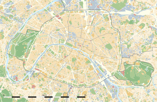 Porte de Champerret Location within Paris | |||||||||||
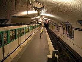
Porte de Champerret is a station on Paris Métro Line 3.
The station is named after the Porte de Champerret, a gate in the nineteenth century Thiers Wall of Paris on the way to the hamlet of Champerret, which was merged with the commune of Levallois-Perret in 1867. The station was opened on 15 February 1911, when the line was extended from Pereire and was the western terminus of the line until its extension to Pont de Levallois – Bécon on 24 September 1937.
Station layout
| Street Level |
| B1 | Mezzanine |
| Line 3 platforms | Loop track | No regular service |
| Westbound | ← | |
| Eastbound | | |
| Loop track | No regular service | |
Gallery
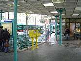 Street-level entrance at Porte de Champerret
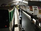 MF 67 at Porte de Champerret
| Wikimedia Commons has media related to Porte de Champerret (Paris Metro). |
References
- Roland, Gérard (2003). Stations de métro. D’Abbesses à Wagram. Éditions Bonneton.
This article is issued from Wikipedia - version of the 11/18/2016. The text is available under the Creative Commons Attribution/Share Alike but additional terms may apply for the media files.