Prairie Township, Hancock County, Illinois
| Prairie Township | |
|---|---|
| Township | |
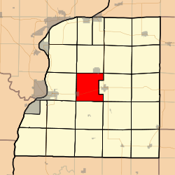 Location in Hancock County | |
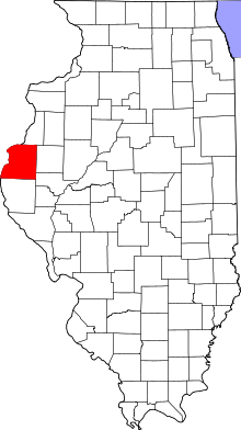 Hancock County's location in Illinois | |
| Coordinates: 40°25′28″N 91°12′26″W / 40.42444°N 91.20722°WCoordinates: 40°25′28″N 91°12′26″W / 40.42444°N 91.20722°W | |
| Country |
|
| State |
|
| County | Hancock |
| Established | September 12, 1854 |
| Area | |
| • Total | 33.12 sq mi (85.8 km2) |
| • Land | 33.07 sq mi (85.7 km2) |
| • Water | 0.05 sq mi (0.1 km2) 0.15% |
| Elevation | 699 ft (213 m) |
| Population (2010) | |
| • Total | 380 |
| • Density | 11.5/sq mi (4.4/km2) |
| Time zone | CST (UTC-6) |
| • Summer (DST) | CDT (UTC-5) |
| ZIP codes | 62321, 62334, 62341, 62379 |
| GNIS feature ID | 0429596 |
Prairie Township is one of twenty-five townships in Hancock County, Illinois, USA. As of the 2010 census, its population was 380 and it contained 179 housing units.[1] It was formed from Montebello and Carthage townships on September 12, 1854.
Geography
According to the 2010 census, the township has a total area of 33.12 square miles (85.8 km2), of which 33.07 square miles (85.7 km2) (or 99.85%) is land and 0.05 square miles (0.13 km2) (or 0.15%) is water.[1]
Cities, towns, villages
Unincorporated towns
(This list is based on USGS data and may include former settlements.)
Cemeteries
The township contains Elvaston Cemetery.
Major highways
Airports and landing strips
- Hanks Hangar Airport
- Kirchner Airport
- Martins Airport
- Schilson Field
School districts
- Hamilton Community Consolidated School District 328
Political districts
- Illinois's 17th congressional district
- State House District 94
- State Senate District 47
References
- United States Census Bureau 2008 TIGER/Line Shapefiles
- "Prairie Township". Geographic Names Information System. United States Geological Survey. Retrieved 2009-09-20.
- United States National Atlas
- 1 2 "Population, Housing Units, Area, and Density: 2010 - County -- County Subdivision and Place -- 2010 Census Summary File 1". United States Census. Retrieved 2013-05-28.
External links
 |
Sonora Township | Rock Creek Township | Pilot Grove Township | |
| Montebello Township | |
Carthage Township | ||
| ||||
| | ||||
| Wythe Township | Bear Creek Township | Harmony Township |
Municipalities and communities of Hancock County, Illinois, United States | ||
|---|---|---|
| Cities | ||
| Town | ||
| Villages | ||
| Townships | ||
| Unincorporated communities | ||
| Footnotes | ‡This populated place also has portions in an adjacent county or counties | |
This article is issued from Wikipedia - version of the 12/3/2013. The text is available under the Creative Commons Attribution/Share Alike but additional terms may apply for the media files.