Pulaski, Georgia
| Pulaski, Georgia | |
|---|---|
| Town | |
 Location in Candler County and the state of Georgia | |
| Coordinates: 32°23′28″N 81°57′22″W / 32.39111°N 81.95611°WCoordinates: 32°23′28″N 81°57′22″W / 32.39111°N 81.95611°W | |
| Country | United States |
| State | Georgia |
| County | Candler |
| Area | |
| • Total | 0.8 sq mi (2.1 km2) |
| • Land | 0.8 sq mi (2.1 km2) |
| • Water | 0 sq mi (0 km2) |
| Elevation | 210 ft (64 m) |
| Population (2010) | |
| • Total | 266 |
| • Density | 334/sq mi (128.9/km2) |
| Time zone | Eastern (EST) (UTC-5) |
| • Summer (DST) | EDT (UTC-4) |
| ZIP code | 30451 |
| Area code(s) | 912 |
| FIPS code | 13-63000[1] |
| GNIS feature ID | 0321217[2] |
Pulaski is a town in Candler County, Georgia, United States. The population was 266 at the 2010 census.[3]
History
The town was named for Count Casimir Pulaski, Revolutionary War hero.[4]
Geography
Pulaski is located in eastern Candler County at 32°23′28″N 81°57′22″W / 32.39111°N 81.95611°W (32.390979, -81.956167).[5] Georgia State Route 46 passes through the town, leading west 6 miles (10 km) to Metter, the county seat. Interstate 16, an east-west highway connecting Savannah and Macon, is 3.5 miles (5.6 km) to the south.
According to the United States Census Bureau, Pulaski has a total area of 0.81 square miles (2.1 km2), all of it land.[3]
Demographics
| Historical population | |||
|---|---|---|---|
| Census | Pop. | %± | |
| 1910 | 207 | — | |
| 1940 | 241 | — | |
| 1950 | 234 | −2.9% | |
| 1960 | 155 | −33.8% | |
| 1970 | 230 | 48.4% | |
| 1980 | 257 | 11.7% | |
| 1990 | 264 | 2.7% | |
| 2000 | 261 | −1.1% | |
| 2010 | 266 | 1.9% | |
| Est. 2015 | 203 | [6] | −23.7% |
As of the census[1] of 2000, there were 261 people, 73 households, and 48 families residing in the town. The population density was 326.8 people per square mile (126.0/km²). There were 83 housing units at an average density of 103.9 per square mile (40.1/km²). The racial makeup of the town was 50.19% White, 27.20% African American, 20.31% from other races, and 2.30% from two or more races. Hispanic or Latino of any race were 22.22% of the population.
There were 73 households out of which 28.8% had children under the age of 18 living with them, 49.3% were married couples living together, 11.0% had a female householder with no husband present, and 34.2% were non-families. 27.4% of all households were made up of individuals and 15.1% had someone living alone who was 65 years of age or older. The average household size was 2.62 and the average family size was 3.04.
In the town the population was spread out with 17.6% under the age of 18, 8.0% from 18 to 24, 20.3% from 25 to 44, 23.4% from 45 to 64, and 30.7% who were 65 years of age or older. The median age was 47 years. For every 100 females there were 143.9 males. For every 100 females age 18 and over, there were 136.3 males.
The median income for a household in the town was $26,667, and the median income for a family was $29,375. Males had a median income of $23,393 versus $20,208 for females. The per capita income for the town was $11,446. About 16.7% of families and 15.7% of the population were below the poverty line, including 22.0% of those under the age of eighteen and 19.5% of those sixty five or over.
References
- 1 2 "American FactFinder". United States Census Bureau. Retrieved 2008-01-31.
- ↑ "US Board on Geographic Names". United States Geological Survey. 2007-10-25. Retrieved 2008-01-31.
- 1 2 "Geographic Identifiers: 2010 Demographic Profile Data (G001): Pulaski town, Georgia". U.S. Census Bureau, American Factfinder. Retrieved July 18, 2014.
- ↑ "Profile for Pulaski, Georgia". ePodunk. Retrieved 2010-06-18.
- ↑ "US Gazetteer files: 2010, 2000, and 1990". United States Census Bureau. 2011-02-12. Retrieved 2011-04-23.
- ↑ "Annual Estimates of the Resident Population for Incorporated Places: April 1, 2010 to July 1, 2015". Retrieved July 2, 2016.
- ↑ "Census of Population and Housing". Census.gov. Retrieved June 4, 2015.
External links
- Pulaski historical marker
Municipalities and communities of Candler County, Georgia, United States | ||
|---|---|---|
| City | 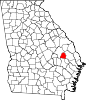 | |
| Town | ||