Putnam, New York
| Putnam | |
|---|---|
| Town | |
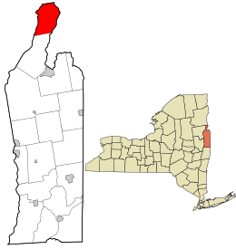 Location in Washington County and the state of New York. | |
| Coordinates: 43°44′43″N 73°24′57″W / 43.74528°N 73.41583°WCoordinates: 43°44′43″N 73°24′57″W / 43.74528°N 73.41583°W | |
| Country | United States |
| State | New York |
| County | Washington |
| Area | |
| • Total | 35.5 sq mi (91.8 km2) |
| • Land | 33.2 sq mi (85.9 km2) |
| • Water | 2.3 sq mi (6.0 km2) |
| Elevation | 873 ft (266 m) |
| Population (2000)[1] | |
| • Total | 645 |
| • Density | 19.5/sq mi (7.5/km2) |
| Time zone | Eastern (EST) (UTC-5) |
| • Summer (DST) | EDT (UTC-4) |
| ZIP code(s)[2] |
12861 (primary)
|
| Area code(s) | 518 |
| FIPS code | 36-60092 |
| GNIS feature ID | 0979402 |
Putnam is a town in northern Washington County, New York, United States. It is part of the Glens Falls Metropolitan Statistical Area.[3] The town population was 645 at the 2000 census.[1] The town is named after Israel Putnam, a hero of the American Revolution.
History
The town was part of the Provincial Patent (1764) made to officer veterans of the French and Indian War while the region was in Charlotte County.
The Hiram Congdon House was listed on the National Register of Historic Places in 1997.[4]
Geography
According to the United States Census Bureau, the town has a total area of 35.5 square miles (92 km2), of which, 33.2 square miles (86 km2) of it is land and 2.3 square miles (6.0 km2) of it (6.49%) is water.
The north town line is the border of Essex County, New York. The east town line is defined by Lake Champlain and the border of Vermont. The west town line is defined by Lake George and Warren County, New York. The town is inside the Adirondack Park.
NY Route 22 is a north-south highway through the center of the town.
Demographics
| Historical population | |||
|---|---|---|---|
| Census | Pop. | %± | |
| 1820 | 892 | — | |
| 1830 | 718 | −19.5% | |
| 1840 | 784 | 9.2% | |
| 1850 | 753 | −4.0% | |
| 1860 | 754 | 0.1% | |
| 1870 | 603 | −20.0% | |
| 1880 | 611 | 1.3% | |
| 1890 | 568 | −7.0% | |
| 1900 | 505 | −11.1% | |
| 1910 | 504 | −0.2% | |
| 1920 | 528 | 4.8% | |
| 1930 | 479 | −9.3% | |
| 1940 | 534 | 11.5% | |
| 1950 | 534 | 0.0% | |
| 1960 | 490 | −8.2% | |
| 1970 | 579 | 18.2% | |
| 1980 | 506 | −12.6% | |
| 1990 | 477 | −5.7% | |
| 2000 | 645 | 35.2% | |
| 2010 | 609 | −5.6% | |
| Est. 2014 | 594 | [5] | −2.5% |
As of the census of 2000, there were 645 people, 248 households, and 181 families residing in the town. The population density was 19.5 people per square mile (7.5/km²). There were 611 housing units at an average density of 18.4 per square mile (7.1/km²). The racial makeup of the town was 99.84% White and 0.16% Asian. Hispanic or Latino of any race were 1.24% of the population.[1]
There were 248 households out of which 31.0% had children under the age of 18 living with them, 63.3% were married couples living together, 6.0% had a female householder with no husband present, and 27.0% were non-families. 22.6% of all households were made up of individuals and 11.7% had someone living alone who was 65 years of age or older. The average household size was 2.60 and the average family size was 3.07.[1]
In the town the population was spread out with 24.7% under the age of 18, 6.4% from 18 to 24, 25.7% from 25 to 44, 28.4% from 45 to 64, and 14.9% who were 65 years of age or older. The median age was 40 years. For every 100 females there were 106.7 males. For every 100 females age 18 and over, there were 105.1 males.[1]
The median income for a household in the town was $51,000, and the median income for a family was $56,429. Males had a median income of $32,500 versus $28,125 for females. The per capita income for the town was $21,355. About 3.6% of families and 5.7% of the population were below the poverty line, including 9.2% of those under age 18 and 8.0% of those age 65 or over.[1]
Communities and locations in Putnam
- Adirondack Camp – A private sleepaway camp located south of Glemburnie by Lake George.
- Glenburnie – A hamlet on Lake George at Blairs Bay.
- Putnam – The hamlet of Putnam on NY-22 and County Road 2.
- Putnam Station – A hamlet in the vicinity of NY-22, County Routes 2 & 3 and Mill Bay[2]
- Wright – A hamlet in the northeast part of the town on Lake Champlain.
Geographic locations
- Blairs Bay – A bay on the east side of Lake George at Glenburnie, bounded on the north end by Anthony's Nose and on the south end by the Adirondack Camp peninsula.
- Charter Brook – A strean entering Lake Champlain in the north part of Putnam.
- Gull Bay – A bay of Lake George south of Camp Adirondack.
- Lamb Shanty Bay – A bay on Lake George in the south part of Putnam.
- Mill Bay – A bay on Lake Champlain.
- Mill Brook – A stream in the south part of the town that empties in Mill Bay.
- Mud Pond – A lake in the southwest part of Putnam.
- Record Hill – An elevation north of Glenburnie.
- Skerrey Point – A projection into Lake George forming part of Gull Bay.
- Smith Bay – A bay south of Skerrey Point.
- South Mountain – An elevation north of Record Hill.
Education
Public education is provided by the Putnam Central School District, the borders of which are coterminus with the town's.[2] The district has a five-member board of education.[7] Putnam Central School is a K-6 school, and students of 7th grade and higher are bused to the nearby Ticonderoga Central School District in Ticonderoga, New York
References
- 1 2 3 4 5 6 "American FactFinder". United States Census Bureau. Retrieved 2008-01-31.
- 1 2 3 Washington County GIS Web Map (Map). Washington County, NY. Retrieved 2010-06-19.
- ↑ "Metropolitan Areas and Components, 1999, with FIPS Codes". US Census Bureau. Retrieved July 7, 2009.
- ↑ National Park Service (2009-03-13). "National Register Information System". National Register of Historic Places. National Park Service.
- ↑ "Annual Estimates of the Resident Population for Incorporated Places: April 1, 2010 to July 1, 2014". Retrieved June 4, 2015.
- ↑ "Census of Population and Housing". Census.gov. Retrieved June 4, 2015.
- ↑ "Members". Putnam Central School. Retrieved 2010-06-19.
External links
Municipalities and communities of Washington County, New York, United States | ||
|---|---|---|
| Towns | 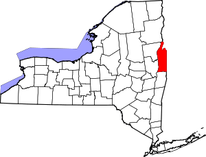 | |
| Villages | ||
| Hamlets | ||
| Footnotes | ‡This populated place also has portions in an adjacent county or counties | |