Ram Sanehi Ghat
| Ram Sanehi Ghat राम सनेही घाट (رام صانعي جهات) | |
|---|---|
| town | |
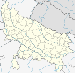 Ram Sanehi Ghat  Ram Sanehi Ghat Location in Uttar Pradesh, India | |
| Coordinates: 26°48′N 81°33′E / 26.80°N 81.55°ECoordinates: 26°48′N 81°33′E / 26.80°N 81.55°E | |
| Country |
|
| State | Uttar Pradesh |
| District | Barabanki |
| Elevation | 110 m (360 ft) |
| Population (2001)[1] | |
| • Total | 364,887 |
| Languages | |
| • Official | Hindi, Urdu |
| Time zone | IST (UTC+5:30) |
| PIN | 225409 |
| Telephone code | 05241 |
| Vehicle registration | UP-41 |
| Website |
up |
Ram Sanehi Ghat(or Ramsanehi Ghat or Ramsanehighat) is a town in Barabanki district in the state of Uttar Pradesh, India. It is a Tehsil and Police station(Thana).[2]
Geography
Ram Sanehi Ghat is located at 26°48′N 81°33′E / 26.80°N 81.55°E[3],.[4] It has an average elevation of 110 metres (360 feet).
There is a flood recording station at the Elgin Bridge which records rise and fall in the Ghaghra River. Tehsil Ram Sanehi Ghat is threatened as soon as water crosses 347 ft mark at the Elgin Bridge.[5]
Demographics
As of 2001 India census,[6] Ram Sanehi Ghat had a population of 364,887. Males constitute 53% of the population and females 47%. Ram Sanehi Ghat has an average literacy rate of 52%, lower than the national average of 59.5%: male literacy is 56%, and female literacy is 47%. In Ram Sanehi Ghat, 17% of the population is under 6 years of age.
Health infrastructure
Tehsil Ram Sanehi Ghat has:[7]
- Health centres - 4
- PHCs - 6
- Sub centres - 5
References
- ↑ http://www.geohive.com/cntry/subs/in-09.aspx
- ↑ http://barabanki.nic.in/admin.htm
- ↑ http://unlocode.hmap.info/?lon=81.54&lat=26.8¢erX=289¢erY=151&scale=-9&scaleALT=-9
- ↑ http://www.airport-images.com/city_1167385_Ramsanehighat
- ↑ Uttar Pradesh district gazetteers, Volume 42 Gazetteer of India Uttar Pradesh District Gazetteers, Uttar Pradesh (India). Govt. of Uttar Pradesh. 1988. pp. 7, 101, 140. Retrieved 2013-06-30.
- ↑ "Census of India 2001: Data from the 2001 Census, including cities, villages and towns (Provisional)". Census Commission of India. Archived from the original on 2004-06-16. Retrieved 2008-11-01.
- ↑ http://jsk.gov.in/hindi/up/up_barabanki.pdf