Red Army Strait
| Red Army Strait Пролив Красной Армии | |
|---|---|
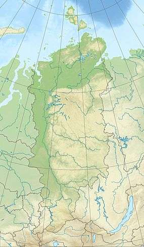 Location in Krasnoyarsk Krai | |
| Location | Arctic |
| Coordinates | 80°07′23″N 95°01′54″E / 80.12306°N 95.03167°ECoordinates: 80°07′23″N 95°01′54″E / 80.12306°N 95.03167°E |
| Ocean/sea sources | Kara Sea / Laptev Sea |
| Basin countries | Russia |
| Max. width | 18 km |
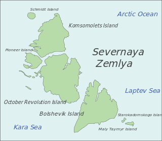
Red Army Strait (Russian: Пролив Красной Армии, Proliv Krasnoy Army)[1] is a strait in Severnaya Zemlya, Russia.[2] It is named after the Red Army (Krasnaya Armiya).
Geography
The Red Army Strait is 18 kilometers (11 mi) wide. It separates Komsomolets Island in the north from October Revolution Island in the south and connects the Kara Sea in the west with the Laptev Sea in the east. The Yuny Strait, separating Pioneer Island from Komsomolets Island, branches to the northwest in the eastern part of the strait.[3]
 Map showing the location of Red Army Strait |
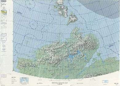 1975 map showing Severnaya Zemlya and the Taymyr Peninsula |
References
- ↑ Characteristics of Icebergs in Their Calving Sites in Russian Arctic: Results of Airborne and Direct Studies during IPY 2007/08
- ↑ "Proliv Krasnoy Armii". Mapcarta. Retrieved 23 November 2016.
- ↑ "Proliv Yunyy". Mapcarta. Retrieved 26 November 2016.
This article is issued from Wikipedia - version of the 11/26/2016. The text is available under the Creative Commons Attribution/Share Alike but additional terms may apply for the media files.