Red Deer Lake (Alberta)
| Red Deer Lake | |
|---|---|
| Location | Ponoka County / Camrose County / County of Wetaskiwin No. 10, Alberta |
| Coordinates | 52°42′27″N 113°01′59″W / 52.70750°N 113.03306°WCoordinates: 52°42′27″N 113°01′59″W / 52.70750°N 113.03306°W |
| Primary outflows | Battle River |
| Basin countries | Canada |
| Max. length | 15 kilometres (9.3 mi) |
| Max. width | 3.4 kilometres (2.1 mi) |
| Surface area | 21 square kilometres (8.1 sq mi) |
| Surface elevation | 775 metres (2,543 ft) |
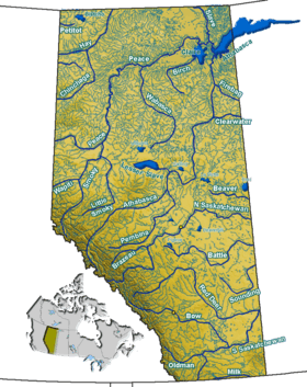
Red Deer Lake is a fresh water alkaline lake situated near Bashaw in central Alberta, Canada.
The 15 kilometres (9.3 mi) long lake is located northwest of the junction of Highway 21 and Highway 53. In descending order of surface area, it straddles the boundaries of Ponoka County, Camrose County and the County of Wetaskiwin No. 10. The lake is drained through a series of marshes into the Battle River.
See also
This article is issued from Wikipedia - version of the 10/8/2015. The text is available under the Creative Commons Attribution/Share Alike but additional terms may apply for the media files.