Richland, Pennsylvania
| Richland, Pennsylvania | |
|---|---|
| Borough | |
 Richland | |
| Coordinates: 40°21′26″N 76°15′26″W / 40.35722°N 76.25722°WCoordinates: 40°21′26″N 76°15′26″W / 40.35722°N 76.25722°W | |
| Country | United States |
| State | Pennsylvania |
| County | Lebanon |
| Incorporated | 1906 |
| Government | |
| • Type | Borough Council |
| Area | |
| • Total | 1.6 sq mi (4 km2) |
| Population (2000) | |
| • Total | 1,508 |
| • Density | 965.7/sq mi (372.9/km2) |
| Time zone | Eastern (EST) (UTC-5) |
| • Summer (DST) | EDT (UTC-4) |
| ZIP code | 17087 |
| Area code(s) | 717 |
Richland is a borough in Lebanon County, Pennsylvania, United States. It is part of the Lebanon, PA Metropolitan Statistical Area. The population was 1,508 at the 2000 census.
Geography
Richland is located at 40°21′26″N 76°15′26″W / 40.35722°N 76.25722°W (40.357122, -76.257187).[1]
According to the United States Census Bureau, the borough has a total area of 1.6 square miles (4.1 km2), all of it land.
Demographics
| Historical population | |||
|---|---|---|---|
| Census | Pop. | %± | |
| 1880 | 297 | — | |
| 1910 | 722 | — | |
| 1920 | 841 | 16.5% | |
| 1930 | 952 | 13.2% | |
| 1940 | 934 | −1.9% | |
| 1950 | 1,090 | 16.7% | |
| 1960 | 1,276 | 17.1% | |
| 1970 | 1,444 | 13.2% | |
| 1980 | 1,470 | 1.8% | |
| 1990 | 1,457 | −0.9% | |
| 2000 | 1,508 | 3.5% | |
| 2010 | 1,519 | 0.7% | |
| Est. 2015 | 1,560 | [2] | 2.7% |
| Sources:[3][4][5] | |||
As of the census[4] of 2000, there were 1,508 people, 582 households, and 444 families residing in the borough. The population density was 965.7 people per square mile (373.2/km²). There were 602 housing units at an average density of 385.5 per square mile (149.0/km²). The racial makeup of the borough was 98.21% White, 0.33% African American, 0.33% Asian, 0.33% from other races, and 0.80% from two or more races. Hispanic or Latino of any race were 0.60% of the population.
There were 582 households, out of which 32.8% had children under the age of 18 living with them, 66.0% were married couples living together, 6.0% had a female householder with no husband present, and 23.7% were non-families. 19.8% of all households were made up of individuals, and 10.5% had someone living alone who was 65 years of age or older. The average household size was 2.59 and the average family size was 2.96.
In the borough the population was spread out, with 25.1% under the age of 18, 6.6% from 18 to 24, 29.4% from 25 to 44, 22.5% from 45 to 64, and 16.4% who were 65 years of age or older. The median age was 38 years. For every 100 females there were 97.4 males. For every 100 females age 18 and over, there were 93.5 males.
The median income for a household in the borough was $45,729, and the median income for a family was $52,063. Males had a median income of $35,208 versus $22,723 for females. The per capita income for the borough was $19,365. About 2.3% of families and 3.2% of the population were below the poverty line, including 2.7% of those under age 18 and 6.0% of those age 65 or over.
History
Richland is unusual in that an active railroad crossing intersects the town square. Further, the two streets that comprise the square, Main Street and Race Street, are the only streets linking the northern and southern portions of the borough. As a result, that crossing can divide the entire town. This quirk has earned Richland mention in Ripley's Believe It or Not! books and on the televised game show, Jeopardy!.[6]
Notable residents
- Levi King Stoltzfus ("Lebanon Levi") - character from 2013-2014 Discovery Television Show "Amish Mafia"
- Nicholas B. Moehlmann - Member, PA House of Representatives
- Peter Zug - Member, PA House of Representatives[7]
References
- ↑ "US Gazetteer files: 2010, 2000, and 1990". United States Census Bureau. 2011-02-12. Retrieved 2011-04-23.
- ↑ "Annual Estimates of the Resident Population for Incorporated Places: April 1, 2010 to July 1, 2015". Retrieved July 2, 2016.
- ↑ "Census of Population and Housing". U.S. Census Bureau. Archived from the original on May 11, 2015. Retrieved 11 December 2013.
- 1 2 "American FactFinder". United States Census Bureau. Retrieved 2008-01-31.
- ↑ "Incorporated Places and Minor Civil Divisions Datasets: Subcounty Resident Population Estimates: April 1, 2010 to July 1, 2012". Population Estimates. U.S. Census Bureau. Archived from the original on June 17, 2013. Retrieved 11 December 2013.
- ↑ http://www.joellenlitz.com/7_wonders_of_lebanon_county.htm
- ↑ "Who is Lebanon Levi from Amish Mafia? Levi Stoltzfus mug shot photo and criminal record". Retrieved December 27, 2012.
External links
Municipalities and communities of Lebanon County, Pennsylvania, United States | ||
|---|---|---|
| City | 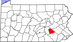 | |
| Boroughs | ||
| Townships | ||
| CDPs | ||
| Unincorporated communities | ||