Ridleyton, South Australia
| Ridleyton Adelaide, South Australia | |||||||||||||
|---|---|---|---|---|---|---|---|---|---|---|---|---|---|
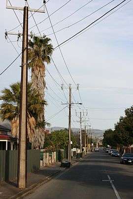 Street view in Ridleyton | |||||||||||||
| Population | |||||||||||||
| • Density | 2,350/km2 (6,100/sq mi) | ||||||||||||
| Established | 1873[3] | ||||||||||||
| Postcode(s) | 5008[4] | ||||||||||||
| Area | 0.4 km2 (0.2 sq mi) | ||||||||||||
| Location | 4.3 km (3 mi) NW of Adelaide city centre[4] | ||||||||||||
| LGA(s) | City of Charles Sturt[5] | ||||||||||||
| State electorate(s) | Croydon (2011)[6] | ||||||||||||
| Federal Division(s) | Adelaide (2011)[7] | ||||||||||||
| |||||||||||||

Ridleyton is an inner northern suburb of Adelaide, South Australia. It is located in the City of Charles Sturt.
History
The area incorporating the current suburb of Ridleyton was originally granted to Osmond Gilles in March 1839. He later transferred it to John Ridley, inventor of the stripper or reaping machine, in June 1842 for £275. In 1873, Ridley lodged a plan to subdivide his land, naming one part Ridleyton.[3]
Geography
Ridleyton is primarily bounded by South Road, Torrens Road, Wood Avenue and Blight Street. The suburb includes the northwestern end of the redeveloped Hawker Street precinct.[8]
Demographics
The 2006 Census by the Australian Bureau of Statistics counted 938 persons in Ridleyton on census night. Of these, 46.3% were male and 53.7% were female.[1]
The majority of residents (59.4%) are of Australian birth, with other common census responses being Vietnam (4.4%), England (3.6%), Greece (3.3%) and China (2.1%).[1]
The age distribution of Ridleyton residents is similar to that of the greater Australian population. 71.4% of residents were over 25 years in 2006, compared to the Australian average of 66.5%; and 28.6% were younger than 25 years, compared to the Australian average of 33.5%.[1]
Politics
Local government
Ridleyton is part of Hindmarsh Ward in the City of Charles Sturt local government area, being represented in that council by Paul Alexandrides and Craig Auricht.[5]
State and federal
Ridleyton lies in the state electoral district of Croydon[6] and the federal electoral division of Adelaide.[7] The suburb is represented in the South Australian House of Assembly by Michael Atkinson[6] and federally by Kate Ellis.[7]
Community
The local newspaper is the Weekly Times Messenger. Other regional and national newspapers such as The Advertiser and The Australian are also available.[9]
Facilities and attractions
Shopping and dining
The Ridleyton Central Shopping Centre services Ridleyton and neighboring suburbs. The centre is accessible from both Hawker Street and South Road.[8] As well as such stores as a pharmacy, bakery and news agency, the centre includes an IGA Foodland supermarket.
Other major businesses in the suburb include:
- BP service station on South Road (including a Subway (restaurant))
- McDonald's restaurant on the corner of South Road and Torrens Road
- BWS liquor store on the corner of Hawker Street and South Road.
The Hawker Street (Bowden & Brompton) and Elizabeth Street (Croydon) shopping and dining precincts are within walking distance of Ridleyton.[8]
Parks
The largest park in Ridleyton is Albert Greenshields Reserve on Torrens Road. This park includes a Girl Guide hall, barbecue area, public restrooms, creek, playing field and a children's playground. There are laneways both to Wright Street and Blight Street.[8]
There are also small parks on Ryan Place and on the corner of Hythe Street and Wood Avenue.[8]
Transportation
Roads
Ridleyton lies beside the intersection of South Road and Torrens Road, and is thus serviced by both. Hawker Street cuts through the centre of the suburb.[8]
Many of the local streets were established in the 19th century. Consequently, roadways tend to be narrow and, with a small volume of traffic, quiet.[10]
Public transport
Ridleyton is serviced by public transport run by the Adelaide Metro.[11]
Trains
There is no train stop in Ridleyton itself. However, the following train services run nearby.[11]
- Grange and Outer Harbour railway lines. The closest station is Croydon.
- Gawler railway line. The closest station is Ovingham.
Buses
The suburb is serviced by the following bus routes:[11]
- 250, 251, 252
- 253, 254, N254
See also
| Wikimedia Commons has media related to Ridleyton, South Australia. |
References
- 1 2 3 4 Australian Bureau of Statistics (25 October 2007). "Ridleyton (State Suburb)". 2006 Census QuickStats. Retrieved 29 May 2011.
- ↑ Australian Bureau of Statistics (9 March 2006). "Ridleyton (State Suburb)". 2001 Census QuickStats. Retrieved 29 May 2011.
- 1 2 "Place Names of South Australia". The Manning Index of South Australian History. State Library of South Australia. Retrieved 29 May 2011.
- 1 2 "Ridleyton, South Australia (Adelaide)". Postcodes-Australia. Postcodes-Australia.com. Retrieved 29 May 2011.
- 1 2 "City of Charles Sturt Wards and Council Members" (PDF). City of Charles Sturt. Retrieved 1 June 2011.
- 1 2 3 "Electoral Districts - Electoral District for the 2010 Election". Electoral Commission SA. Archived from the original on 22 August 2011. Retrieved 29 May 2011.
- 1 2 3 "Find my electorate: Adelaide". Australian Electoral Commission. Retrieved 29 May 2011.
- 1 2 3 4 5 6 Adelaide and surrounds street directory (47th ed.). UBD. 2009. ISBN 978-0-7319-2336-6.
- ↑ "South Australian Newspapers". Newspapers.com.au. Australia G'day. Retrieved 29 May 2011.
- ↑ "Bowden, Brompton, Ridleyton & Ovingham Local Area Traffic Management Plan" (PDF). Tonkin Consulting. 18 September 2009. Retrieved 29 April 2011.
- 1 2 3 "Public Transport in Adelaide". Adelaide Metro official website. Dept. for Transport, Energy and Infrastructure, Public Transport Division. Retrieved 29 May 2011.
External links
| Wikimedia Commons has media related to Ridleyton, South Australia. |
- "City of Charles Sturt". Official website. City of Charles Sturt. Retrieved 29 May 2011.
Coordinates: 34°53′33″S 138°34′13″E / 34.8925°S 138.5703°E