Rileyville, Pennsylvania
| Rileyville, Pennsylvania | |
|---|---|
| Village | |
| Village of Rileyville | |
 Rileyville, Pennsylvania Rileyville's Location within Pennsylvania. | |
| Coordinates: 41°42′56″N 75°13′46″W / 41.71556°N 75.22944°WCoordinates: 41°42′56″N 75°13′46″W / 41.71556°N 75.22944°W | |
| Country | United States |
| Commonwealth | Pennsylvania |
| U.S. Congressional District | PA-10 |
| School District |
Wayne Highlands Region II |
| County | Wayne |
| Magisterial District | 22-3-04[1] |
| Township | Lebanon |
| Elevation | 1,611[2] ft (491 m) |
| Time zone | Eastern (EST) (UTC-5) |
| • Summer (DST) | Eastern Daylight (EDT) (UTC-4) |
| ZIP code |
De jure None De facto 18431[3] (Honesdale) |
| Area code(s) | 570 |
| GNIS feature ID | 1204511[2] |
| FIPS code | 42-127-42176[4]-64884[2] |
| Major roads |
|
Rileyville is a village in Lebanon Township, Wayne County, Pennsylvania. It is located at the intersection of Route 191 and Route 371.
References
- ↑ "District Magistrate". Wayne County, PA. Wayne County Courthouse. 2014. Retrieved 14 November 2014.
- 1 2 3 "Rileyville". Geographic Names Information System. United States Geological Survey. 2 August 1979. Retrieved 23 April 2015.
- ↑ "US Postal Code Boundaries". Google. Google, Inc. 3 February 2014. Retrieved 24 November 2014.
- ↑ U.S. Census Bureau. Census 2000. "Census Demographic Profiles, Lebanon Township" (PDF). CenStats Databases. Retrieved 23 April 2015.
Municipalities and communities of Wayne County, Pennsylvania, United States | ||
|---|---|---|
| Boroughs | 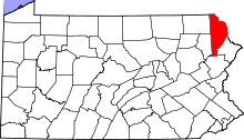 | |
| Townships | ||
| CDPs | ||
| Unincorporated communities | ||
This article is issued from Wikipedia - version of the 11/14/2016. The text is available under the Creative Commons Attribution/Share Alike but additional terms may apply for the media files.