Rivière-Bonaventure, Quebec
| Rivière-Bonaventure | |
|---|---|
| Unorganized territory | |
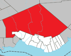 Location within Bonaventure RCM. | |
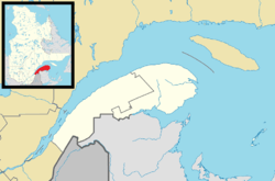 Rivière-Bonaventure Location in eastern Quebec. | |
| Coordinates: 48°30′N 65°36′W / 48.500°N 65.600°WCoordinates: 48°30′N 65°36′W / 48.500°N 65.600°W[1] | |
| Country |
|
| Province |
|
| Region |
Gaspésie– Îles-de-la-Madeleine |
| RCM | Bonaventure |
| Constituted | January 1, 1986 |
| Government[2] | |
| • Federal riding |
Gaspésie— Îles-de-la-Madeleine |
| • Prov. riding | Bonaventure |
| Area[2][3] | |
| • Total | 3,052.00 km2 (1,178.38 sq mi) |
| • Land | 3,057.46 km2 (1,180.49 sq mi) |
|
There is an apparent contradiction between two authoritative sources | |
| Population (2011)[3] | |
| • Total | 25 |
| • Density | 0.0/km2 (0/sq mi) |
| • Pop 2006-2011 |
|
| • Dwellings | 47 |
| Time zone | EST (UTC-5) |
| • Summer (DST) | EDT (UTC-4) |
| Highways |
|
Rivière-Bonaventure is an unorganized territory in the Gaspésie–Îles-de-la-Madeleine region of Quebec, Canada.
It is named after the 115 kilometres (71 mi) long Bonaventure River that bisects the territory from north to south.[4]
Demographics
Population
| Historical Census Data - Rivière-Bonaventure, Quebec[5] | ||||||||||||||||||||||||||
|---|---|---|---|---|---|---|---|---|---|---|---|---|---|---|---|---|---|---|---|---|---|---|---|---|---|---|
|
|
| ||||||||||||||||||||||||
Private dwellings occupied by usual residents: 16 (total dwellings: 47)
See also
References
- ↑ Reference number 149675 of the Commission de toponymie du Québec (French)
- 1 2 "Rivière-Bonaventure". Répertoire des municipalités (in French). Ministère des Affaires municipales, des Régions et de l'Occupation du territoire. Retrieved 2011-12-30.
- 1 2 "Rivière-Bonaventure census profile". 2011 Census data. Statistics Canada. Retrieved 2011-12-30.
- ↑ "Rivière Bonaventure" (in French). Commission de toponymie du Québec. Retrieved 2012-01-03.
- ↑ Statistics Canada: 1996, 2001, 2006, 2011 census
 |
Lac-Casault | Mont-Albert | Rivière-Saint-Jean | |
| Rivière-Nouvelle | |
Mont-Alexandre | ||
| ||||
| | ||||
| Carleton-sur-Mer | Maria / Cascapédia–Saint-Jules / New Richmond / St-Alphonse / St-Elzéar / Hope / St-Godefroi / Shigawake | Port-Daniel–Gascons |
| Cities | |
|---|---|
| Municipalities | |
| Parishes | |
| Townships | |
| Unorganized Territories | |
| |
This article is issued from Wikipedia - version of the 3/8/2014. The text is available under the Creative Commons Attribution/Share Alike but additional terms may apply for the media files.