Rodovia Fernão Dias
| |
|---|---|
|
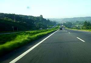
The Fernão Dias highway near the border between the states of São Paulo and Minas Gerais. | |
| Route information | |
| Maintained by Autopista Fernão Dias (OHL) (since 2008) | |
| Length: | 562.1 km (349.3 mi) |
| Existed: | 1959 (duplication made to a Dual carriageway in 2005) – present |
| Major junctions | |
| North end: | Avenida Cardeal Eugênio Pacelli in Contagem, MG |
| South end: | Avenida Educador Paulo Freire in Vila Maria, São Paulo, SP |
| Highway system | |
|
Highways in Brazil | |

.jpg)
The Rodovia Fernão Dias (official designation BR-381 or SP-010 in the state of São Paulo) is a federal highway which runs in the Brazilian states of São Paulo and southern region of Minas Gerais. In Atibaia, the Fernão Dias highway intersects the Dom Pedro I highway, which runs from Campinas to Jacareí.
The highway is thus named in honour of Fernão Dias Paes Leme, a Brazilian explorer and "bandeirante" of the 17th century. It is 562.1 km long.
Major cities cut by the BR-381
São Paulo
Minas Gerais
- Belo Horizonte
- Betim
- Camanducaia
- Carmo da Cachoeira
- Contagem
- Igarapé
- Itapeva
- Nepomuceno
- Carmopolis de Minas
- Oliveira
- Pouso Alegre
- Santo Antônio do Amparo
- São Joaquim de Bicas
- Três Corações
- Vale do Aço (Metropolitan area)
Location of the toll plazas
The Fernão Dias highway near the city of Atibaia.
São Paulo
- Km 007 - Vargem
Minas Gerais
- Km 902 - Cambuí
- Km 804 - São Gonçalo do Sapucaí
- Km 733 - Carmo da Cachoeira
- Km 659 - Santo Antonio do Amparo
- Km 596 - Carmópolis of Mines
- Km 546 - Itatiaiaçu
Note: All squares are bidirectional.
See also
External links
- BR-381. Ministry of Transportation.
| Rodovias | |
|---|---|
| Expressways |
|
| Surface streets |
|
| Rodovias radiais | |
|---|---|
| Rodovias longitudinais | |
| Rodovias transversais |
|
| Rodovias diagonais | |
| Rodovias de ligação |
|
This article is issued from Wikipedia - version of the 10/18/2016. The text is available under the Creative Commons Attribution/Share Alike but additional terms may apply for the media files.