Rognac
| Rognac | ||
|---|---|---|
|
Rognac railway station, with a passing freight train and an Intercity-TER | ||
| ||
 Rognac | ||
|
Location within Provence-A.-C.d'A. region 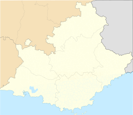 Rognac | ||
| Coordinates: 43°29′19″N 5°13′59″E / 43.4886°N 5.2331°ECoordinates: 43°29′19″N 5°13′59″E / 43.4886°N 5.2331°E | ||
| Country | France | |
| Region | Provence-Alpes-Côte d'Azur | |
| Department | Bouches-du-Rhône | |
| Arrondissement | Istres | |
| Canton | Berre-l'Étang | |
| Intercommunality | Salon-Étang de Berre-Durance | |
| Government | ||
| • Mayor (2008–2014) | Jean-Pierre Guillaume | |
| Area1 | 17.46 km2 (6.74 sq mi) | |
| Population (2008)2 | 12,195 | |
| • Density | 700/km2 (1,800/sq mi) | |
| Time zone | CET (UTC+1) | |
| • Summer (DST) | CEST (UTC+2) | |
| INSEE/Postal code | 13081 / 13340 | |
| Elevation |
0–271 m (0–889 ft) (avg. 15 m or 49 ft) | |
|
1 French Land Register data, which excludes lakes, ponds, glaciers > 1 km² (0.386 sq mi or 247 acres) and river estuaries. 2 Population without double counting: residents of multiple communes (e.g., students and military personnel) only counted once. | ||

.svg.png)
Rognac is a commune in the Bouches-du-Rhône department in southern France.
International relations
Twin towns – Sister cities
Rognac is twinned with:
Rockenhausen, Germany
 Veria, Greece
Population
| Historical population | ||
|---|---|---|
| Year | Pop. | ±% |
| 1793 | 511 | — |
| 1800 | 558 | +9.2% |
| 1806 | 555 | −0.5% |
| 1821 | 637 | +14.8% |
| 1831 | 555 | −12.9% |
| 1836 | 625 | +12.6% |
| 1841 | 220 | −64.8% |
| 1846 | 570 | +159.1% |
| 1851 | 748 | +31.2% |
| 1856 | 789 | +5.5% |
| 1861 | 873 | +10.6% |
| 1866 | 873 | +0.0% |
| 1872 | 840 | −3.8% |
| 1876 | 842 | +0.2% |
| 1881 | 683 | −18.9% |
| 1886 | 678 | −0.7% |
| 1891 | 653 | −3.7% |
| 1896 | 722 | +10.6% |
| 1901 | 741 | +2.6% |
| 1906 | 769 | +3.8% |
| 1911 | 763 | −0.8% |
| 1921 | 958 | +25.6% |
| 1926 | 1,165 | +21.6% |
| 1931 | 1,395 | +19.7% |
| 1936 | 1,614 | +15.7% |
| 1946 | 2,008 | +24.4% |
| 1954 | 2,696 | +34.3% |
| 1962 | 3,590 | +33.2% |
| 1968 | 4,270 | +18.9% |
| 1975 | 5,105 | +19.6% |
| 1982 | 9,330 | +82.8% |
| 1990 | 11,099 | +19.0% |
| 1999 | 11,631 | +4.8% |
| 2008 | 12,195 | +4.8% |
See also
References
| Wikimedia Commons has media related to Rognac. |
This article is issued from Wikipedia - version of the 2/12/2016. The text is available under the Creative Commons Attribution/Share Alike but additional terms may apply for the media files.