Root, New York
| Root, New York | |
|---|---|
| Town | |
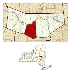 Location in Montgomery County and the state of New York. | |
| Coordinates: 42°51′1″N 74°28′48″W / 42.85028°N 74.48000°WCoordinates: 42°51′1″N 74°28′48″W / 42.85028°N 74.48000°W | |
| Country | United States |
| State | New York |
| County | Montgomery |
| Government | |
| • Type | Town Council |
| • Town Supervisor | Gary A. Kamp (R) |
| • Town Council |
Members' List
|
| Area | |
| • Total | 51.0 sq mi (132.1 km2) |
| • Land | 50.8 sq mi (131.6 km2) |
| • Water | 0.2 sq mi (0.5 km2) |
| Elevation | 863 ft (263 m) |
| Population (2010) | |
| • Total | 1,715 |
| • Density | 33.9/sq mi (13.1/km2) |
| Time zone | Eastern (EST) (UTC-5) |
| • Summer (DST) | EDT (UTC-4) |
| ZIP code | 12166 |
| Area code(s) | 518 |
| FIPS code | 36-63561 |
| GNIS feature ID | 0979432 |
Root is a town in Montgomery County, New York, United States. The population was 1,715 at the 2010 census. The town was named for Erastus Root, a legislator.[1]
The Town of Root is in the south-central part of the county and is southwest of Amsterdam.
The Erie Canal passes the north part of Root.
History
Root was in Corry's patent. The first British settler located near Currytown before the American Revolution but this was very much the frontier. During the Revolution, the small colonial community was raided and burned by Iroquois allies of the British.
Root was once part of the original "Town of Mohawk." It was created in 1823 from part of the Town of Charleston.
Geography
According to the United States Census Bureau, the town has a total area of 51.0 square miles (132 km2), of which, 50.8 square miles (132 km2) of it is land and 0.2 square miles (0.52 km2) of it (0.41%) is water.
The north town line is defined by the Mohawk River, and the south town line is the border of Schoharie County.
The New York State Thruway crosses the north part of the town, following the course of the Mohawk River. New York State Route 5S also follows the course of the Mohawk and intersects New York State Route 162 at Sprakers in the northwest part of Root.
Demographics
| Historical population | |||
|---|---|---|---|
| Census | Pop. | %± | |
| 1830 | 2,750 | — | |
| 1840 | 2,979 | 8.3% | |
| 1850 | 2,736 | −8.2% | |
| 1860 | 2,622 | −4.2% | |
| 1870 | 2,492 | −5.0% | |
| 1880 | 2,275 | −8.7% | |
| 1890 | 2,041 | −10.3% | |
| 1900 | 1,653 | −19.0% | |
| 1910 | 1,512 | −8.5% | |
| 1920 | 1,198 | −20.8% | |
| 1930 | 1,021 | −14.8% | |
| 1940 | 1,106 | 8.3% | |
| 1950 | 1,214 | 9.8% | |
| 1960 | 1,243 | 2.4% | |
| 1970 | 1,513 | 21.7% | |
| 1980 | 1,801 | 19.0% | |
| 1990 | 1,692 | −6.1% | |
| 2000 | 1,752 | 3.5% | |
| 2010 | 1,715 | −2.1% | |
| Est. 2014 | 1,695 | [2] | −1.2% |
As of the census[4] of 2000, there were 1,752 people, 656 households, and 492 families residing in the town. The population density was 34.5 people per square mile (13.3/km²). There were 755 housing units at an average density of 14.9 per square mile (5.7/km²). The racial makeup of the town was 98.06% White, 0.40% African American, 0.29% Native American, 0.34% Asian, 0.23% from other races, and 0.68% from two or more races. Hispanic or Latino of any race were 1.14% of the population.
There were 656 households out of which 33.4% had children under the age of 18 living with them, 62.0% were married couples living together, 7.9% had a female householder with no husband present, and 25.0% were non-families. 19.7% of all households were made up of individuals and 10.1% had someone living alone who was 65 years of age or older. The average household size was 2.67 and the average family size was 3.08.
In the town the population was spread out with 26.7% under the age of 18, 5.5% from 18 to 24, 27.9% from 25 to 44, 26.3% from 45 to 64, and 13.6% who were 65 years of age or older. The median age was 40 years. For every 100 females there were 100.9 males. For every 100 females age 18 and over, there were 100.9 males.
The median income for a household in the town was $38,060, and the median income for a family was $41,927. Males had a median income of $28,073 versus $22,656 for females. The per capita income for the town was $16,206. About 8.4% of families and 11.8% of the population were below the poverty line, including 17.3% of those under age 18 and 9.1% of those age 65 or over.
Government
The Town of Root is a town of the Second Class under New York State law, with a Town Board of four members plus a Town Supervisor, who is a voting member of the Board.
Town of Root Supervisors
Gary A. Kamp (2014 - Present)
John W. Thayer (2008–2013)
Brian S. Cechnicki (2004–2007)
John Van Kersen (1992–2003)
John W. Cechnicki (1982–1991)
Communities and locations in Root
- Browns Hollow – A location southwest of Root Center.
- Currytown – A hamlet on NY-162 near the center of Root. The name is derived from "Corry's patent."
- Flat Creek – A location southwest of Currytown, located on Flat Creek.
- Flat Creek – A tributary of the Mohawk River, flowing northward through western Root.
- Kilmartin Corners – A location by the south town line.
- Little Nose – A landmark near the Mohawk River, which along with Big Nose on the opposite bank imarks a place called "The Noses."
- Lykers (formerly "Lykers Corners") – A location south of Root Center.
- Randall – A hamlet in the northeast part of Root on NY-5S.
- Root Center – A hamlet south of Currytown.
- Rural Grove – A hamlet southeast of Currytown on NY-162.
- Sprakers (formerly "Sprakers Basin") – A hamlet, located on the Erie Canal and Mohawk River and the junction of NY-5S and NY-162 in the northeast part of Root.
- Stone Ridge – A hamlet on the town line in the northeast corner of the town on NY-5S.
- Sutphens Hollow – A former community in the northwest part of Root, located by Flat Creek and formerly called "Hamilton Hollow."
- Yatesville – A former community located by the Mohawk River.
References
- ↑ Zurlo, Sam (15 April 1996). "Area place names reflect local history and personalities". The Daily Gazette. pp. B5. Retrieved 23 April 2015.
- ↑ "Annual Estimates of the Resident Population for Incorporated Places: April 1, 2010 to July 1, 2014". Retrieved June 4, 2015.
- ↑ "Census of Population and Housing". Census.gov. Retrieved June 4, 2015.
- ↑ "American FactFinder". United States Census Bureau. Retrieved 2008-01-31.
External links
Municipalities and communities of Montgomery County, New York, United States | ||
|---|---|---|
| City | 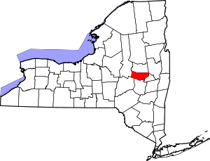 | |
| Towns | ||
| Villages | ||
| CDP | ||
| Hamlets | ||