Rose Hill Acres, Texas
| Rose Hill Acres, Texas | |
|---|---|
| City | |
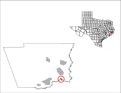
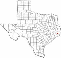 Location of Rose Hill Acres, Texas | |
 | |
| Coordinates: 30°11′45″N 94°11′39″W / 30.19583°N 94.19417°WCoordinates: 30°11′45″N 94°11′39″W / 30.19583°N 94.19417°W | |
| Country | United States |
| State | Texas |
| County | Hardin |
| Area | |
| • Total | 0.4 sq mi (1.0 km2) |
| • Land | 0.4 sq mi (1.0 km2) |
| • Water | 0.0 sq mi (0.0 km2) |
| Elevation | 23 ft (7 m) |
| Population (2000) | |
| • Total | 480 |
| • Density | 1,185.9/sq mi (457.9/km2) |
| Time zone | Central (CST) (UTC-6) |
| • Summer (DST) | CDT (UTC-5) |
| ZIP code | 77657 |
| Area code(s) | 409 |
| FIPS code | 48-63272[1] |
| GNIS feature ID | 1388535[2] |
Rose Hill Acres is a city in Hardin County, Texas, United States. The population was 441 at the 2010 census. The city is little more than two residential neighborhoods situated between Beaumont and Lumberton. It is part of the Beaumont–Port Arthur Metropolitan Statistical Area. Rose Hill Acres has a small government structure led by Mayor Rick Thomisee.
Rose Hill Acres is served by the Lumberton Independent School District and the Lumberton Municipal Utility District.
Road access is provided by U.S. Highway 69, U.S. Highway 96, and U.S. Highway 287, all three of which run concurrently in one freeway, collectively referred to as the Eastex Freeway.
Geography
Rose Hill Acres is located in extreme southern Hardin County, Texas, and is bounded on the south by Pine Island Bayou.
Rose Hill Acres is located at 30°11′45″N 94°11′39″W / 30.19583°N 94.19417°W (30.195811, -94.194094).[3]
According to the United States Census Bureau, the city has a total area of 0.4 square miles (1.0 km2), all of it land.
Historical development
This residential suburb of Beaumont was incorporated in 1968 by a 70 to 9 margin.[4] The population growth was as follows: in 1970 its population was 431, in 1980 it was 460, and in the early 1990s, near 490 residents.
Demographics
| Historical population | |||
|---|---|---|---|
| Census | Pop. | %± | |
| 1970 | 431 | — | |
| 1980 | 460 | 6.7% | |
| 1990 | 468 | 1.7% | |
| 2000 | 480 | 2.6% | |
| 2010 | 441 | −8.1% | |
| Est. 2015 | 445 | [5] | 0.9% |
As of the census[1] of 2000, there were 480 people, 169 households, and 141 families residing in the city. The population density was 1,185.9 people per square mile (463.3/km²). There were 175 housing units at an average density of 432.4 per square mile (168.9/km²). The racial makeup of the city was 96.88% White, 0.83% Native American, 0.21% Asian, 0.42% Pacific Islander, 0.62% from other races, and 1.04% from two or more races. Hispanic or Latino of any race were 4.79% of the population.
There were 169 households out of which 37.3% had children under the age of 18 living with them, 74.6% were married couples living together, 5.9% had a female householder with no husband present, and 16.0% were non-families. 13.0% of all households were made up of individuals and 10.1% had someone living alone who was 65 years of age or older. The average household size was 2.84 and the average family size was 3.11.
In the city the population was spread out with 27.3% under the age of 18, 5.6% from 18 to 24, 24.2% from 25 to 44, 25.6% from 45 to 64, and 17.3% who were 65 years of age or older. The median age was 40 years. For every 100 females there were 96.7 males. For every 100 females age 18 and over, there were 90.7 males.
The median income for a household in the city was $50,313, and the median income for a family was $55,179. Males had a median income of $42,500 versus $23,750 for females. The per capita income for the city was $19,215. About 7.1% of families and 8.1% of the population were below the poverty line, including 11.7% of those under age 18 and 6.4% of those age 65 or over.
References
- 1 2 "American FactFinder". United States Census Bureau. Retrieved 2008-01-31.
- ↑ "US Board on Geographic Names". United States Geological Survey. 2007-10-25. Retrieved 2008-01-31.
- ↑ "US Gazetteer files: 2010, 2000, and 1990". United States Census Bureau. 2011-02-12. Retrieved 2011-04-23.
- ↑ TSHA Online - Texas State Historical Association
- ↑ "Annual Estimates of the Resident Population for Incorporated Places: April 1, 2010 to July 1, 2015". Retrieved July 2, 2016.
- ↑ "Census of Population and Housing". Census.gov. Retrieved June 4, 2015.
External links
- City of Rose Hill Acres
- U.S. Geological Survey Geographic Names Information System: Rose Hill Acres, Texas
Municipalities and communities of Hardin County, Texas, United States | ||
|---|---|---|
| Cities | 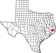 | |
| CDPs | ||
| Unincorporated communities | ||
| Ghost town | ||
| Footnotes | ‡This populated place also has portions in an adjacent county or counties | |