Rosedale Township, Jersey County, Illinois
| Rosedale Township | |
|---|---|
| Township | |
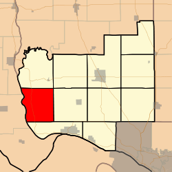 Location in Jersey County | |
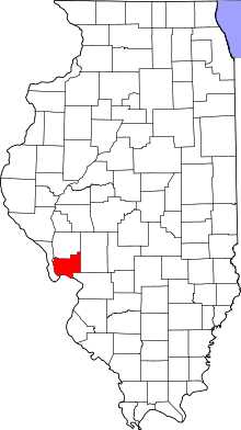 Jersey County's location in Illinois | |
| Coordinates: 39°02′39″N 90°32′06″W / 39.04417°N 90.53500°WCoordinates: 39°02′39″N 90°32′06″W / 39.04417°N 90.53500°W | |
| Country | United States |
| State | Illinois |
| County | Jersey |
| Established | November 5, 1878 |
| Area | |
| • Total | 32.12 sq mi (83.2 km2) |
| • Land | 30.25 sq mi (78.3 km2) |
| • Water | 1.87 sq mi (4.8 km2) 5.82% |
| Elevation | 604 ft (184 m) |
| Population (2010) | |
| • Total | 456 |
| • Density | 15.1/sq mi (5.8/km2) |
| Time zone | CST (UTC-6) |
| • Summer (DST) | CDT (UTC-5) |
| ZIP codes | 62031, 62037 |
| GNIS feature ID | 0429672 |
Rosedale Township is one of eleven townships in Jersey County, Illinois, United States. As of the 2010 census, its population was 456 and it contained 295 housing units.[1]
History
The name of Rosedale Township was changed from Illinois Township on June 7, 1882.
Geography
According to the 2010 census, the township has a total area of 32.12 square miles (83.2 km2), of which 30.25 square miles (78.3 km2) (or 94.18%) is land and 1.87 square miles (4.8 km2) (or 5.82%) is water.[1]
Unincorporated towns
Adjacent townships
- Richwood Township (north)
- English Township (northeast)
- Otter Creek Township (east)
- Quarry Township (southeast)
Cemeteries
The township contains two active cemeteries, Meadow Branch and Rosedale, as well as several that are inactive.[2]
Major highways
Rivers
Lakes
- Beaver Lake
- Deep Lake
- Eagle Lake
- Flat Lake
- Fowler Lake
- Upper Flat Lake
Landmarks
School districts
Political districts
- Illinois' 17th congressional district
- State House District 97
- State Senate District 49
Notes
- 1 2 "Population, Housing Units, Area, and Density: 2010 - County -- County Subdivision and Place -- 2010 Census Summary File 1". United States Census. Retrieved 2013-05-28.
- ↑ "Rosedale Township, Jersey County, Illinois T7N-R13W - Cemetery Listings". Jersey County ILGenWeb. Retrieved 17 June 2013.
References
- "Rosedale Township, Jersey County, Illinois". Geographic Names Information System. United States Geological Survey. Retrieved 2010-01-17.
- United States Census Bureau 2007 TIGER/Line Shapefiles
- United States National Atlas
External links
Municipalities and communities of Jersey County, Illinois, United States | ||
|---|---|---|
| Cities | ||
| Town | ||
| Villages | ||
| Townships | ||
| Unincorporated communities | ||
| Footnotes | ‡ This populated place also has portions in an adjacent county or counties | |
This article is issued from Wikipedia - version of the 1/7/2015. The text is available under the Creative Commons Attribution/Share Alike but additional terms may apply for the media files.