Rosita, Colorado
| Rosita, Colorado | |
|---|---|
| Town | |
 Location in Custer County and the state of Colorado | |
| Coordinates: 38°05′50″N 105°20′10″W / 38.09722°N 105.33611°WCoordinates: 38°05′50″N 105°20′10″W / 38.09722°N 105.33611°W | |
| Country |
|
| State |
|
| County | Custer County[1] |
| Founded | 1872 |
| Government | |
| • Type | ghost town |
| Elevation[1] | 2,685 m (8,809 ft) |
| Time zone | MST (UTC-7) |
| • Summer (DST) | MDT (UTC-6) |
| ZIP code[2] | Westcliffe 81252 |
| Area code(s) | 719 |
| GNIS feature ID | 0192319 |
Rosita was a silver mining town — now a ghost town — in Custer County, Colorado, United States. Rosita is Spanish for little rose. Although the old town has almost entirely disappeared (the former post office building is now an operating restaurant),[3] the surrounding area has been largely developed into semi-rural home sites.
The town was used in the filming of the 1958 western movie Saddle the Wind.
History
Rosita was founded in late 1872 by prospectors attracted by discoveries of silver. The town was composed of tents and log cabins, but soon had stores, carpenters, a hotel, saloon, blacksmith shop, and an assayer. By 1874 the town had more than a thousand residents and 400 buildings. A US post office opened in 1874, and in September 1874 the Rosita Index began as a weekly newspaper. Rosita took the seat of Custer County away from Ula (now also a ghost town) in 1878.
Despite some rich strikes in the Pocahantas and Humboldt mines, the silver veins around Rosita ran out of ore in a few years. In the early 1880s, Rosita was surpassed by the nearby mining towns of Querida and Silver Cliff. After a bitter four-year fight, Silver Cliff took the county seat from Rosita in the 1886 election, and Rosita declined further. The US post office was closed in 1966.[4] ZIP code 81252 now serves Rosita, but mail must be addressed to Westcliffe.[2]
Geography
Rosita is at an elevation of 8809 feet (2685 m), at 38°05′50″N 105°20′10″W / 38.09722°N 105.33611°W.
See also
List of ghost towns in Colorado
References
| Historical population | |||
|---|---|---|---|
| Census | Pop. | %± | |
| 1880 | 1,008 | — | |
| 1890 | 304 | −69.8% | |
| 1900 | 110 | −63.8% | |
| 1910 | 42 | −61.8% | |
| 1920 | 45 | 7.1% | |
| 1930 | 27 | −40.0% | |
- 1 2 "US Board on Geographic Names". United States Geological Survey. 2007-10-25. Retrieved 2008-01-31.
- 1 2 "ZIP Code Lookup" (JavaScript/HTML). United States Postal Service. Retrieved 2008-01-02.
- ↑ Letter Drop Inn Restaurant - Fine Dining in Historic Rosita Colorado
- ↑ Gayle Turk (1975) Wet Mountain Valley, Colorado Springs: Little London Press, p.9-21.
External links
Municipalities and communities of Custer County, Colorado, United States | ||
|---|---|---|
| Towns | 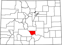 | |
| Unincorporated community | ||
| Ghost towns | ||