Ross Township, Greene County, Ohio
| Ross Township, Greene County, Ohio | |
|---|---|
| Township | |
|
Former township school near Grape Grove | |
 Location of Ross Township in Greene County | |
| Coordinates: 39°43′20″N 83°43′23″W / 39.72222°N 83.72306°WCoordinates: 39°43′20″N 83°43′23″W / 39.72222°N 83.72306°W | |
| Country | United States |
| State | Ohio |
| County | Greene |
| Area | |
| • Total | 36.3 sq mi (94.0 km2) |
| • Land | 36.3 sq mi (94.0 km2) |
| • Water | 0.0 sq mi (0.0 km2) |
| Elevation[1] | 1,073 ft (327 m) |
| Population (2000) | |
| • Total | 744 |
| • Density | 20.5/sq mi (7.9/km2) |
| Time zone | Eastern (EST) (UTC-5) |
| • Summer (DST) | EDT (UTC-4) |
| FIPS code | 39-68630[2] |
| GNIS feature ID | 1086171[1] |

Ross Township is one of the twelve townships of Greene County, Ohio, United States. The 2000 census found 744 people in the township.[3]
Geography
Located in the northeastern corner of the county, it borders the following townships:
- Madison Township, Clark County - north
- Stokes Township, Madison County - northeast
- Jefferson Township, Fayette County - southeast
- Silvercreek Township - south
- New Jasper Township - southwest
- Cedarville Township - west
It is the only township in the county with a border on Madison County.
Part of the village of Jamestown is located in southern Ross Township.
The highest point in Greene County, 1135 feet (345.9 m), is located 2.2 miles (3.5 km) west of the northeastern corner of the county,[4] in northern Ross Township.[5]
Name and history
Ross Township was established in 1811.[6] Ross was the name of a pioneer settler.[7]
Statewide, other Ross Townships are located in Butler and Jefferson Counties.
Government

The township is governed by a three-member board of trustees, who are elected in November of odd-numbered years to a four-year term beginning on the following January 1. Two are elected in the year after the presidential election and one is elected in the year before it. There is also an elected township fiscal officer,[8] who serves a four-year term beginning on April 1 of the year after the election, which is held in November of the year before the presidential election. Vacancies in the fiscal officership or on the board of trustees are filled by the remaining trustees.
References
- 1 2 "US Board on Geographic Names". United States Geological Survey. 2007-10-25. Retrieved 2008-01-31.
- ↑ "American FactFinder". United States Census Bureau. Retrieved 2008-01-31.
- ↑ Greene County, Ohio — Population by Places Estimates Ohio State University, 2007. Accessed 15 May 2007.
- ↑ Greene County, Ohio Statistics. Greene County. Accessed 2007-06-01.
- ↑ DeLorme. (2004). Ohio Atlas & Gazetteer, p. 66. Yarmouth, Maine: DeLorme. ISBN 0-89933-281-1.
- ↑ Broadstone, Michael A. (1918). History of Greene County, Ohio: Its People, Industries and Institutions, Volume 1. B.F. Bowen. p. 309.
- ↑ Dills, R. S. (1881). History of Greene County: Together with Historic Notes on the Northwest, and the State of Ohio. Odell & Mayer. p. 739.
- ↑ §503.24, §505.01, and §507.01 of the Ohio Revised Code. Accessed 4/30/2009.
External links
Municipalities and communities of Greene County, Ohio, United States | ||
|---|---|---|
| Cities | 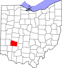 | |
| Villages | ||
| Townships | ||
| CDPs | ||
| Unincorporated communities | ||
| Footnotes | ‡This populated place also has portions in an adjacent county or counties | |