Roxbury, Kansas
| Roxbury, Kansas | |
|---|---|
| Unincorporated community | |
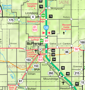 KDOT map of McPherson County (legend) | |
 Roxbury | |
| Coordinates: 38°33′3″N 97°25′49″W / 38.55083°N 97.43028°WCoordinates: 38°33′3″N 97°25′49″W / 38.55083°N 97.43028°W[1] | |
| Country | United States |
| State | Kansas |
| County | McPherson |
| Elevation[1] | 1,339 ft (408 m) |
| Time zone | CST (UTC-6) |
| • Summer (DST) | CDT (UTC-5) |
| Area code | 620 |
| FIPS code | 20-61550 [1] |
| GNIS ID | 477097 [1] |
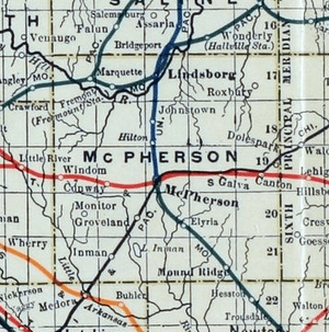
Roxbury is an unincorporated community and census-designated place about 14.8 miles east of Lindsborg in McPherson County, Kansas, United States.[1][2] The population was 100 at the 1910 census.
History
Early history
For many millennia, the Great Plains of North America was inhabited by nomadic Native Americans. From the 16th century to 18th century, the Kingdom of France claimed ownership of large parts of North America. In 1762, after the French and Indian War, France secretly ceded New France to Spain, per the Treaty of Fontainebleau.
19th century
In 1802, Spain returned most of the land to France. In 1803, most of the land for modern day Kansas was acquired by the United States from France as part of the 828,000 square mile Louisiana Purchase for 2.83 cents per acre.
In 1854, the Kansas Territory was organized, then in 1861 Kansas became the 34th U.S. state. In 1867, McPherson County was established within the Kansas Territory, which included the land for modern day Moundridge.
The original name for the area was Colfax, which was established in 1871 as a trading post. It was renamed to Roxbury on March 4, 1875 due to an act of legislature.[3]
Notable people
- Duane Earl Pope, convicted bank robber and murderer
Further reading
References
- 1 2 3 4 5 Geographic Names Information System (GNIS) details for Roxbury, Kansas; United States Geological Survey (USGS); October 13, 1978.
- ↑
- ↑ Blackmar, Frank Wilson (1912). Kansas: A Cyclopedia of State History, Volume 2. Standard Publishing Company. p. 610.
External links
- Historical
- Historic Images of Roxbury, Special Photo Collections at Wichita State University Library
- Maps
Municipalities and communities of McPherson County, Kansas, United States | ||
|---|---|---|
| Cities | 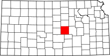 | |
| CDP | ||
| Unincorporated communities | ||
| Townships |
| |
| Footnotes | ‡This populated place also has portions in an adjacent county or counties | |