São Bento do Sapucaí
| São Bento do Sapucaí | |||
|---|---|---|---|
| Municipality | |||
| Estância Climática de São Bento do Sapucaí | |||
|
Portal at entry to São Bento do Sapucaí | |||
| |||
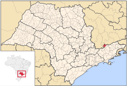 Location in São Paulo state | |||
 São Bento do Sapucaí Location in São Paulo state | |||
| Coordinates: 22°41′20″S 45°43′51″W / 22.68889°S 45.73083°WCoordinates: 22°41′20″S 45°43′51″W / 22.68889°S 45.73083°W | |||
| Country |
| ||
| Region | Southeast | ||
| State | São Paulo | ||
| Mesoregion | Vale do Paraíba Paulista | ||
| Area[1] | |||
| • Total | 252.6 km2 (97.5 sq mi) | ||
| Elevation | 886 m (2,907 ft) | ||
| Population (2010)[2] | |||
| • Total | 10,462 | ||
| • Density | 41/km2 (110/sq mi) | ||
| Demonym(s) | São-bentista | ||
| Time zone | UTC -3 | ||


São Bento do Sapucaí is a Brazilian municipality in São Paulo state.
Once known as a religious and traditional town, the municipality of São Bento do Sapucaí, now with its population reaching 10,000 inhabitants, is known for its mild weather, beautiful landscapes, and great conditions for the practice of many action sports.
History
First settlings in that area were made by Bandeirantes that went up the Serra da Mantiqueira trying to reach the gold mining regions of Minas Gerais. The town was founded on August 6, 1832 and Saint Benedict was chosen as the patron saint. The name of the place comes from the saint (São Bento in Portuguese) and the river Sapucaí, that crosses town. Around 1850, José Pereira Alves and his wife, Ignez Leite de Toledo donated a large area of land to the town, with the purpose of building a great church in honor of St. Benedict. The town's folk went in a religious procession to retrieve an image of the saint from the nearest chapel (which was almost in Sapucaí-Mirim, Minas Gerais), and then the "Igreja Matriz de São Bento" (St. Benedict's Matrix Church) started to be built by the slaves. Still today, you can find in there paintings of well-known artists that date back to 1853.
Geography
Located 164 km northeast of São Paulo, on a mountain chain called Serra da Mantiqueira, it has a total area of 251.2 km². The topography is very mountainous. There are many hills and waterfalls (the highest being Toldi Falls with more than 200 m). The city's average altitude is 886 meters, and the highest peak is a rock compound known as Pedra do Baú with an elevation of 1,950 metres (6,400 ft).
The municipality contains 66% of the 39,800 hectares (98,000 acres) Sapucaí Mirim Environmental Protection Area, created in 1998.[3]
References
- ↑ IBGE. "Área da unidade territorial" (in Portuguese). Retrieved 23 November 2015.
- ↑ "Censo Populacional 2010". Censo Populacional 2010 (in Portuguese). Instituto Brasileiro de Geografia e Estatística (IBGE). 29 November 2010. Retrieved 11 December 2010.
- ↑ APA Sapucaí-Mirim (in Portuguese), ISA: Instituto Socioambiental, retrieved 2016-10-02