Pedra do Baú
| Pedra do Baú | |
|---|---|
 | |
| Highest point | |
| Elevation | 1,950 m (6,400 ft) |
| Prominence | 300 m (980 ft) |
| Coordinates | 22°41′20″S 45°39′41″W / 22.68889°S 45.66139°WCoordinates: 22°41′20″S 45°39′41″W / 22.68889°S 45.66139°W |
| Geography | |
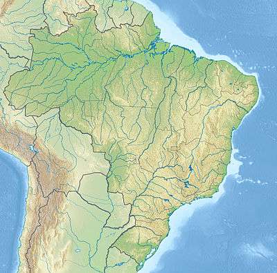 Pedra do Baú Location of Pedra do Baú in Brazil | |
| Location | São Bento do Sapucaí, São Paulo, Brazil |
| Parent range | Mantiqueira Mountains |
| Climbing | |
| First ascent | 1940 |
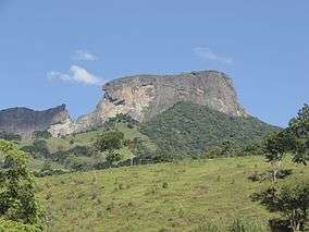
Pedra do Baú and the 'Pedra do Baú complex are rock formations in the Mantiqueira Mountains (Serra da Mantiqueira). They are located in the municipality of São Bento do Sapucaí, São Paulo, Brazil.
Geography
The gneiss rock complex comprises three distinct "rock formation landmarks": Pedra do Baú, Bauzinho, and Ana Chata.
At its highest point, the elevation is 1,950 metres (6,400 ft).[1]
On 28 December 2010 the Pedra do Baú Natural Monument was created with 3,154 hectares (7,790 acres), a state-level natural monument that is part of the Mantiqueira Mosaic of conservation units.[2]
Ecotourism
The formation is a popular site for rock climbing, paragliding, and other forms of ecotourism.[3]
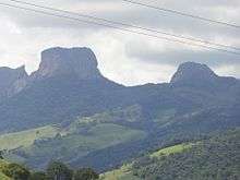
Left to Right: Bauzinho, Pedra do Baú, Ana Chata

Pedra do Baú

View of Pedra do Baú and surroundings panorama
References
- ↑ "Prefeitura Municipal da Estância Climática de São Bento do Sapucaí" (in Portuguese). Saobentodosapucai.sp.gov.br. Retrieved 2012-03-22.
- ↑ o mosaico mantiqueira – Mosaico.
- ↑ "Pedra do Baú - Altus Turismo Ecológico" (in Portuguese). Altus.tur.br. Retrieved 2012-03-22.
Sources
- o mosaico mantiqueira (in Portuguese), Mosaico Mantiqueira, retrieved 2016-09-26
External links
| Wikimedia Commons has media related to Pedra do Baú. |
This article is issued from Wikipedia - version of the 10/2/2016. The text is available under the Creative Commons Attribution/Share Alike but additional terms may apply for the media files.