Saint-Jean-de-Brébeuf, Quebec
| Saint-Jean-de-Brébeuf | |
|---|---|
| Municipality | |
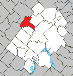 Location within Les Appalaches RCM. | |
 Saint-Jean-de-Brébeuf Location in province of Quebec. | |
| Coordinates: 46°11′N 71°28′W / 46.183°N 71.467°WCoordinates: 46°11′N 71°28′W / 46.183°N 71.467°W[1] | |
| Country |
|
| Province |
|
| Region | Chaudière-Appalaches |
| RCM | Les Appalaches |
| Constituted | January 1, 1946 |
| Government[2] | |
| • Mayor | Ghislain Hamel |
| • Federal riding | Mégantic—L'Érable |
| • Prov. riding | Lotbinière-Frontenac |
| Area[2][3] | |
| • Total | 79.50 km2 (30.70 sq mi) |
| • Land | 79.00 km2 (30.50 sq mi) |
| Population (2011)[3] | |
| • Total | 359 |
| • Density | 4.5/km2 (12/sq mi) |
| • Pop 2006-2011 |
|
| • Dwellings | 166 |
| Time zone | EST (UTC−5) |
| • Summer (DST) | EDT (UTC−4) |
| Postal code(s) | G6G 0A1 |
| Area code(s) | 418 and 581 |
| Highways |
|
Saint-Jean-de-Brébeuf is a municipality in the Municipalité régionale de comté des Appalaches in Quebec, Canada. It is part of the Chaudière-Appalaches region and the population is 397 as of 2009.
First named Lower Ireland due to its location in the township of Ireland and in opposition to Upper Ireland, now the hamlet of Maple Grove in Irlande, Saint-Jean-de-Brébeuf was first colonized by English, Irish and Scottish settlers. The current name was given to the municipality at its constitution in 1946. It honours Jean de Brébeuf, a French Jesuit missionary martyred in Sainte-Marie among the Hurons, near Midland, Ontario, in 1649.
Sources
- Commission de toponymie du Québec
- Ministère des Affaires municipales, des Régions et de l'Occupation du territoire
 |
Inverness | | ||
| |
Kinnear's Mills | |||
| ||||
| | ||||
| Saint-Ferdinand | Saint-Adrien-d'Irlande | Thetford Mines |
| Cities & Towns | |
|---|---|
| Municipalities | |
| Parishes | |
| |
This article is issued from Wikipedia - version of the 6/27/2016. The text is available under the Creative Commons Attribution/Share Alike but additional terms may apply for the media files.