Saint-Marc-du-Lac-Long, Quebec
| Saint-Marc-du-Lac-Long | |
|---|---|
| Parish municipality | |
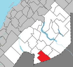 Location within Témiscouata RCM | |
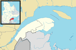 Saint-Marc-du-Lac-Long Location in eastern Quebec | |
| Coordinates: 47°23′N 68°54′W / 47.383°N 68.900°WCoordinates: 47°23′N 68°54′W / 47.383°N 68.900°W[1] | |
| Country |
|
| Province |
|
| Region | Bas-Saint-Laurent |
| RCM | Témiscouata |
| Constituted | June 11, 1938 |
| Government[2] | |
| • Mayor | Adrien Kennedy |
| • Federal riding |
Rimouski-Neigette— Témiscouata—Les Basques |
| • Prov. riding | Rivière-du-Loup-Témiscouata |
| Area[2][3] | |
| • Total | 155.90 km2 (60.19 sq mi) |
| • Land | 148.88 km2 (57.48 sq mi) |
| Population (2011)[3] | |
| • Total | 440 |
| • Density | 3.0/km2 (8/sq mi) |
| • Pop 2006-2011 |
|
| • Dwellings | 275 |
| Time zone | EST (UTC−5) |
| • Summer (DST) | EDT (UTC−4) |
| Postal code(s) | G0L 1T0 |
| Area code(s) | 418 and 581 |
| Highways |
|
Saint-Marc-du-Lac-Long is a parish municipality in the Canadian province of Quebec, located in the Témiscouata Regional County Municipality.

Aerial view of St-Marc
See also
References
External links
 Media related to Saint-Marc-du-Lac-Long, Quebec at Wikimedia Commons
 |
Saint-Eusèbe | | ||
| Rivière-Bleue | |
Packington Saint-Jean-de-la-Lande | ||
| ||||
| | ||||
| |
|
| Cities & Towns | |
|---|---|
| Municipalities | |
| Parishes | |
| |
This article is issued from Wikipedia - version of the 12/1/2016. The text is available under the Creative Commons Attribution/Share Alike but additional terms may apply for the media files.