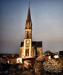
Saint-Rémy-en-Mauges
| Saint-Rémy-en-Mauges | |
|---|---|
 | |
 Saint-Rémy-en-Mauges | |
|
Location within Pays de la Loire region  Saint-Rémy-en-Mauges | |
| Coordinates: 47°16′18″N 1°04′28″W / 47.2717°N 1.0744°WCoordinates: 47°16′18″N 1°04′28″W / 47.2717°N 1.0744°W | |
| Country | France |
| Region | Pays de la Loire |
| Department | Maine-et-Loire |
| Arrondissement | Cholet |
| Canton | Beaupréau |
| Area1 | 21.56 km2 (8.32 sq mi) |
| Population (2012)2 | 1,464 |
| • Density | 68/km2 (180/sq mi) |
| Time zone | CET (UTC+1) |
| • Summer (DST) | CEST (UTC+2) |
| INSEE/Postal code | 49316 / 49110 |
| Elevation |
17–109 m (56–358 ft) (avg. 109 m or 358 ft) |
|
1 French Land Register data, which excludes lakes, ponds, glaciers > 1 km² (0.386 sq mi or 247 acres) and river estuaries. 2 Population without double counting: residents of multiple communes (e.g., students and military personnel) only counted once. | |
Saint-Rémy-en-Mauges is a former commune in the Maine-et-Loire department in western France.
Geography
The commune is traversed by the Èvre river.
History
On 15 December 2015, La Boissière-sur-Èvre, Chaudron-en-Mauges, La Chaussaire, Le Fief-Sauvin, Le Fuilet, Montrevault, Le Puiset-Doré, Saint-Pierre-Montlimart, Saint-Quentin-en-Mauges, Saint-Rémy-en-Mauges and La Salle-et-Chapelle-Aubry merged becoming one commune called Montrevault-sur-Èvre.
See also
References
| Wikimedia Commons has media related to Saint-Rémy-en-Mauges. |
This article is issued from Wikipedia - version of the 1/15/2016. The text is available under the Creative Commons Attribution/Share Alike but additional terms may apply for the media files.