Sainte-Cécile-de-Whitton, Quebec
| Sainte-Cécile-de-Whitton | |
|---|---|
| Municipality | |
 | |
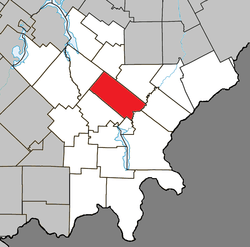 Location within Le Granit RCM. | |
 Sainte-Cécile-de-Whitton Location in southern Quebec. | |
| Coordinates: 45°40′N 70°56′W / 45.667°N 70.933°WCoordinates: 45°40′N 70°56′W / 45.667°N 70.933°W[1] | |
| Country |
|
| Province |
|
| Region | Estrie |
| RCM | Le Granit |
| Constituted | September 19, 1889 |
| Government[2] | |
| • Mayor | Diane Turgeon |
| • Federal riding | Mégantic—L'Érable |
| • Prov. riding | Mégantic |
| Area[2][3] | |
| • Total | 149.40 km2 (57.68 sq mi) |
| • Land | 146.00 km2 (56.37 sq mi) |
| Population (2011)[3] | |
| • Total | 892 |
| • Density | 6.1/km2 (16/sq mi) |
| • Pop 2006–2011 |
|
| • Dwellings | 438 |
| Time zone | EST (UTC−5) |
| • Summer (DST) | EDT (UTC−4) |
| Postal code(s) | G0Y 1J0 |
| Area code(s) | 819 |
| Highways |
|
| Website |
www dewhitton |
Sainte-Cécile-de-Whitton is a municipality in Quebec, in the regional county municipality of Le Granit in the administrative region of Estrie. It is named after Saint Cecilia, the patron saint of musicians and Church music.
References
External links
 Media related to Sainte-Cécile-de-Whitton at Wikimedia Commons
- Official website
- Répertoire des municipalités du Québec
- Commission de toponymie du Québec
- Affaires municipales et régions – cartes régionales
 |
Saint-Romain | Saint-Sébastien | | |
| |
Lac-Drolet | |||
| ||||
| | ||||
| Nantes | Lac-Mégantic | Audet Frontenac |
| Cities | |
|---|---|
| Municipalities | |
| Parishes | |
| Townships | |
| |
This article is issued from Wikipedia - version of the 12/19/2014. The text is available under the Creative Commons Attribution/Share Alike but additional terms may apply for the media files.