Salekasa
| Salekasa सालेकसा | |
|---|---|
| Town | |
| Country |
|
| State | Maharashtra |
| District | Gondia |
| Government | |
| • Body | Gram Panchayat |
| Languages | |
| • Official | Marathi |
| Time zone | IST (UTC+5:30) |
| PIN | 441916 |
| Telephone code | 07180 |
| Vehicle registration | MH35 |
| Nearest city | Gondia |
| Lok Sabha constituency | Gadchiroli |
| Vidhan Sabha constituency | Amgaon |
| Civic agency | Tahsil Karyalaya |
Salekasa is a town and a tehsil in Deori subdivision of Gondia district in Nagpur revenue Division in the Berar region in the state of Maharashtra, India.
It is railway station ( code SKS ) under Nagpur Division of South East Central Railway. There is Famous Gadhmata Devi Temple to west side of city. In Navratri there is mahapooja and other cultural activities are organized in association with Temple Trust and local people. The Hazara fall waterfall is nearby to salekasa is one of the natural attraction for tourists. You can reach there by Bus or Private vehicle and also by Train, the nearest railway station is Darekasa. hazarafall is having height more than 100 meter and surrounded by jungle and most beautiful place in gondia district. Salekasa is completely surrounded by natural beauty and more beautiful in monsoon season. Halabitola is place near to the Salekasa having Ardhya Nareswar (Lord Shiv) Temple and which is famous among District. Here the main attraction center is large 100 ft long thrishul which was created by contribution among people which are visit there and people from Salekasa. Salekasa is self-sufficient for higher Education and not dependent on other city. there is facility for Graduation and post graduation in Commerce and Art in Town. For Technical Education Amgaon is nearby Town to move. Salekasa is small town which well known example for Unity of Different Culture. Marathi, Panjabi, Gond, Powari, Sindhi, Muslims,adiwasi are there which is share there culture and roles with Each other. The town having Number of temples, Gurudwara and masjid. The Main occupation of people is farming and related works. It is well connected by Roads (Gondia-Gongargadh) and also via Train. National Highway No. 6 is just 40–45 km away from it(Deori).
 |
Amgaon, Gondia | Kanha National Park | | |
| |
Balaghat(Madhya Pradesh) | |||
| ||||
| | ||||
| Deori | Darekasa, Dongargarh(Chhattisgarh) |
Gondia district topics | ||
|---|---|---|
| History | 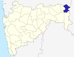 | |
| Geography | ||
| Cities and towns | ||
| Transport | ||
| Culture | ||
| Lok Sabha constituencies | ||
| Vidhan Sabha constituencies | ||
Coordinates: 21°18′N 80°31′E / 21.300°N 80.517°E