San Pa Tong District
| San Pa Tong สันป่าตอง | |
|---|---|
| Amphoe | |
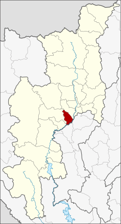 Amphoe location in Chiang Mai Province | |
| Coordinates: 18°37′43″N 98°53′44″E / 18.62861°N 98.89556°ECoordinates: 18°37′43″N 98°53′44″E / 18.62861°N 98.89556°E | |
| Country |
|
| Province | Chiang Mai |
| Seat | Yu Wa |
| Area | |
| • Total | 178.18 km2 (68.80 sq mi) |
| Population (2010) | |
| • Total | 75,600 |
| • Density | 431.2/km2 (1,117/sq mi) |
| Time zone | ICT (UTC+7) |
| Postal code | 50120 |
| Geocode | 5012 |
San Pa Tong (Thai: สันป่าตอง) is a district (amphoe) of Chiang Mai Province in northern Thailand.
Geography
Neighboring districts are (from the southwest clockwise) Doi Lo, Mae Wang, Hang Dong of Chiang Mai Province, Mueang Lamphun and Pa Sang of Lamphun Province.
History
Originally named Ban Mae, it was renamed to San Pa Tong in 1939.[1]
The remains of an ancient walled town of the Haripunchai Kingdom, Wiang Tha Kan, which was founded approximately 1,000 years ago, lie in the southern part of this district, in tambon Ban Klang.[2]
Administration
The district is divided into 11 subdistricts (tambon), which are further subdivided into 122 villages (muban). There are three subdistrict municipalities (thesaban tambon) - San Pa Tong covers parts of tambon Yu Wa, Makham Luang and Thung Tom; and Ban Klang which covers parts of Ban Klang, Tha Wang Phrao, Makham Luang and Ma Khun Wan. The area of Thung Tom subdistrict not covered by San Pa Thong municipality also forms a subdistrict municipality. There are further 10 Tambon administrative organizations (TAO), covering the non-municipal areas of each subdistrict.
| No. | Name | Thai | Villages | Inh.[3] |
|---|---|---|---|---|
| 1. | Yu Wa | ยุหว่า | 15 | 13,361 |
| 2. | San Klang | สันกลาง | 9 | 4,648 |
| 3. | Tha Wang Phrao | ท่าวังพร้าว | 7 | 3,480 |
| 4. | Makham Luang | มะขามหลวง | 11 | 6,539 |
| 5. | Mae Ka | แม่ก๊า | 14 | 7,373 |
| 6. | Ban Mae | บ้านแม | 13 | 6,635 |
| 7. | Ban Klang | บ้านกลาง | 11 | 9,835 |
| 8. | Thung Satok | ทุ่งสะโตก | 12 | 6,398 |
| 10. | Thung Tom | ทุ่งต้อม | 11 | 7,258 |
| 14. | Nam Bo Luang | น้ำบ่อหลวง | 11 | 4,845 |
| 15. | Makhun Wan | มะขุนหวาน | 8 | 5,228 |
Missing numbers are tambon which now form Mae Wang district.
See also
- Chiang Mai Metropolitan Area
References
- ↑ พระราชกฤษฎีกาเปลี่ยนนามอำเภอ กิ่งอำเภอ และตำบลบางแห่ง พุทธศักราช ๒๔๘๒ (PDF). Royal Gazette (in Thai). 56 (0 ก): 354–364. April 17, 1939.
- ↑ http://www.bangkokpost.com/travel/5488_info_wiang-tha-kan.html
- ↑ "Population statistics 2010". Department of Provincial Administration.